
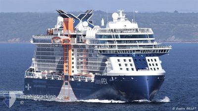
CELEBRITY APEX
Passenger
Current Trip
| Time Travelled | 10 h, 38 mins |
|---|---|
| Remaining Time | 23 h, 15 mins |
| Distance Travelled | 203.10 nm |
| Remaining Distance | 464.15 nm |
| AVG Speed | 19.5 Knopen |
| MAX Speed | 21 Knopen |
| AVG Wind | 14.9 knots |
| MAX Wind | 16.1 knots |
| MIN Temp | 23.9°C / 75.02°F |
| MAX Temp | 26.4°C / 79.52°F |
| Diepgang | 8.3 M |
| Positie ontvangen | 1 h, 30 m geleden |
Current Position
| Lengtegraad | -72.87335° |
|---|---|
| Breedtegraat | 21.89358° |
| Status | Under way using engine |
| Snelheid | 20 Knopen |
| Koers | 322.5° |
| Gebied | North Atlantic Ocean |
| Station | T-AIS |
| Positie ontvangen | 1 h, 30 m geleden |
Info
Information
The current position of CELEBRITY APEX is in North Atlantic Ocean with coordinates 21.89358° / -72.87335° as reported on 2024-04-26 07:04 by AIS to our vessel tracker app. The vessel's current speed is 20 Knopen and is heading at the port of PORT EVERGLADES. The estimated time of arrival as calculated by MyShipTracking vessel tracking app is 2024-04-27 07:50 LT
The vessel CELEBRITY APEX (IMO: 9838383, MMSI: 215105000) is a Passenger It's sailing under the flag of [MT] Malta.
In this page you can find informations about the vessels current position, last detected port calls, and current voyage information. If the vessels is not in coverage by AIS you will find the latest position.
The current position of CELEBRITY APEX is detected by our AIS receivers and we are not responsible for the reliability of the data. The last position was recorded while the vessel was in Coverage by the Ais receivers of our vessel tracking app.
The current draught of CELEBRITY APEX as reported by AIS is 8.3 meters
Weather
| Temperature | 25.4°C / 77.72°F |
|---|---|
| Wind Speed | 14 knots |
| Direction | 68° ENE |
| Pressure | 1014.3 hPa |
| Humidity | 78.7 % |
| Cloud Coverage | 15 % |
Featured Company
Last Port Calls
| Port | Arrival | Departure | Time In Port |
|---|---|---|---|
| 2024-04-25 14:29 | 2024-04-25 21:57 | 7 h | |
| 2024-04-23 13:44 | 2024-04-23 22:55 | 9 h | |
| 2024-04-22 18:45 | 2024-04-23 02:15 | 7 h | |
| 2024-04-20 10:32 | 2024-04-20 20:13 | 9 h | |
| 2024-04-17 11:41 | 2024-04-17 20:42 | 9 h | |
| 2024-04-16 12:13 | 2024-04-16 22:21 | 10 h | |
| 2024-04-14 11:22 | 2024-04-14 20:56 | 9 h | |
| 2024-04-13 10:35 | 2024-04-13 19:54 | 9 h | |
| 2024-04-11 14:18 | 2024-04-11 21:45 | 7 h | |
| 2024-04-09 13:39 | 2024-04-09 22:47 | 9 h |
Most Visited Ports (Last year)
| Port | Arrivals | |
|---|---|---|
| 23 | ||
| 14 | ||
| 12 | ||
| 11 | ||
| 10 | ||
| 10 |
Last Trips
| Origin | Departure | Destination | Arrival | Distance | |
|---|---|---|---|---|---|
| 2024-04-23 18:55 | 2024-04-25 10:29 | 455.52 nm | |||
| 2024-04-22 22:15 | 2024-04-23 09:44 | 182.93 nm | |||
| 2024-04-20 16:13 | 2024-04-22 14:45 | 919.27 nm | |||
| 2024-04-17 15:42 | 2024-04-20 06:32 | 997.45 nm | |||
| 2024-04-16 16:21 | 2024-04-17 06:41 | 216.53 nm | |||
| 2024-04-14 16:56 | 2024-04-16 06:13 | 585.28 nm | |||
| 2024-04-13 15:54 | 2024-04-14 07:22 | 175.99 nm | |||
| 2024-04-11 17:45 | 2024-04-13 06:35 | 675.38 nm | |||
| 2024-04-09 18:47 | 2024-04-11 10:18 | 455.41 nm | |||
| 2024-04-08 22:11 | 2024-04-09 09:39 | 183.38 nm |
Events
| Tijd | Evenement | Details | Positie / Bestemming | Info |
|---|---|---|---|---|
| 2024-04-26 07:07 | Status Changed | Default Under way using engine |
21.90500 / -72.88333
US PEF
|
Snelheid: 20 kn Koers: 322.5° |
| 2024-04-26 07:04 | Buitenbereik |
21.89358 / -72.87335
North Atlantic Ocean
US PEF
|
Snelheid: 20 kn Koers: 322.5° |
|
| 2024-04-26 06:38 | Wijzig zee gebeid | Bahamas part of the North Atlantic Ocean Turks and Caicos part of the North Atlantic Ocean |
21.77306 / -72.77516
North Atlantic Ocean
US PEF
|
Snelheid: 20.2 kn Koers: 322.5° |
| 2024-04-26 05:11 | Status Changed | Under way using engine Default |
21.38942 / -72.45216
US PEF
|
Snelheid: 21 kn Koers: 322° |
| 2024-04-26 05:07 | Status Changed | Default Under way using engine |
21.37167 / -72.43667
US PEF
|
Snelheid: 20.7 kn Koers: 321.5° |
| 2024-04-26 04:39 | Destination Changed | US PEF DO POP |
21.24841 / -72.33201
US PEF
|
Snelheid: 20.2 kn Koers: 321.3° |
| 2024-04-26 04:39 | ETA Changed | 2024/04/27 10:15 2024/04/25 14:00 |
21.24841 / -72.33201
US PEF
|
Snelheid: 20.2 kn Koers: 321.3° |
| 2024-04-26 04:28 | Wijzig zee gebeid | Turks and Caicos part of the North Atlantic Ocean Puerto Rican part of the North Atlantic Ocean |
21.20250 / -72.29293
North Atlantic Ocean
|
Snelheid: 18.7 kn Koers: 321.4° |
| 2024-04-26 04:28 | Status Changed | Under way using engine Default |
21.20250 / -72.29293
DO POP
|
Snelheid: 18.7 kn Koers: 321° |
| 2024-04-26 04:17 | Binnenbereik |
21.20250 / -72.29293
North Atlantic Ocean
|
Snelheid: 18.7 kn Koers: 321.4° |