
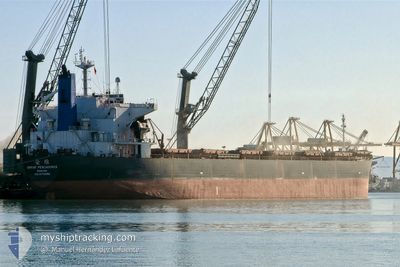
BROTHER GLORY
Bulk Carrier
Current Trip
LUHUASHAN/CHINA
| Time Travelled | --- |
|---|---|
| Remaining Time | --- |
| Distance Travelled | 8447.71 nm |
| Remaining Distance | --- |
| AVG Speed | 9.7 Knopen |
| MAX Speed | 14.6 Knopen |
| AVG Wind | 8.1 knots |
| MAX Wind | 21.3 knots |
| MIN Temp | 19.6°C / 67.28°F |
| MAX Temp | 30.4°C / 86.72°F |
| Diepgang | 13.5 M |
| Positie ontvangen | 17 h, 17 m geleden |
Current Position
| Lengtegraad | 118.67615° |
|---|---|
| Breedtegraat | 24.30352° |
| Status | Under way using engine |
| Snelheid | 9.3 Knopen |
| Koers | 54.6° |
| Gebied | South China Sea |
| Station | T-AIS |
| Positie ontvangen | 17 h, 17 m geleden |
Info
Information
The current position of BROTHER GLORY is in South China Sea with coordinates 24.30352° / 118.67615° as reported on 2024-04-26 18:11 by AIS to our vessel tracker app. The vessel's current speed is 9.3 Knopen
The vessel BROTHER GLORY (IMO: 9170298, MMSI: 636018916) is a Bulk Carrier that was built in 1998 ( 26 Jaar oud ). It's sailing under the flag of [LR] Liberia.
In this page you can find informations about the vessels current position, last detected port calls, and current voyage information. If the vessels is not in coverage by AIS you will find the latest position.
The current position of BROTHER GLORY is detected by our AIS receivers and we are not responsible for the reliability of the data. The last position was recorded while the vessel was in Coverage by the Ais receivers of our vessel tracking app.
The current draught of BROTHER GLORY as reported by AIS is 13.5 meters
Weather
| Temperature | 19.9°C / 67.82°F |
|---|---|
| Wind Speed | 8 knots |
| Direction | 47° NE |
| Pressure | 1010.1 hPa |
| Humidity | 94.5 % |
| Cloud Coverage | 84 % |
Featured Company
Most Visited Ports (Last year)
| Port | Arrivals | |
|---|---|---|
| 2 | ||
| 1 | ||
| 1 | ||
| 1 | ||
| 1 |
Last Trips
| Origin | Departure | Destination | Arrival | Distance |
|---|
Events
| Tijd | Evenement | Details | Positie / Bestemming | Info |
|---|---|---|---|---|
| 2024-04-27 11:19 | Stop beweging | 11.93 nm, North East of LIAN JIANG |
26.45766 / 120.03748
LUHUASHAN/CHINA
|
Snelheid: 0.2 kn Koers: 286° |
| 2024-04-26 18:16 | Status Changed | Default Under way using engine |
24.31233 / 118.68948
LUHUASHAN/CHINA
|
Snelheid: 9.3 kn Koers: 54.6° |
| 2024-04-26 18:11 | Status Changed | Under way using engine Default |
24.30352 / 118.67615
LUHUASHAN/CHINA
|
Snelheid: 9.4 kn Koers: 54° |
| 2024-04-26 18:11 | Buitenbereik |
24.30352 / 118.67615
South China Sea
LUHUASHAN/CHINA
|
Snelheid: 9.3 kn Koers: 54.6° |
|
| 2024-04-26 18:09 | Status Changed | Default Under way using engine |
24.30043 / 118.67151
LUHUASHAN/CHINA
|
Snelheid: 9.4 kn Koers: 54.9° |
| 2024-04-26 17:29 | Status Changed | Under way using engine Default |
24.24459 / 118.57889
LUHUASHAN/CHINA
|
Snelheid: 9.3 kn Koers: 69° |
| 2024-04-26 17:28 | Status Changed | Default Under way using engine |
24.24367 / 118.57625
LUHUASHAN/CHINA
|
Snelheid: 9.4 kn Koers: 68.4° |
| 2024-04-26 17:08 | Destination Changed | LUHUASHAN/CHINA CAO FEIDIAN/CHINA |
24.21859 / 118.52421
LUHUASHAN/CHINA
|
Snelheid: 9.6 kn Koers: 58.3° |
| 2024-04-26 17:08 | ETA Changed | 2024/05/02 04:00 2024/05/01 08:00 |
24.21859 / 118.52421
LUHUASHAN/CHINA
|
Snelheid: 9.6 kn Koers: 58.3° |
| 2024-04-26 14:47 | Status Changed | Under way using engine Default |
23.89582 / 118.27415
CAO FEIDIAN/CHINA
|
Snelheid: 10.9 kn Koers: 44° |