
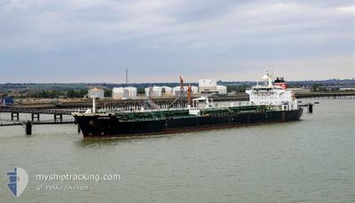
CAN KA
Oil Products Tanker
Current Trip
| Time Travelled | 2 days |
|---|---|
| Remaining Time | --- |
| Distance Travelled | 578.15 nm |
| Remaining Distance | --- |
| AVG Speed | 10 Knopen |
| MAX Speed | 11.6 Knopen |
| AVG Wind | 11.1 knots |
| MAX Wind | 27.2 knots |
| MIN Temp | 13°C / 55.4°F |
| MAX Temp | 16.4°C / 61.52°F |
| Diepgang | 10.4 M |
| Positie ontvangen | Nu |
Current Position
| Lengtegraad | 29.35895° |
|---|---|
| Breedtegraat | 41.38101° |
| Status | Under way using engine |
| Snelheid | 0.6 Knopen |
| Koers | 316° |
| Gebied | Black Sea |
| Station | T-AIS |
| Positie ontvangen | Nu |
Info
Information
The current position of CAN KA is in Black Sea with coordinates 41.38101° / 29.35895° as reported on 2024-05-02 03:46 by AIS to our vessel tracker app. The vessel's current speed is 0.6 Knopen and is heading at the port of KALAMATA. The estimated time of arrival as calculated by MyShipTracking vessel tracking app is 2024-05-05 09:00 LT
The vessel CAN KA (IMO: 9312925, MMSI: 271049994) is a Oil Products Tanker that was built in 2006 ( 18 Jaar oud ). It's sailing under the flag of [TR] Turkey.
In this page you can find informations about the vessels current position, last detected port calls, and current voyage information. If the vessels is not in coverage by AIS you will find the latest position.
The current position of CAN KA is detected by our AIS receivers and we are not responsible for the reliability of the data. The last position was recorded while the vessel was in Coverage by the Ais receivers of our vessel tracking app.
The current draught of CAN KA as reported by AIS is 10.4 meters
Weather
| Temperature | 13.4°C / 56.12°F |
|---|---|
| Wind Speed | 10 knots |
| Direction | 329° NNW |
| Pressure | 1013.1 hPa |
| Humidity | 91.7 % |
| Cloud Coverage | 100 % |
Featured Company
Last Port Calls
| Port | Arrival | Departure | Time In Port |
|---|---|---|---|
| 2024-04-26 11:24 | 2024-04-29 03:56 | 2 d | |
| 2024-04-17 15:12 | 2024-04-20 02:52 | 2 d | |
| 2024-04-16 03:08 | 2024-04-17 07:56 | 1 d | |
| 2024-04-14 09:52 | 2024-04-15 16:11 | 1 d | |
| 2024-04-13 11:52 | 2024-04-14 07:56 | 20 h | |
| 2024-04-06 05:29 | 2024-04-09 11:09 | 3 d | |
| 2024-03-22 12:45 | 2024-03-24 08:01 | 1 d | |
| 2024-03-20 13:19 | 2024-03-22 10:58 | 1 d | |
| 2024-03-18 05:02 | 2024-03-20 11:30 | 2 d | |
| 2024-03-15 03:10 | 2024-03-17 19:42 | 2 d |
Last Trips
| Origin | Departure | Destination | Arrival | Distance | |
|---|---|---|---|---|---|
| 2024-04-20 05:52 | 2024-04-26 15:24 | 698.06 nm | |||
| 2024-04-17 10:56 | 2024-04-17 18:12 | 82.53 nm | |||
| 2024-04-15 19:11 | 2024-04-16 06:08 | 97.73 nm | |||
| 2024-04-14 10:56 | 2024-04-14 12:52 | 16.64 nm | |||
| 2024-04-09 15:09 | 2024-04-13 14:52 | 670.16 nm | |||
| 2024-03-24 11:01 | 2024-04-06 09:29 | 708.54 nm | |||
| 2024-03-22 13:58 | 2024-03-22 15:45 | 15.34 nm | |||
| 2024-03-20 14:30 | 2024-03-20 16:19 | 16.71 nm | |||
| 2024-03-17 22:42 | 2024-03-18 08:02 | 83.43 nm | |||
| 2024-03-07 14:42 | 2024-03-15 06:10 | 103.18 nm |
Events
| Tijd | Evenement | Details | Positie / Bestemming | Info |
|---|---|---|---|---|
| 2024-05-01 19:30 | Status Changed | Under way using engine Default |
41.43510 / 29.33888
GRKLX
|
Snelheid: 0.5 kn Koers: 316° |
| 2024-05-01 19:17 | Status Changed | Default Under way using engine |
41.43632 / 29.33990
GRKLX
|
Snelheid: 0.4 kn Koers: 321° |
| 2024-05-01 15:30 | Stop beweging | 17.9 nm, North East of RUMELI FENERI |
41.45905 / 29.36930
GRKLX
|
Snelheid: 0.2 kn Koers: 356° |
| 2024-05-01 14:12 | Start beweging | 10.96 nm, North West of SILE |
41.32811 / 29.46503
GRKLX
|
Snelheid: 3.6 kn Koers: 41° |
| 2024-05-01 14:01 | Status Changed | Under way using engine Default |
41.33154 / 29.45958
GRKLX
|
Snelheid: 0.9 kn Koers: 124° |
| 2024-05-01 13:53 | Status Changed | Default Under way using engine |
41.33411 / 29.45972
GRKLX
|
Snelheid: 1.3 kn Koers: 126° |
| 2024-05-01 13:45 | Status Changed | Under way using engine Default |
41.33653 / 29.46000
GRKLX
|
Snelheid: 1.1 kn Koers: 125° |
| 2024-05-01 13:38 | Status Changed | Default Under way using engine |
41.33890 / 29.46043
GRKLX
|
Snelheid: 0.7 kn Koers: 127° |
| 2024-05-01 13:14 | Destination Changed | GRKLX TRMAR |
41.34632 / 29.46156
GRKLX
|
Snelheid: 1.2 kn Koers: 126° |
| 2024-05-01 13:14 | ETA Changed | 2024/05/05 09:00 2024/05/01 09:00 |
41.34632 / 29.46156
GRKLX
|
Snelheid: 1.2 kn Koers: 126° |