
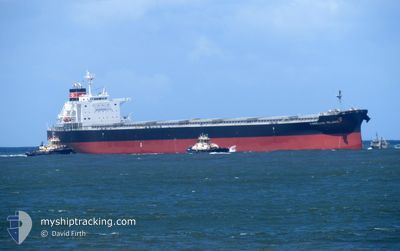
CAMELLIA ISLAND
Cargo
Current Trip
| Time Travelled | --- |
|---|---|
| Remaining Time | --- |
| Distance Travelled | 1662.68 nm |
| Remaining Distance | --- |
| AVG Speed | 8.4 Knopen |
| MAX Speed | 15.4 Knopen |
| AVG Wind | 13 knots |
| MAX Wind | 33 knots |
| MIN Temp | 14.5°C / 58.1°F |
| MAX Temp | 23.3°C / 73.94°F |
| Diepgang | 11.9 M |
| Positie ontvangen | 3 d geleden |
Current Position
| Lengtegraad | 134.66475° |
|---|---|
| Breedtegraat | 33.85834° |
| Status | Under way using engine |
| Snelheid | 0.6 Knopen |
| Koers | 250° |
| Gebied | Philippine Sea |
| Station | T-AIS |
| Positie ontvangen | 3 d geleden |
Info
Information
The current position of CAMELLIA ISLAND is in Philippine Sea with coordinates 33.85834° / 134.66475° as reported on 2024-05-06 23:48 by AIS to our vessel tracker app. The vessel's current speed is 0.6 Knopen
The vessel CAMELLIA ISLAND (IMO: 9885013, MMSI: 355966000) is a Cargo It's sailing under the flag of [PA] Panama.
In this page you can find informations about the vessels current position, last detected port calls, and current voyage information. If the vessels is not in coverage by AIS you will find the latest position.
The current position of CAMELLIA ISLAND is detected by our AIS receivers and we are not responsible for the reliability of the data. The last position was recorded while the vessel was in Coverage by the Ais receivers of our vessel tracking app.
The current draught of CAMELLIA ISLAND as reported by AIS is 11.9 meters
Weather
| Temperature | 18.4°C / 65.12°F |
|---|---|
| Wind Speed | 10 knots |
| Direction | 188° S |
| Pressure | 1022.5 hPa |
| Humidity | 69.4 % |
| Cloud Coverage | 2 % |
Featured Company
Last Port Calls
| Port | Arrival | Departure | Time In Port |
|---|---|---|---|
| 2024-03-02 02:08 |
Most Visited Ports (Last year)
| Port | Arrivals | |
|---|---|---|
| 1 | ||
| 1 | ||
| 1 | ||
| 1 | ||
| 1 | ||
| 1 |
Last Trips
| Origin | Departure | Destination | Arrival | Distance |
|---|
Events
| Tijd | Evenement | Details | Positie / Bestemming | Info |
|---|---|---|---|---|
| 2024-05-07 03:27 | Stop beweging | 0.9 nm, South of TACHIBANA |
33.85865 / 134.66417
JP TBN
|
Snelheid: Koers: 250° |
| 2024-05-07 03:22 | Start beweging | 1.23 nm, South East of TACHIBANA |
33.85613 / 134.67387
JP TBN
|
Snelheid: 3.4 kn Koers: 287° |
| 2024-05-06 23:54 | Status Changed | Default Under way using engine |
33.85846 / 134.66428
JP TBN
|
Snelheid: 0.6 kn Koers: 250° |
| 2024-05-06 23:54 | Stop beweging | 0.91 nm, South of TACHIBANA |
33.85846 / 134.66428
JP TBN
|
Snelheid: 0.1 kn Koers: 249° |
| 2024-05-06 23:48 | Buitenbereik |
33.85834 / 134.66475
Philippine Sea
JP TBN
|
Snelheid: 0.6 kn Koers: 261.7° |
|
| 2024-05-06 23:41 | Status Changed | Under way using engine Default |
33.85771 / 134.66754
JP TBN
|
Snelheid: 2.6 kn Koers: 284° |
| 2024-05-06 23:28 | Status Changed | Default Under way using engine |
33.85661 / 134.68034
JP TBN
|
Snelheid: 6 kn Koers: 250.7° |
| 2024-05-06 23:06 | Draught Changed | 11.9 12.9 |
33.88605 / 134.71918
JP TBN
|
Snelheid: 8.9 kn Koers: 251° |
| 2024-05-06 23:06 | Destination Changed | JP TBN JP THR |
33.88605 / 134.71918
JP TBN
|
Snelheid: 8.9 kn Koers: 251° |
| 2024-05-06 23:06 | ETA Changed | 2024/05/07 09:30 2024/02/21 15:00 |
33.88605 / 134.71918
JP TBN
|
Snelheid: 8.9 kn Koers: 251° |