
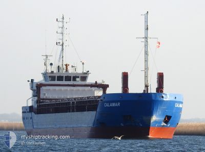
CALAMAR
General Cargo
Current Trip
| Time Travelled | 4 h, 7 mins |
|---|---|
| Remaining Time | 17 h, 25 mins |
| Distance Travelled | 42.59 nm |
| Remaining Distance | 189.30 nm |
| AVG Speed | 10.6 Knopen |
| MAX Speed | 10.9 Knopen |
| AVG Wind | 12.5 knots |
| MAX Wind | 15.3 knots |
| MIN Temp | 5.6°C / 42.08°F |
| MAX Temp | 5.7°C / 42.26°F |
| Diepgang | 4 M |
| Positie ontvangen | 1 h, 6 m geleden |
Current Position
| Lengtegraad | --- |
|---|---|
| Breedtegraat | --- |
| Status | Under way using engine |
| Snelheid | 10.4 Knopen |
| Koers | 352.7° |
| Gebied | Gulf of Bothnia |
| Station | T-AIS |
| Positie ontvangen | 1 h, 6 m geleden |
Info
Information
The current position of CALAMAR is in Gulf of Bothnia with coordinates 61.47735° / 20.90257° as reported on 2025-12-08 11:26 by AIS to our vessel tracker app. The vessel's current speed is 10.4 Knopen and is heading at the port of KOKKOLA. The estimated time of arrival as calculated by MyShipTracking vessel tracking app is 2025-12-09 07:57 LT
The vessel CALAMAR (IMO: 9528512, MMSI: 209732000) is a General Cargo that was built in 2011 ( 14 Jaar oud ). It's sailing under the flag of [CY] Cyprus.
In this page you can find informations about the vessels current position, last detected port calls, and current voyage information. If the vessels is not in coverage by AIS you will find the latest position.
The current position of CALAMAR is detected by our AIS receivers and we are not responsible for the reliability of the data. The last position was recorded while the vessel was in Coverage by the Ais receivers of our vessel tracking app.
The current draught of CALAMAR as reported by AIS is 4 meters
Weather
| Temperature | 5.7°C / 42.26°F |
|---|---|
| Wind Speed | 13 knots |
| Direction | 166° SSE |
| Pressure | 1005.8 hPa |
| Humidity | 96.9 % |
| Cloud Coverage | 100 % |
Featured Company
Last Port Calls
| Port | Arrival | Departure | Time In Port |
|---|---|---|---|
| 2025-12-07 20:22 | 2025-12-08 10:25 | 14 h | |
| 2025-12-05 14:31 | 2025-12-06 01:23 | 10 h | |
| 2025-11-29 13:23 | 2025-12-02 19:05 | 3 d | |
| 2025-11-24 04:24 | 2025-11-25 01:21 | 20 h | |
| 2025-11-20 18:13 | 2025-11-22 16:05 | 1 d | |
| 2025-11-12 22:26 | 2025-11-14 00:36 | 1 d | |
| 2025-11-11 00:10 | 2025-11-11 19:22 | 19 h | |
| 2025-11-04 02:05 | 2025-11-07 00:06 | 2 d | |
| 2025-10-26 10:34 | 2025-10-30 22:59 | 4 d | |
| 2025-10-17 22:13 | 2025-10-25 10:28 | 7 d |
Last Trips
| Origin | Departure | Destination | Arrival | Distance | |
|---|---|---|---|---|---|
| 2025-12-06 01:23 | 2025-12-07 20:22 | 347.91 nm | |||
| 2025-12-02 19:05 | 2025-12-05 14:31 | 718.54 nm | |||
| 2025-11-25 01:21 | 2025-11-29 13:23 | 685.61 nm | |||
| 2025-11-22 16:05 | 2025-11-24 04:24 | 362.76 nm | |||
| 2025-11-14 00:36 | 2025-11-20 18:13 | 1347.76 nm | |||
| 2025-11-11 19:22 | 2025-11-12 22:26 | 219.80 nm | |||
| 2025-11-07 00:06 | 2025-11-11 00:10 | 934.30 nm | |||
| 2025-10-30 22:59 | 2025-11-04 02:05 | 689.43 nm | |||
| 2025-10-25 10:28 | 2025-10-26 10:34 | 203.20 nm | |||
| 2025-10-14 22:23 | 2025-10-17 22:13 | 757.23 nm |
Events
| Tijd | Evenement | Details | Positie / Bestemming | Info |
|---|---|---|---|---|
| 2025-12-08 11:33 | Status Changed | Default Under way using engine |
61.49844 / 20.89659
FI KOK
|
Snelheid: 10.4 kn Koers: 352.7° |
| 2025-12-08 11:26 | Buitenbereik |
61.47735 / 20.90257
Gulf of Bothnia
FI KOK
|
Snelheid: 10.4 kn Koers: 352.7° |
|
| 2025-12-08 11:22 | Status Changed | Under way using engine Default |
61.46737 / 20.90536
FI KOK
|
Snelheid: 10.4 kn Koers: 352° |
| 2025-12-08 11:09 | Status Changed | Default Under way using engine |
61.42924 / 20.91600
FI KOK
|
Snelheid: 10.5 kn Koers: 348° |
| 2025-12-08 10:19 | Status Changed | Under way using engine Default |
61.28363 / 20.98100
FI KOK
|
Snelheid: 10.9 kn Koers: 348° |
| 2025-12-08 10:17 | Status Changed | Default Under way using engine |
61.27775 / 20.98383
FI KOK
|
Snelheid: 10.9 kn Koers: 347.7° |
| 2025-12-08 08:25 | Vertrekhaven |
|
61.11453 / 21.43660
FI KOK
|
Snelheid: 5.3 kn Koers: 268° |
| 2025-12-08 08:24 | Start beweging |
61.11463 / 21.44174
[FI] RAUMA
|
Snelheid: 5.3 kn Koers: 268° |
|
| 2025-12-08 07:59 | Draught Changed | 4 0 |
61.11401 / 21.44562
[FI] RAUMA
|
Snelheid: Koers: 146° |
| 2025-12-08 07:59 | Destination Changed | FI KOK FI RAU |
61.11401 / 21.44562
[FI] RAUMA
|
Snelheid: Koers: 146° |