
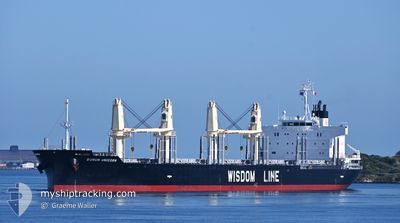
BUNUN UNICORN
Cargo
Current Trip
SGSIN>PEBGB
| Time Travelled | 9 days |
|---|---|
| Remaining Time | --- |
| Distance Travelled | 2164.92 nm |
| Remaining Distance | --- |
| AVG Speed | 11.4 Knopen |
| MAX Speed | 15.3 Knopen |
| AVG Wind | 17.5 knots |
| MAX Wind | 29 knots |
| MIN Temp | 7°C / 44.6°F |
| MAX Temp | 19.4°C / 66.92°F |
| Diepgang | 10.3 M |
| Positie ontvangen | 6 d geleden |
Current Position
| Lengtegraad | -54.81983° |
|---|---|
| Breedtegraat | -35.07218° |
| Status | Under way using engine |
| Snelheid | 15.4 Knopen |
| Koers | 89.8° |
| Gebied | South Atlantic Ocean |
| Station | T-AIS |
| Positie ontvangen | 6 d geleden |
Info
Information
The current position of BUNUN UNICORN is in South Atlantic Ocean with coordinates -35.07218° / -54.81983° as reported on 2024-05-14 21:18 by AIS to our vessel tracker app. The vessel's current speed is 15.4 Knopen
The vessel BUNUN UNICORN (IMO: 9949687, MMSI: 352002632) is a Cargo It's sailing under the flag of [PA] Panama.
In this page you can find informations about the vessels current position, last detected port calls, and current voyage information. If the vessels is not in coverage by AIS you will find the latest position.
The current position of BUNUN UNICORN is detected by our AIS receivers and we are not responsible for the reliability of the data. The last position was recorded while the vessel was in Coverage by the Ais receivers of our vessel tracking app.
The current draught of BUNUN UNICORN as reported by AIS is 10.3 meters
Weather
| Temperature | 13.3°C / 55.94°F |
|---|---|
| Wind Speed | 10 knots |
| Direction | 211° SSW |
| Pressure | 1026 hPa |
| Humidity | 67.9 % |
| Cloud Coverage | 3 % |
Featured Company
Last Port Calls
| Port | Arrival | Departure | Time In Port |
|---|---|---|---|
| 2024-05-05 23:17 | 2024-05-11 07:49 | 5 d | |
| 2024-04-25 18:58 | 2024-04-27 15:26 | 1 d | |
| 2024-04-12 12:31 | 2024-04-18 20:30 | 6 d | |
| 2024-04-04 16:21 | 2024-04-07 21:44 | 3 d |
Last Trips
| Origin | Departure | Destination | Arrival | Distance | |
|---|---|---|---|---|---|
| 2024-04-27 12:26 | 2024-05-05 20:17 | 1620.37 nm | |||
| 2024-04-18 17:30 | 2024-04-25 15:58 | 1274.14 nm | |||
| 2024-04-07 18:44 | 2024-04-12 09:31 | 16.37 nm | |||
| 2024-01-21 05:38 | 2024-04-04 13:21 | 2059.79 nm |
Events
| Tijd | Evenement | Details | Positie / Bestemming | Info |
|---|---|---|---|---|
| 2024-05-14 21:22 | Status Changed | Default Under way using engine |
-35.07168 / -54.79803
SGSIN>PEBGB
|
Snelheid: 15.4 kn Koers: 89.8° |
| 2024-05-14 21:18 | Buitenbereik |
-35.07218 / -54.81983
South Atlantic Ocean
SGSIN>PEBGB
|
Snelheid: 15.4 kn Koers: 89.8° |
|
| 2024-05-14 20:40 | ETA Changed | 2024/06/13 22:00 2024/06/18 15:00 |
-35.07109 / -55.01526
SGSIN>PEBGB
|
Snelheid: 14.8 kn Koers: 92.4° |
| 2024-05-14 20:23 | Wijzig zee gebeid | Uruguayan part of the South Atlantic Ocean Uruguayan part of the Rio de La Plata |
-35.06779 / -55.09829
South Atlantic Ocean
|
Snelheid: 14 kn Koers: 93.2° |
| 2024-05-14 19:26 | Wijzig zee gebeid | Uruguayan part of the Rio de La Plata Argentinean part of the Rio de La Plata |
-35.07230 / -55.35540
Rio de La Plata
|
Snelheid: 12.7 kn Koers: 91.3° |
| 2024-05-14 19:25 | Status Changed | Under way using engine Default |
-35.07228 / -55.35690
SGSIN>PEBGB
|
Snelheid: 12.5 kn Koers: 91° |
| 2024-05-14 19:07 | Binnenbereik |
-35.07230 / -55.35540
Rio de La Plata
|
Snelheid: 12.7 kn Koers: 91.3° |
|
| 2024-05-14 06:40 | Start beweging | 7.61 nm, North East of LA PLATA |
-34.73667 / -57.81603
SGSIN>PEBGB
|
Snelheid: 3.1 kn Koers: 61° |
| 2024-05-12 05:03 | Stop beweging | 7.46 nm, North East of LA PLATA |
-34.74030 / -57.81401
SGSIN>PEBGB
|
Snelheid: 0.3 kn Koers: 272° |
| 2024-05-12 02:26 | Buitenbereik |
-34.61202 / -58.23526
Rio de La Plata
|
Snelheid: 10.2 kn Koers: 117.7° |