
BUGOE
General Cargo
Current Trip
| Time Travelled | 2 days |
|---|---|
| Remaining Time | --- |
| Distance Travelled | 618.85 nm |
| Remaining Distance | 224.51 nm |
| AVG Speed | 9.7 Knopen |
| MAX Speed | 10.9 Knopen |
| AVG Wind | 14.4 knots |
| MAX Wind | 19 knots |
| MIN Temp | 10.8°C / 51.44°F |
| MAX Temp | 14.6°C / 58.28°F |
| Diepgang | 4.6 M |
| Positie ontvangen | Nu |
Current Position
| Lengtegraad | 10.16512° |
|---|---|
| Breedtegraat | 54.37098° |
| Status | Under way using engine |
| Snelheid | 0.7 Knopen |
| Koers | 219° |
| Gebied | Baltic Sea |
| Station | T-AIS |
| Positie ontvangen | Nu |
Info
Information
The current position of BUGOE is in Baltic Sea with coordinates 54.37098° / 10.16512° as reported on 2024-06-06 10:03 by AIS to our vessel tracker app. The vessel's current speed is 0.7 Knopen and is heading at the port of PAPENBURG. The estimated time of arrival as calculated by MyShipTracking vessel tracking app is 2024-06-07 09:00 LT
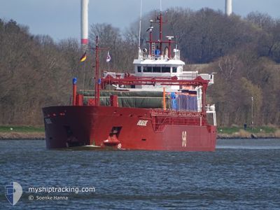
The vessel BUGOE (IMO: 9376775, MMSI: 255806390) is a General Cargo that was built in 2008 ( 16 Jaar oud ). It's sailing under the flag of [PT] Portugal.
In this page you can find informations about the vessels current position, last detected port calls, and current voyage information. If the vessels is not in coverage by AIS you will find the latest position.
The current position of BUGOE is detected by our AIS receivers and we are not responsible for the reliability of the data. The last position was recorded while the vessel was in Coverage by the Ais receivers of our vessel tracking app.
The current draught of BUGOE as reported by AIS is 4.6 meters
Weather
| Temperature | 14.2°C / 57.56°F |
|---|---|
| Wind Speed | 12 knots |
| Direction | 231° SW |
| Pressure | 1015.9 hPa |
| Humidity | 63.4 % |
| Cloud Coverage | 100 % |
Featured Company
Last Port Calls
| Port | Arrival | Departure | Time In Port |
|---|---|---|---|
| 2024-06-01 15:41 | 2024-06-03 21:50 | 2 d | |
| 2024-05-20 09:20 | 2024-05-21 17:24 | 1 d | |
| 2024-05-17 19:44 | 2024-05-18 18:23 | 22 h | |
| 2024-05-11 17:57 | 2024-05-14 18:19 | 3 d | |
| 2024-05-04 11:50 | 2024-05-08 02:52 | 3 d | |
| 2024-04-27 19:36 | 2024-04-30 22:25 | 3 d | |
| 2024-04-23 15:17 | 2024-04-23 17:23 | 2 h | |
| 2024-04-19 14:18 | 2024-04-20 23:05 | 1 d | |
| 2024-04-16 16:48 | 2024-04-18 01:17 | 1 d | |
| 2024-04-14 06:04 | 2024-04-14 06:07 | 3 m |
Last Trips
| Origin | Departure | Destination | Arrival | Distance | |
|---|---|---|---|---|---|
| 2024-05-21 17:24 | 2024-06-01 15:41 | 455.15 nm | |||
| 2024-05-18 18:23 | 2024-05-20 09:20 | 370.05 nm | |||
| 2024-05-14 18:19 | 2024-05-17 19:44 | 207.00 nm | |||
| 2024-05-08 02:52 | 2024-05-11 17:57 | 902.68 nm | |||
| 2024-04-30 22:25 | 2024-05-04 11:50 | 676.70 nm | |||
| 2024-04-23 17:23 | 2024-04-27 19:36 | 932.34 nm | |||
| 2024-04-20 23:05 | 2024-04-23 15:17 | 613.45 nm | |||
| 2024-04-18 01:17 | 2024-04-19 14:18 | 267.55 nm | |||
| 2024-04-14 06:07 | 2024-04-16 16:48 | 465.59 nm | |||
| 2024-04-13 03:52 | 2024-04-14 06:04 | 221.62 nm |
Events
| Tijd | Evenement | Details | Positie / Bestemming | Info |
|---|---|---|---|---|
| 2024-06-06 09:46 | Stop beweging | 0.73 nm, South of STICKENHΟRN SPORT |
54.37100 / 10.16383
PAPENBURG
|
Snelheid: 0.3 kn Koers: 216° |
| 2024-06-06 06:02 | Wijzig zee gebeid | German part of the Baltic Sea Danish part of the Baltic Sea |
54.56893 / 10.55608
Baltic Sea
PAPENBURG
|
Snelheid: 4.6 kn Koers: 245.2° |
| 2024-06-06 04:23 | Wijzig zee gebeid | Danish part of the Baltic Sea German part of the Baltic Sea |
54.58683 / 10.80883
Baltic Sea
PAPENBURG
|
Snelheid: 9.2 kn Koers: 265° |
| 2024-06-06 02:14 | Wijzig zee gebeid | German part of the Baltic Sea Danish part of the Baltic Sea |
54.56033 / 11.33650
Baltic Sea
PAPENBURG
|
Snelheid: 9.5 kn Koers: 292.7° |
| 2024-06-05 19:20 | Gevonden in zee | Danish part of the Baltic Sea |
54.83472 / 12.92597
Baltic Sea
PAPENBURG
|
Snelheid: 10.1 kn Koers: 248° |
| 2024-06-05 16:23 | Wijzig zee gebeid | German part of the Baltic Sea Swedish part of the Baltic Sea |
55.01950 / 13.76817
Baltic Sea
PAPENBURG
|
Snelheid: 10.7 kn Koers: 247° |
| 2024-06-05 11:59 | Wijzig zee gebeid | Swedish part of the Baltic Sea Danish part of the Kattegat |
55.50750 / 14.75517
Baltic Sea
PAPENBURG
|
Snelheid: 10.1 kn Koers: 242.3° |
| 2024-06-05 10:17 | Wijzig zee gebeid | Danish part of the Kattegat Swedish part of the Baltic Sea |
55.64667 / 15.20600
Kattegat
PAPENBURG
|
Snelheid: 10.1 kn Koers: 241.2° |
| 2024-06-04 20:18 | Status Changed | Under way using engine Default |
57.03873 / 18.71092
PAPENBURG
|
Snelheid: 10.6 kn Koers: 220° |
| 2024-06-04 20:04 | Status Changed | Default Under way using engine |
57.07117 / 18.76150
PAPENBURG
|
Snelheid: 10.7 kn Koers: 220.5° |