
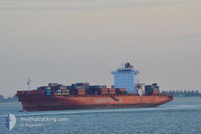
BSG BAHAMAS
Container Ship
Current Trip
| Time Travelled | 1 day |
|---|---|
| Remaining Time | 13 h, 20 mins |
| Distance Travelled | 825.21 nm |
| Remaining Distance | 808.13 nm |
| AVG Speed | 18.4 Knopen |
| MAX Speed | 21.5 Knopen |
| AVG Wind | 7.1 knots |
| MAX Wind | 18 knots |
| MIN Temp | 26.8°C / 80.24°F |
| MAX Temp | 29.2°C / 84.56°F |
| Diepgang | 8.6 M |
| Positie ontvangen | 1 d geleden |
Current Position
| Lengtegraad | -77.04823° |
|---|---|
| Breedtegraat | 21.77161° |
| Status | Under way using engine |
| Snelheid | 19.7 Knopen |
| Koers | 116.3° |
| Gebied | North Atlantic Ocean |
| Station | T-AIS |
| Positie ontvangen | 1 d geleden |
Info
Information
The current position of BSG BAHAMAS is in North Atlantic Ocean with coordinates 21.77161° / -77.04823° as reported on 2024-05-26 05:10 by AIS to our vessel tracker app. The vessel's current speed is 19.7 Knopen and is heading at the port of CARTAGENA. The estimated time of arrival as calculated by MyShipTracking vessel tracking app is 2024-05-27 16:36 LT
The vessel BSG BAHAMAS (IMO: 9439498, MMSI: 636093031) is a Container Ship that was built in 2009 ( 15 Jaar oud ). It's sailing under the flag of [LR] Liberia.
In this page you can find informations about the vessels current position, last detected port calls, and current voyage information. If the vessels is not in coverage by AIS you will find the latest position.
The current position of BSG BAHAMAS is detected by our AIS receivers and we are not responsible for the reliability of the data. The last position was recorded while the vessel was in Coverage by the Ais receivers of our vessel tracking app.
The current draught of BSG BAHAMAS as reported by AIS is 8.6 meters
Weather
| Temperature | 28.3°C / 82.94°F |
|---|---|
| Wind Speed | 18 knots |
| Direction | 78° ENE |
| Pressure | 1011.1 hPa |
| Humidity | 80.6 % |
| Cloud Coverage | 100 % |
Featured Company
Last Port Calls
| Port | Arrival | Departure | Time In Port |
|---|---|---|---|
| 2024-05-24 19:49 | 2024-05-25 07:59 | 12 h | |
| 2024-05-20 15:34 | 2024-05-23 03:04 | 2 d | |
| 2024-05-16 05:02 | 2024-05-17 08:10 | 1 d | |
| 2024-05-13 05:52 | 2024-05-13 20:56 | 15 h | |
| 2024-05-13 03:43 | 2024-05-13 05:28 | 1 h | |
| 2024-05-07 19:38 | 2024-05-09 18:34 | 1 d | |
| 2024-05-05 14:17 | 2024-05-06 14:27 | 1 d | |
| 2024-05-01 11:38 | 2024-05-01 23:38 | 11 h | |
| 2024-04-29 09:43 | 2024-04-30 01:07 | 15 h | |
| 2024-04-25 05:34 | 2024-04-26 15:47 | 1 d |
Most Visited Ports (Last year)
| Port | Arrivals | |
|---|---|---|
| 13 | ||
| 8 | ||
| 7 | ||
| 7 | ||
| 6 | ||
| 6 |
Last Trips
| Origin | Departure | Destination | Arrival | Distance | |
|---|---|---|---|---|---|
| 2024-05-23 03:04 | 2024-05-24 19:49 | 420.33 nm | |||
| 2024-05-17 08:10 | 2024-05-20 15:34 | 649.39 nm | |||
| 2024-05-13 20:56 | 2024-05-16 05:02 | 1030.80 nm | |||
| 2024-05-13 05:28 | 2024-05-13 05:52 | 1.77 nm | |||
| 2024-05-09 18:34 | 2024-05-13 03:43 | 1279.87 nm | |||
| 2024-05-06 14:27 | 2024-05-07 19:38 | 282.49 nm | |||
| 2024-05-01 23:38 | 2024-05-05 14:17 | 1157.18 nm | |||
| 2024-04-30 01:07 | 2024-05-01 11:38 | 412.62 nm | |||
| 2024-04-26 15:47 | 2024-04-29 09:43 | 644.55 nm | |||
| 2024-04-22 20:54 | 2024-04-25 05:34 | 952.34 nm |
Events
| Tijd | Evenement | Details | Positie / Bestemming | Info |
|---|---|---|---|---|
| 2024-05-26 05:27 | Status Changed | Default Under way using engine |
21.73310 / -76.95739
COCTG
|
Snelheid: 19.7 kn Koers: 116.3° |
| 2024-05-26 05:10 | Wijzig zee gebeid | Cuban part of the North Atlantic Ocean Bahamas part of the North Atlantic Ocean |
21.77161 / -77.04823
North Atlantic Ocean
COCTG
|
Snelheid: 19.7 kn Koers: 116.3° |
| 2024-05-26 05:10 | Status Changed | Under way using engine Default |
21.77161 / -77.04823
COCTG
|
Snelheid: 19.7 kn Koers: 132° |
| 2024-05-26 05:10 | Buitenbereik |
21.77161 / -77.04823
North Atlantic Ocean
COCTG
|
Snelheid: 19.7 kn Koers: 116.3° |
|
| 2024-05-26 05:02 | Binnenbereik |
21.77161 / -77.04823
North Atlantic Ocean
COCTG
|
Snelheid: 19.7 kn Koers: 116.3° |
|
| 2024-05-25 15:16 | Status Changed | Default Under way using engine |
25.39217 / -79.57797
COCTG
|
Snelheid: 19.2 kn Koers: 181.2° |
| 2024-05-25 15:03 | Buitenbereik |
25.46276 / -79.57877
North Atlantic Ocean
COCTG
|
Snelheid: 19.2 kn Koers: 181.2° |
|
| 2024-05-25 13:37 | Wijzig zee gebeid | Bahamas part of the North Atlantic Ocean United States part of the North Atlantic Ocean |
25.89791 / -79.68499
North Atlantic Ocean
COCTG
|
Snelheid: 19 kn Koers: 133.5° |
| 2024-05-25 11:59 | Vertrekhaven |
|
26.08722 / -80.11378
COCTG
|
Snelheid: 5.2 kn Koers: 346° |
| 2024-05-25 11:50 | Start beweging |
26.07537 / -80.11430
[US] FORT LAUDERDALE
|
Snelheid: 3.1 kn Koers: 359° |