
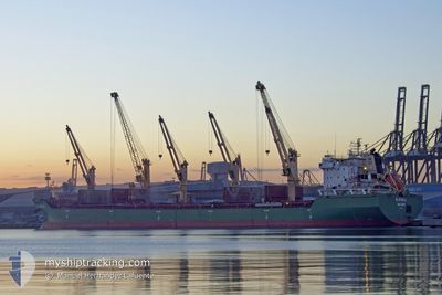
BLUEBILL
Bulk Carrier
Current Trip
| Time Travelled | 2 days |
|---|---|
| Remaining Time | 19 h, 0 mins |
| Distance Travelled | 645.62 nm |
| Remaining Distance | 169.65 nm |
| AVG Speed | 11.6 Knopen |
| MAX Speed | 17.1 Knopen |
| AVG Wind | 26.3 knots |
| MAX Wind | 42 knots |
| MIN Temp | 7.5°C / 45.5°F |
| MAX Temp | 10°C / 50°F |
| Diepgang | 5.9 M |
| Positie ontvangen | 1 m geleden |
Current Position
| Lengtegraad | --- |
|---|---|
| Breedtegraat | --- |
| Status | Under way using engine |
| Snelheid | 8 Knopen |
| Koers | 108.1° |
| Gebied | North Sea |
| Station | T-AIS |
| Positie ontvangen | 1 m geleden |
Info
Information
The current position of BLUEBILL is in North Sea with coordinates 57.80952° / 5.73592° as reported on 2025-12-08 02:39 by AIS to our vessel tracker app. The vessel's current speed is 8 Knopen and is heading at the port of SKAGEN. The estimated time of arrival as calculated by MyShipTracking vessel tracking app is 2025-12-08 22:41 LT
The vessel BLUEBILL (IMO: 9263306, MMSI: 538010365) is a Bulk Carrier that was built in 2004 ( 21 Jaar oud ). It's sailing under the flag of [MH] Marshall Is.
In this page you can find informations about the vessels current position, last detected port calls, and current voyage information. If the vessels is not in coverage by AIS you will find the latest position.
The current position of BLUEBILL is detected by our AIS receivers and we are not responsible for the reliability of the data. The last position was recorded while the vessel was in Coverage by the Ais receivers of our vessel tracking app.
The current draught of BLUEBILL as reported by AIS is 5.9 meters
Weather
| Temperature | 8.5°C / 47.3°F |
|---|---|
| Wind Speed | 35 knots |
| Direction | 113° ESE |
| Pressure | 989.2 hPa |
| Humidity | 94.6 % |
| Cloud Coverage | 100 % |
Featured Company
Last Port Calls
| Port | Arrival | Departure | Time In Port |
|---|---|---|---|
| 2025-12-03 00:09 | 2025-12-05 12:47 | 2 d | |
| 2025-11-22 04:33 | 2025-11-22 20:04 | 15 h | |
| 2025-11-20 19:28 | 2025-11-20 20:16 | 48 m | |
| 2025-11-14 08:22 | 2025-11-18 16:22 | 4 d | |
| 2025-11-02 22:43 | 2025-11-02 23:49 | 1 h | |
| 2025-10-28 08:55 | 2025-11-02 19:22 | 5 d | |
| 2025-10-26 22:31 | 2025-10-26 23:31 | 1 h | |
| 2025-10-03 21:33 |
Most Visited Ports (Last year)
| Port | Arrivals | |
|---|---|---|
| 4 | ||
| 4 | ||
| 2 | ||
| 2 | ||
| 2 | ||
| 1 |
Last Trips
| Origin | Departure | Destination | Arrival | Distance | |
|---|---|---|---|---|---|
| 2025-11-22 20:04 | 2025-12-03 00:09 | 2681.46 nm | |||
| 2025-11-20 20:16 | 2025-11-22 04:33 | 297.38 nm | |||
| 2025-11-18 16:22 | 2025-11-20 19:28 | 349.05 nm | |||
| 2025-11-02 23:49 | 2025-11-14 08:22 | 435.37 nm | |||
| 2025-11-02 19:22 | 2025-11-02 22:43 | 27.59 nm | |||
| 2025-10-26 23:31 | 2025-10-28 08:55 | 317.24 nm | |||
| 2025-10-03 21:33 | 2025-10-26 22:31 | 6689.26 nm |
Events
| Tijd | Evenement | Details | Positie / Bestemming | Info |
|---|---|---|---|---|
| 2025-12-07 21:26 | Status Changed | Under way using engine Default |
58.08310 / 4.25598
DK SKA
|
Snelheid: 9.7 kn Koers: 108° |
| 2025-12-07 21:19 | Status Changed | Default Under way using engine |
58.08900 / 4.22244
DK SKA
|
Snelheid: 9.7 kn Koers: 106.3° |
| 2025-12-07 21:13 | Wijzig zee gebeid | Norwegian part of the North Sea United Kingdom part of the North Sea |
58.09419 / 4.19250
North Sea
DK SKA
|
Snelheid: 9.7 kn Koers: 106.3° |
| 2025-12-07 21:13 | Status Changed | Under way using engine Default |
58.09419 / 4.19250
DK SKA
|
Snelheid: 10 kn Koers: 109° |
| 2025-12-07 20:58 | Binnenbereik |
58.09419 / 4.19250
North Sea
DK SKA
|
Snelheid: 9.7 kn Koers: 106.3° |
|
| 2025-12-06 20:55 | Status Changed | Default Under way using engine |
58.64389 / -2.44841
DK SKA
|
Snelheid: 8.3 kn Koers: 93.5° |
| 2025-12-06 20:49 | Status Changed | Under way using engine Default |
58.64512 / -2.47504
DK SKA
|
Snelheid: 7.9 kn Koers: 95° |
| 2025-12-06 20:49 | Buitenbereik |
58.64512 / -2.47504
North Sea
DK SKA
|
Snelheid: 8.3 kn Koers: 93.5° |
|
| 2025-12-06 20:47 | Status Changed | Default Under way using engine |
58.64542 / -2.48258
DK SKA
|
Snelheid: 7.6 kn Koers: 91.6° |
| 2025-12-06 17:46 | Wijzig zee gebeid | United Kingdom part of the North Sea United Kingdom part of the North Atlantic Ocean |
58.72041 / -3.40127
North Sea
DK SKA
|
Snelheid: 10.3 kn Koers: 91.2° |