
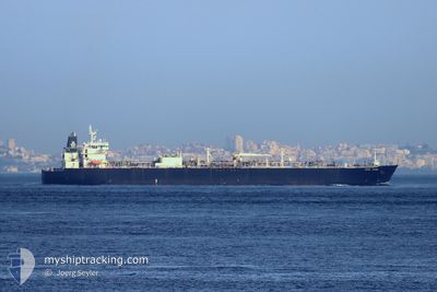
BERGE NINGBO
Lpg Tanker
Current Trip
| Time Travelled | 14 days |
|---|---|
| Remaining Time | --- |
| Distance Travelled | 2490.90 nm |
| Remaining Distance | --- |
| AVG Speed | 10.6 Knopen |
| MAX Speed | 15.3 Knopen |
| AVG Wind | 8.8 knots |
| MAX Wind | 18.3 knots |
| MIN Temp | 14.7°C / 58.46°F |
| MAX Temp | 28.8°C / 83.84°F |
| Diepgang | 7.8 M |
| Positie ontvangen | 7 m geleden |
Current Position
| Lengtegraad | --- |
|---|---|
| Breedtegraat | --- |
| Status | At anchor |
| Snelheid | |
| Koers | 331° |
| Gebied | Singapore Strait |
| Station | T-AIS |
| Positie ontvangen | 7 m geleden |
Info
Information
The current position of BERGE NINGBO is in Singapore Strait with coordinates 1.18655° / 103.68505° as reported on 2026-01-06 09:33 by AIS to our vessel tracker app. The vessel's current speed is 0 Knopen
The vessel BERGE NINGBO (IMO: 9308493, MMSI: 477099600) is a Lpg Tanker that was built in 2006 ( 20 Jaar oud ). It's sailing under the flag of [HK] Hong Kong.
In this page you can find informations about the vessels current position, last detected port calls, and current voyage information. If the vessels is not in coverage by AIS you will find the latest position.
The current position of BERGE NINGBO is detected by our AIS receivers and we are not responsible for the reliability of the data. The last position was recorded while the vessel was in Coverage by the Ais receivers of our vessel tracking app.
The current draught of BERGE NINGBO as reported by AIS is 7.8 meters
Weather
| Temperature | 27.8°C / 82.04°F |
|---|---|
| Wind Speed | 14 knots |
| Direction | 27° NNE |
| Pressure | 1008.5 hPa |
| Humidity | 76.3 % |
| Cloud Coverage | 79 % |
Featured Company
Most Visited Ports (Last year)
| Port | Arrivals | |
|---|---|---|
| 8 | ||
| 6 | ||
| 1 | ||
| 1 |
Events
| Tijd | Evenement | Details | Positie / Bestemming | Info |
|---|---|---|---|---|
| 2026-01-06 09:21 | Status Changed | At anchor Default |
1.18685 / 103.68532
SGSIN PWBGA
|
Snelheid: Koers: 324° |
| 2026-01-06 09:00 | Status Changed | Default At anchor |
1.18703 / 103.68557
SGSIN PWBGA
|
Snelheid: 0.1 kn Koers: 311° |
| 2026-01-06 08:54 | Status Changed | At anchor Default |
1.18710 / 103.68565
SGSIN PWBGA
|
Snelheid: Koers: 307° |
| 2026-01-06 08:30 | Status Changed | Default At anchor |
1.18777 / 103.68578
SGSIN PWBGA
|
Snelheid: Koers: 300° |
| 2026-01-06 08:18 | Status Changed | At anchor Default |
1.18810 / 103.68577
SGSIN PWBGA
|
Snelheid: Koers: 292° |
| 2026-01-06 08:03 | Status Changed | Default At anchor |
1.18815 / 103.68601
SGSIN PWBGA
|
Snelheid: Koers: 288° |
| 2026-01-06 07:27 | Status Changed | At anchor Default |
1.18858 / 103.68605
SGSIN PWBGA
|
Snelheid: Koers: 271° |
| 2026-01-06 07:00 | Status Changed | Default At anchor |
1.18823 / 103.68612
SGSIN PWBGA
|
Snelheid: 0.1 kn Koers: 282° |
| 2026-01-06 06:54 | Status Changed | At anchor Default |
1.18810 / 103.68618
SGSIN PWBGA
|
Snelheid: 0.1 kn Koers: 284° |
| 2026-01-06 06:51 | Status Changed | Default At anchor |
1.18802 / 103.68623
SGSIN PWBGA
|
Snelheid: Koers: 287° |