
BASS
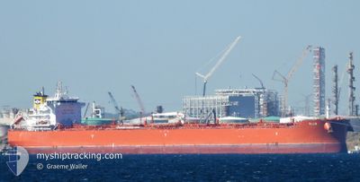
Tanker
Current Trip
| Time Travelled | 12 days |
|---|---|
| Remaining Time | --- |
| Distance Travelled | 2887.73 nm |
| Remaining Distance | --- |
| AVG Speed | 10.9 Knopen |
| MAX Speed | 16.2 Knopen |
| AVG Wind | 15.3 knots |
| MAX Wind | 28 knots |
| MIN Temp | 25.9°C / 78.62°F |
| MAX Temp | 34.5°C / 94.1°F |
| Diepgang | 10.2 M |
| Positie ontvangen | 5 d geleden |
Current Position
| Lengtegraad | 76.51559° |
|---|---|
| Breedtegraat | 8.29578° |
| Status | Under way using engine |
| Snelheid | 12.1 Knopen |
| Koers | 318.7° |
| Gebied | Laccadive Sea |
| Station | T-AIS |
| Positie ontvangen | 5 d geleden |
Info
Information
The current position of BASS is in Laccadive Sea with coordinates 8.29578° / 76.51559° as reported on 2024-05-26 15:26 by AIS to our vessel tracker app. The vessel's current speed is 12.1 Knopen
The vessel BASS (IMO: 9885908, MMSI: 538009014) is a Tanker It's sailing under the flag of [MH] Marshall Is.
In this page you can find informations about the vessels current position, last detected port calls, and current voyage information. If the vessels is not in coverage by AIS you will find the latest position.
The current position of BASS is detected by our AIS receivers and we are not responsible for the reliability of the data. The last position was recorded while the vessel was in Coverage by the Ais receivers of our vessel tracking app.
The current draught of BASS as reported by AIS is 10.2 meters
Weather
| Temperature | 29.1°C / 84.38°F |
|---|---|
| Wind Speed | 16 knots |
| Direction | 238° WSW |
| Pressure | 1004.2 hPa |
| Humidity | 79.6 % |
| Cloud Coverage | 100 % |
Featured Company
Last Port Calls
| Port | Arrival | Departure | Time In Port |
|---|---|---|---|
| 2024-05-17 15:37 | 2024-05-19 19:37 | 2 d | |
| 2024-04-14 10:20 | 2024-04-15 12:50 | 1 d |
Most Visited Ports (Last year)
| Port | Arrivals | |
|---|---|---|
| 3 | ||
| 3 | ||
| 3 | ||
| 2 | ||
| 1 | ||
| 1 |
Last Trips
| Origin | Departure | Destination | Arrival | Distance | |
|---|---|---|---|---|---|
| 2024-04-15 12:50 | 2024-05-17 15:37 | 5761.39 nm | |||
| 2024-03-10 23:19 | 2024-04-14 10:20 | 7132.29 nm |
Events
| Tijd | Evenement | Details | Positie / Bestemming | Info |
|---|---|---|---|---|
| 2024-05-31 18:28 | Start beweging | 5.73 nm, North of SIKKA |
22.58940 / 69.84894
SIKKA INDIA
|
Snelheid: 3.1 kn Koers: 272° |
| 2024-05-30 10:17 | Stop beweging | 5.95 nm, North of SIKKA |
22.59012 / 69.86678
SIKKA INDIA
|
Snelheid: 0.3 kn Koers: 264° |
| 2024-05-30 07:47 | Start beweging | 8.51 nm, North of SIKKA |
22.62645 / 69.89510
SIKKA INDIA
|
Snelheid: 3.2 kn Koers: 236° |
| 2024-05-30 05:41 | Stop beweging | 8.46 nm, North East of SIKKA |
22.62389 / 69.89924
SIKKA INDIA
|
Snelheid: 0.2 kn Koers: 110° |
| 2024-05-26 15:31 | Status Changed | Default Under way using engine |
8.30646 / 76.50549
SIKKA INDIA
|
Snelheid: 12.1 kn Koers: 318.7° |
| 2024-05-26 15:26 | Buitenbereik |
8.29578 / 76.51559
Laccadive Sea
SIKKA INDIA
|
Snelheid: 12.1 kn Koers: 318.7° |
|
| 2024-05-26 11:11 | Status Changed | Under way using engine Default |
7.86355 / 77.20240
SIKKA INDIA
|
Snelheid: 11 kn Koers: 296° |
| 2024-05-26 11:07 | Status Changed | Default Under way using engine |
7.85500 / 77.21500
SIKKA INDIA
|
Snelheid: 11.3 kn Koers: 312.9° |
| 2024-05-26 10:01 | ETA Changed | 2024/05/29 22:30 2024/05/28 20:30 |
7.73565 / 77.38699
SIKKA INDIA
|
Snelheid: 11.6 kn Koers: 311° |
| 2024-05-26 09:48 | Status Changed | Under way using engine Default |
7.71295 / 77.41821
SIKKA INDIA
|
Snelheid: 11 kn Koers: 303° |