
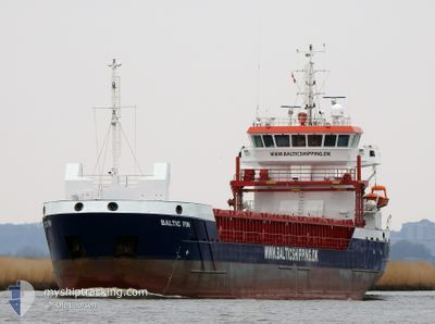
BALTIC FIN
Cargo
Current Trip
| Time Travelled | 3 h, 56 mins |
|---|---|
| Remaining Time | 2 days |
| Distance Travelled | 31.01 nm |
| Remaining Distance | 559.84 nm |
| AVG Speed | 8.6 Knopen |
| MAX Speed | 11.2 Knopen |
| AVG Wind | 11.4 knots |
| MAX Wind | 15 knots |
| MIN Temp | 11.5°C / 52.7°F |
| MAX Temp | 12.9°C / 55.22°F |
| Diepgang | 4.1 M |
| Positie ontvangen | 36 m geleden |
Current Position
| Lengtegraad | 4.18421° |
|---|---|
| Breedtegraat | 52.53298° |
| Status | Under way using engine |
| Snelheid | 11.1 Knopen |
| Koers | 307.4° |
| Gebied | North Sea |
| Station | T-AIS |
| Positie ontvangen | 36 m geleden |
Info
Information
The current position of BALTIC FIN is in North Sea with coordinates 52.53298° / 4.18421° as reported on 2024-05-20 01:31 by AIS to our vessel tracker app. The vessel's current speed is 11.1 Knopen and is heading at the port of KALMAR. The estimated time of arrival as calculated by MyShipTracking vessel tracking app is 2024-05-22 07:29 LT
The vessel BALTIC FIN (IMO: 9953925, MMSI: 210543000) is a Cargo It's sailing under the flag of [CY] Cyprus.
In this page you can find informations about the vessels current position, last detected port calls, and current voyage information. If the vessels is not in coverage by AIS you will find the latest position.
The current position of BALTIC FIN is detected by our AIS receivers and we are not responsible for the reliability of the data. The last position was recorded while the vessel was in Coverage by the Ais receivers of our vessel tracking app.
The current draught of BALTIC FIN as reported by AIS is 4.1 meters
Weather
| Temperature | 12.7°C / 54.86°F |
|---|---|
| Wind Speed | 15 knots |
| Direction | 8° N |
| Pressure | 1012.6 hPa |
| Humidity | 91.5 % |
| Cloud Coverage | 4 % |
Featured Company
Last Port Calls
| Port | Arrival | Departure | Time In Port |
|---|---|---|---|
| 2024-05-18 18:07 | 2024-05-20 00:11 | 1 d | |
| 2024-05-12 07:01 | 2024-05-13 19:57 | 1 d | |
| 2024-05-10 21:55 | 2024-05-11 17:25 | 19 h | |
| 2024-05-05 20:43 | 2024-05-07 22:58 | 2 d | |
| 2024-05-01 18:48 | 2024-05-04 14:22 | 2 d | |
| 2024-04-29 06:05 | 2024-04-29 20:38 | 14 h | |
| 2024-04-24 06:37 | 2024-04-27 12:36 | 3 d | |
| 2024-04-14 19:16 | 2024-04-19 15:06 | 4 d | |
| 2024-04-07 08:11 | 2024-04-09 13:19 | 2 d | |
| 2024-04-01 07:35 | 2024-04-03 18:15 | 2 d |
Last Trips
| Origin | Departure | Destination | Arrival | Distance | |
|---|---|---|---|---|---|
| 2024-05-13 19:57 | 2024-05-18 18:07 | 838.61 nm | |||
| 2024-05-11 17:25 | 2024-05-12 07:01 | 128.24 nm | |||
| 2024-05-07 22:58 | 2024-05-10 21:55 | 571.25 nm | |||
| 2024-05-04 14:22 | 2024-05-05 20:43 | 307.92 nm | |||
| 2024-04-29 20:38 | 2024-05-01 18:48 | 356.57 nm | |||
| 2024-04-27 12:36 | 2024-04-29 06:05 | 68.78 nm | |||
| 2024-04-19 15:06 | 2024-04-24 06:37 | 981.00 nm | |||
| 2024-04-09 13:19 | 2024-04-14 19:16 | 439.65 nm | |||
| 2024-04-03 18:15 | 2024-04-07 08:11 | 461.33 nm | |||
| 2024-03-22 15:44 | 2024-04-01 07:35 | 1292.11 nm |
Events
| Tijd | Evenement | Details | Positie / Bestemming | Info |
|---|---|---|---|---|
| 2024-05-20 01:34 | Status Changed | Default Under way using engine |
52.53914 / 4.17118
SEKLR
|
Snelheid: 11.1 kn Koers: 307.4° |
| 2024-05-20 01:31 | Status Changed | Under way using engine Default |
52.53298 / 4.18421
SEKLR
|
Snelheid: 10.8 kn Koers: 303° |
| 2024-05-20 01:29 | Status Changed | Default Under way using engine |
52.52874 / 4.19350
SEKLR
|
Snelheid: 10.9 kn Koers: 281.7° |
| 2024-05-19 23:59 | Start beweging | 0.36 nm, East of IJMUIDEN |
52.46587 / 4.59721
SEKLR
|
Snelheid: 3.8 kn Koers: 270° |
| 2024-05-19 23:38 | Stop beweging | 0.46 nm, East of IJMUIDEN |
52.46585 / 4.60018
SEKLR
|
Snelheid: 0.3 kn Koers: 269° |
| 2024-05-19 22:11 | Vertrekhaven |
|
52.41478 / 4.86210
SEKLR
|
Snelheid: 8.2 kn Koers: 303° |
| 2024-05-19 22:04 | Start beweging |
52.40319 / 4.87361
[NL] AMSTERDAM
|
Snelheid: 5.7 kn Koers: 45° |
|
| 2024-05-19 22:00 | Destination Changed | SEKLR SIKLR |
52.40188 / 4.86849
[NL] AMSTERDAM
|
Snelheid: 0.8 kn Koers: 66° |
| 2024-05-19 22:00 | ETA Changed | 2024/05/22 12:00 2024/05/21 12:00 |
52.40188 / 4.86849
[NL] AMSTERDAM
|
Snelheid: 0.8 kn Koers: 66° |
| 2024-05-19 21:56 | Status Changed | Under way using engine Default |
52.40187 / 4.86833
[NL] AMSTERDAM
|
Snelheid: Koers: 52° |