
AWTAD
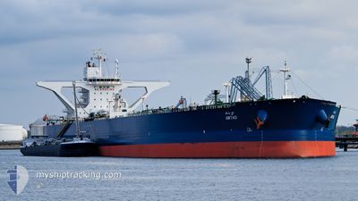
Crude Oil Tanker
Current Trip
| Time Travelled | 2 days |
|---|---|
| Remaining Time | --- |
| Distance Travelled | 193.27 nm |
| Remaining Distance | --- |
| AVG Speed | 6.6 Knopen |
| MAX Speed | 12.7 Knopen |
| AVG Wind | 12.5 knots |
| MAX Wind | 16.9 knots |
| MIN Temp | 26.7°C / 80.06°F |
| MAX Temp | 29.8°C / 85.64°F |
| Diepgang | 21.2 M |
| Positie ontvangen | Nu |
Current Position
| Lengtegraad | 52.72339° |
|---|---|
| Breedtegraat | 26.72138° |
| Status | Under way using engine |
| Snelheid | 12 Knopen |
| Koers | 142° |
| Gebied | Persian Gulf |
| Station | T-AIS |
| Positie ontvangen | Nu |
Info
Information
The current position of AWTAD is in Persian Gulf with coordinates 26.72138° / 52.72339° as reported on 2024-05-21 09:14 by AIS to our vessel tracker app. The vessel's current speed is 12 Knopen and is heading at the port of JIZAN. The estimated time of arrival as calculated by MyShipTracking vessel tracking app is 2024-05-29 11:00 LT
The vessel AWTAD (IMO: 9519717, MMSI: 403539000) is a Crude Oil Tanker that was built in 2011 ( 13 Jaar oud ). It's sailing under the flag of [SA] Saudi Arabia.
In this page you can find informations about the vessels current position, last detected port calls, and current voyage information. If the vessels is not in coverage by AIS you will find the latest position.
The current position of AWTAD is detected by our AIS receivers and we are not responsible for the reliability of the data. The last position was recorded while the vessel was in Coverage by the Ais receivers of our vessel tracking app.
The current draught of AWTAD as reported by AIS is 21.2 meters
Weather
| Temperature | 29.6°C / 85.28°F |
|---|---|
| Wind Speed | 3 knots |
| Direction | 142° SE |
| Pressure | 1005.9 hPa |
| Humidity | 65.6 % |
| Cloud Coverage | --- |
Featured Company
Last Port Calls
| Port | Arrival | Departure | Time In Port |
|---|---|---|---|
| 2024-05-18 09:18 | 2024-05-19 06:30 | 21 h | |
| 2024-04-21 06:41 | 2024-04-23 01:36 | 1 d | |
| 2024-03-23 21:03 | 2024-03-24 19:31 | 22 h |
Most Visited Ports (Last year)
| Port | Arrivals | |
|---|---|---|
| 3 | ||
| 2 | ||
| 1 |
Last Trips
| Origin | Departure | Destination | Arrival | Distance | |
|---|---|---|---|---|---|
| 2024-04-23 10:36 | 2024-05-18 12:18 | 6558.82 nm | |||
| 2024-03-24 22:31 | 2024-04-21 15:41 | 6701.23 nm | |||
| 2023-12-29 08:09 | 2024-03-24 00:03 | 11362.12 nm |
Events
| Tijd | Evenement | Details | Positie / Bestemming | Info |
|---|---|---|---|---|
| 2024-05-21 02:24 | Draught Changed | 21.2 12.2 |
27.13538 / 51.30937
SAGIZ
|
Snelheid: 12.4 kn Koers: 98.8° |
| 2024-05-21 02:24 | Destination Changed | SAGIZ SARTA |
27.13538 / 51.30937
SAGIZ
|
Snelheid: 12.4 kn Koers: 98.8° |
| 2024-05-21 02:24 | ETA Changed | 2024/05/29 11:00 2024/05/19 15:00 |
27.13538 / 51.30937
SAGIZ
|
Snelheid: 12.4 kn Koers: 98.8° |
| 2024-05-21 01:40 | Status Changed | Under way using engine Default |
27.15891 / 51.14030
SARTA
|
Snelheid: 12.6 kn Koers: 98° |
| 2024-05-21 01:27 | Status Changed | Default Under way using engine |
27.16613 / 51.09041
SARTA
|
Snelheid: 12.6 kn Koers: 98.3° |
| 2024-05-21 01:10 | Gevonden in zee | Iranian part of the Persian Gulf |
27.17378 / 51.02769
Persian Gulf
|
Snelheid: 12.6 kn Koers: 99.2° |
| 2024-05-21 01:09 | Status Changed | Under way using engine Default |
27.17466 / 51.02191
SARTA
|
Snelheid: 12.5 kn Koers: 97° |
| 2024-05-21 01:09 | Binnenbereik |
27.17378 / 51.02769
Persian Gulf
|
Snelheid: 12.6 kn Koers: 99.2° |
|
| 2024-05-20 19:20 | Start beweging | 19.04 nm, North of RAS TANURA |
26.94478 / 50.02880
SARTA
|
Snelheid: 3.5 kn Koers: 29° |
| 2024-05-19 14:50 | Buitenbereik |
26.93995 / 50.03760
Persian Gulf
SARTA
|
Snelheid: 0.1 kn Koers: 160.9° |