
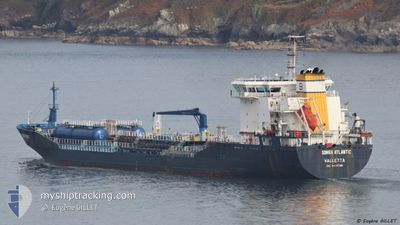
SONGA ATLANTIC
Oil/Chemical Tanker
Current Trip
| Time Travelled | 18 h, 5 mins |
|---|---|
| Remaining Time | 17 h, 2 mins |
| Distance Travelled | 179.19 nm |
| Remaining Distance | 175.27 nm |
| AVG Speed | 9.5 Knopen |
| MAX Speed | 11.3 Knopen |
| AVG Wind | 13.8 knots |
| MAX Wind | 17.9 knots |
| MIN Temp | 9°C / 48.2°F |
| MAX Temp | 12.7°C / 54.86°F |
| Diepgang | 6.5 M |
| Positie ontvangen | Nu |
Current Position
| Lengtegraad | 14.80875° |
|---|---|
| Breedtegraat | 54.62740° |
| Status | Under way using engine |
| Snelheid | 10.5 Knopen |
| Koers | 81° |
| Gebied | Kattegat |
| Station | T-AIS |
| Positie ontvangen | Nu |
Info
Information
The current position of SONGA ATLANTIC is in Kattegat with coordinates 54.62740° / 14.80875° as reported on 2024-05-13 19:12 by AIS to our vessel tracker app. The vessel's current speed is 10.5 Knopen and is heading at the port of GDANSK. The estimated time of arrival as calculated by MyShipTracking vessel tracking app is 2024-05-14 14:15 LT
The vessel SONGA ATLANTIC (IMO: 9447328, MMSI: 248713000) is a Oil/Chemical Tanker that was built in 2010 ( 14 Jaar oud ). It's sailing under the flag of [MT] Malta.
In this page you can find informations about the vessels current position, last detected port calls, and current voyage information. If the vessels is not in coverage by AIS you will find the latest position.
The current position of SONGA ATLANTIC is detected by our AIS receivers and we are not responsible for the reliability of the data. The last position was recorded while the vessel was in Coverage by the Ais receivers of our vessel tracking app.
The current draught of SONGA ATLANTIC as reported by AIS is 6.5 meters
Weather
| Temperature | 11.1°C / 51.98°F |
|---|---|
| Wind Speed | 15 knots |
| Direction | 90° E |
| Pressure | 1018.8 hPa |
| Humidity | 72.9 % |
| Cloud Coverage | 19 % |
Featured Company
Last Port Calls
| Port | Arrival | Departure | Time In Port |
|---|---|---|---|
| 2024-05-13 03:05 | 2024-05-13 03:08 | 2 m | |
| 2024-05-10 05:14 | 2024-05-11 11:27 | 1 d | |
| 2024-05-02 19:40 | 2024-05-05 04:51 | 2 d | |
| 2024-04-25 04:18 | 2024-04-26 14:53 | 1 d | |
| 2024-04-19 09:25 | 2024-04-20 19:50 | 1 d | |
| 2024-04-10 02:21 | 2024-04-11 11:33 | 1 d | |
| 2024-04-03 16:27 | 2024-04-05 03:09 | 1 d | |
| 2024-03-29 01:43 | 2024-03-30 16:39 | 1 d | |
| 2024-03-12 18:19 | 2024-03-13 15:40 | 21 h | |
| 2024-03-11 15:45 | 2024-03-12 16:05 | 1 d |
Most Visited Ports (Last year)
| Port | Arrivals | |
|---|---|---|
| 13 | ||
| 10 | ||
| 10 | ||
| 7 | ||
| 6 | ||
| 5 |
Last Trips
| Origin | Departure | Destination | Arrival | Distance | |
|---|---|---|---|---|---|
| 2024-05-11 11:27 | 2024-05-13 03:05 | 374.87 nm | |||
| 2024-05-05 04:51 | 2024-05-10 05:14 | 251.88 nm | |||
| 2024-04-26 14:53 | 2024-05-02 19:40 | 207.52 nm | |||
| 2024-04-20 19:50 | 2024-04-25 04:18 | 295.10 nm | |||
| 2024-04-11 11:33 | 2024-04-19 09:25 | 83.66 nm | |||
| 2024-04-05 03:09 | 2024-04-10 02:21 | 52.23 nm | |||
| 2024-03-30 16:39 | 2024-04-03 16:27 | 281.79 nm | |||
| 2024-03-13 15:40 | 2024-03-29 01:43 | 1605.78 nm | |||
| 2024-03-12 16:05 | 2024-03-12 18:19 | 17.41 nm | |||
| 2024-03-08 09:26 | 2024-03-11 15:45 | 759.32 nm |
Events
| Tijd | Evenement | Details | Positie / Bestemming | Info |
|---|---|---|---|---|
| 2024-05-13 18:16 | Gevonden in zee | Danish part of the Kattegat |
54.60423 / 14.53067
Kattegat
PLGDN
|
Snelheid: 10.3 kn Koers: 81° |
| 2024-05-13 16:13 | Status Changed | Under way using engine Default |
54.66992 / 13.94562
PLGDN
|
Snelheid: 10.3 kn Koers: 100° |
| 2024-05-13 16:12 | Status Changed | Default Under way using engine |
54.67037 / 13.94165
PLGDN
|
Snelheid: 10.4 kn Koers: 101° |
| 2024-05-13 14:42 | Destination Changed | PLGDN GDANSK |
54.75315 / 13.52112
PLGDN
|
Snelheid: 10.1 kn Koers: 92° |
| 2024-05-13 08:47 | Wijzig zee gebeid | German part of the Baltic Sea Danish part of the Baltic Sea |
54.39702 / 12.05818
Baltic Sea
GDANSK
|
Snelheid: 10.5 kn Koers: 89° |
| 2024-05-13 06:20 | Gevonden in zee | Danish part of the Baltic Sea |
54.50678 / 11.42893
Baltic Sea
GDANSK
|
Snelheid: 9.2 kn Koers: 117° |
| 2024-05-13 03:47 | Gevonden in zee | German part of the Baltic Sea |
54.56988 / 10.78292
Baltic Sea
GDANSK
|
Snelheid: 9.8 kn Koers: 83° |
| 2024-05-13 03:08 | Wijzig zee gebeid | Danish part of the Baltic Sea German part of the Baltic Sea |
54.55837 / 10.59933
Baltic Sea
GDANSK
|
Snelheid: 9.9 kn Koers: 79° |
| 2024-05-13 01:47 | Wijzig zee gebeid | German part of the Baltic Sea German part of the North Sea |
54.46222 / 10.26867
Baltic Sea
GDANSK
|
Snelheid: 10.6 kn Koers: 34° |
| 2024-05-13 01:08 | Vertrekhaven |
|
54.36417 / 10.16843
GDANSK
|
Snelheid: 10.2 kn Koers: 66° |