
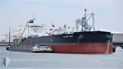
ATLANTA SPIRIT
Tanker
Current Trip
| Time Travelled | 2 days |
|---|---|
| Remaining Time | 1 day |
| Distance Travelled | 762.38 nm |
| Remaining Distance | 435.33 nm |
| AVG Speed | 12.2 Knopen |
| MAX Speed | 13.4 Knopen |
| AVG Wind | 12.6 knots |
| MAX Wind | 19 knots |
| MIN Temp | 8.9°C / 48.02°F |
| MAX Temp | 18.2°C / 64.76°F |
| Diepgang | 15.7 M |
| Positie ontvangen | 18 h, 55 m geleden |
Current Position
| Lengtegraad | --- |
|---|---|
| Breedtegraat | --- |
| Status | Under way using engine |
| Snelheid | 12.4 Knopen |
| Koers | 269.3° |
| Gebied | Mediterranean Sea - Eastern Basin |
| Station | T-AIS |
| Positie ontvangen | 18 h, 55 m geleden |
Info
Information
The current position of ATLANTA SPIRIT is in Mediterranean Sea - Eastern Basin with coordinates 34.52103° / 25.71184° as reported on 2026-01-05 20:31 by AIS to our vessel tracker app. The vessel's current speed is 12.4 Knopen and is heading at the port of VALLETTA. The estimated time of arrival as calculated by MyShipTracking vessel tracking app is 2026-01-07 19:03 LT
The vessel ATLANTA SPIRIT (IMO: 9578646, MMSI: 311000438) is a Tanker It's sailing under the flag of [BS] Bahamas.
In this page you can find informations about the vessels current position, last detected port calls, and current voyage information. If the vessels is not in coverage by AIS you will find the latest position.
The current position of ATLANTA SPIRIT is detected by our AIS receivers and we are not responsible for the reliability of the data. The last position was recorded while the vessel was in Coverage by the Ais receivers of our vessel tracking app.
The current draught of ATLANTA SPIRIT as reported by AIS is 15.7 meters
Weather
| Temperature | 18.1°C / 64.58°F |
|---|---|
| Wind Speed | 12 knots |
| Direction | 184° S |
| Pressure | 1011.5 hPa |
| Humidity | 73.6 % |
| Cloud Coverage | 94 % |
Featured Company
Most Visited Ports (Last year)
| Port | Arrivals | |
|---|---|---|
| 2 | ||
| 2 | ||
| 1 | ||
| 1 | ||
| 1 | ||
| 1 |
Events
| Tijd | Evenement | Details | Positie / Bestemming | Info |
|---|---|---|---|---|
| 2026-01-05 20:44 | Status Changed | Default Under way using engine |
34.51855 / 25.65726
MTMLA
|
Snelheid: 12.4 kn Koers: 269.3° |
| 2026-01-05 20:31 | Gevonden in zee | Greek part of the Mediterranean Sea - Eastern Basin |
34.52103 / 25.71184
Mediterranean Sea - Eastern Basin
MTMLA
|
Snelheid: 12.4 kn Koers: 269.3° |
| 2026-01-05 20:31 | Status Changed | Under way using engine Default |
34.52103 / 25.71184
MTMLA
|
Snelheid: 12 kn Koers: 269° |
| 2026-01-05 20:31 | Binnenbereik |
34.52103 / 25.71184
Mediterranean Sea - Eastern Basin
MTMLA
|
Snelheid: 12.4 kn Koers: 269.3° |
|
| 2026-01-05 20:31 | Buitenbereik |
34.52103 / 25.71184
Mediterranean Sea - Eastern Basin
MTMLA
|
Snelheid: 12.4 kn Koers: 269.3° |
|
| 2026-01-04 18:26 | Status Changed | Default Under way using engine |
35.53720 / 32.21620
MTMLA
|
Snelheid: 12.2 kn Koers: 257.1° |
| 2026-01-04 18:09 | Status Changed | Under way using engine Default |
35.54971 / 32.28831
MTMLA
|
Snelheid: 12 kn Koers: 257° |
| 2026-01-04 18:09 | Buitenbereik |
35.54971 / 32.28831
Mediterranean Sea - Eastern Basin
MTMLA
|
Snelheid: 12.2 kn Koers: 257.1° |
|
| 2026-01-04 17:52 | Binnenbereik |
35.54971 / 32.28831
Mediterranean Sea - Eastern Basin
MTMLA
|
Snelheid: 12.2 kn Koers: 257.1° |
|
| 2026-01-04 17:05 | Buitenbereik |
35.59990 / 32.54521
Mediterranean Sea - Eastern Basin
MTMLA
|
Snelheid: 12.8 kn Koers: 259.5° |