
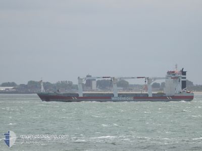
ARUBABORG
General Cargo
Current Trip
NOKVD
| Time Travelled | 26 days |
|---|---|
| Remaining Time | --- |
| Distance Travelled | 6738.95 nm |
| Remaining Distance | --- |
| AVG Speed | 12.3 Knopen |
| MAX Speed | 16.9 Knopen |
| AVG Wind | 16.3 knots |
| MAX Wind | 37 knots |
| MIN Temp | 5.7°C / 42.26°F |
| MAX Temp | 28.8°C / 83.84°F |
| Diepgang | 8.4 M |
| Positie ontvangen | 2 m geleden |
Current Position
| Lengtegraad | --- |
|---|---|
| Breedtegraat | --- |
| Status | Moored |
| Snelheid | |
| Koers | 238° |
| Gebied | North Sea |
| Station | T-AIS |
| Positie ontvangen | 2 m geleden |
Info
Information
The current position of ARUBABORG is in North Sea with coordinates 58.27516° / 6.88773° as reported on 2025-12-10 13:36 by AIS to our vessel tracker app. The vessel's current speed is 0 Knopen
The vessel ARUBABORG (IMO: 9466295, MMSI: 246719000) is a General Cargo that was built in 2010 ( 15 Jaar oud ). It's sailing under the flag of [NL] Netherlands.
In this page you can find informations about the vessels current position, last detected port calls, and current voyage information. If the vessels is not in coverage by AIS you will find the latest position.
The current position of ARUBABORG is detected by our AIS receivers and we are not responsible for the reliability of the data. The last position was recorded while the vessel was in Coverage by the Ais receivers of our vessel tracking app.
The current draught of ARUBABORG as reported by AIS is 8.4 meters
Weather
| Temperature | 7.8°C / 46.04°F |
|---|---|
| Wind Speed | 12 knots |
| Direction | 239° WSW |
| Pressure | 1002.9 hPa |
| Humidity | 85.7 % |
| Cloud Coverage | 100 % |
Featured Company
Last Port Calls
| Port | Arrival | Departure | Time In Port |
|---|---|---|---|
| 2025-11-10 11:24 | 2025-11-13 08:42 | 2 d | |
| 2025-10-31 17:02 | 2025-11-02 06:20 | 1 d | |
| 2025-10-08 23:12 | 2025-10-14 14:36 | 5 d | |
| 2025-10-04 05:24 | 2025-10-08 07:20 | 4 d |
Most Visited Ports (Last year)
| Port | Arrivals | |
|---|---|---|
| 2 | ||
| 2 | ||
| 1 | ||
| 1 | ||
| 1 | ||
| 1 |
Last Trips
| Origin | Departure | Destination | Arrival | Distance | |
|---|---|---|---|---|---|
| 2025-11-02 06:20 | 2025-11-10 11:24 | 2014.15 nm | |||
| 2025-10-14 14:36 | 2025-10-31 17:02 | 4531.58 nm | |||
| 2025-10-08 07:20 | 2025-10-08 23:12 | 207.09 nm | |||
| 2025-09-17 22:12 | 2025-10-04 05:24 | 4285.17 nm |
Events
| Tijd | Evenement | Details | Positie / Bestemming | Info |
|---|---|---|---|---|
| 2025-12-10 01:36 | Status Changed | Moored Default |
58.27517 / 6.88772
NOKVD
|
Snelheid: Koers: 238° |
| 2025-12-10 01:27 | Status Changed | Default Moored |
58.27518 / 6.88773
NOKVD
|
Snelheid: 0.1 kn Koers: 238° |
| 2025-12-10 00:06 | Status Changed | Moored Default |
58.27517 / 6.88773
NOKVD
|
Snelheid: Koers: -1° |
| 2025-12-10 00:04 | Status Changed | Default Moored |
58.27500 / 6.88833
NOKVD
|
Snelheid: Koers: 238° |
| 2025-12-09 21:06 | Status Changed | Moored Default |
58.27517 / 6.88774
NOKVD
|
Snelheid: Koers: -1° |
| 2025-12-09 21:01 | Status Changed | Default Moored |
58.27500 / 6.88833
NOKVD
|
Snelheid: Koers: 239° |
| 2025-12-09 20:18 | Status Changed | Moored Under way using engine |
58.27517 / 6.88774
NOKVD
|
Snelheid: Koers: 238° |
| 2025-12-09 20:01 | Stop beweging | 7.42 nm, East of FLEKKEFJORD |
58.27505 / 6.88774
NOKVD
|
Snelheid: 0.3 kn Koers: 236° |
| 2025-12-09 12:03 | Wijzig zee gebeid | Norwegian part of the North Sea Danish part of the North Sea |
56.90115 / 6.03227
North Sea
NOKVD
|
Snelheid: 13.1 kn Koers: 14.9° |
| 2025-12-09 10:27 | Status Changed | Under way using engine Default |
56.55706 / 5.94140
NOKVD
|
Snelheid: 13.1 kn Koers: 2° |