
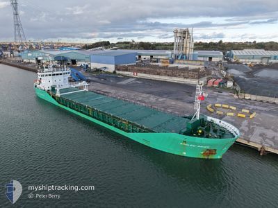
ARKLOW RAVEN
General Cargo
Current Trip
| Time Travelled | 15 h, 34 mins |
|---|---|
| Remaining Time | --- |
| Distance Travelled | 145.01 nm |
| Remaining Distance | 4.73 nm |
| AVG Speed | 11 Knopen |
| MAX Speed | 13.3 Knopen |
| AVG Wind | 12.7 knots |
| MAX Wind | 19 knots |
| MIN Temp | 7.4°C / 45.32°F |
| MAX Temp | 10.1°C / 50.18°F |
| Diepgang | 4 M |
| Positie ontvangen | 1 m geleden |
Current Position
| Lengtegraad | --- |
|---|---|
| Breedtegraat | --- |
| Status | At anchor |
| Snelheid | 0.1 Knopen |
| Koers | 168° |
| Gebied | Irish Sea and St. George's Channel |
| Station | T-AIS |
| Positie ontvangen | 1 m geleden |
Info
Information
The current position of ARKLOW RAVEN is in Irish Sea and St. George's Channel with coordinates 53.31101° / -6.08999° as reported on 2025-12-13 00:16 by AIS to our vessel tracker app. The vessel's current speed is 0.1 Knopen and is heading at the port of DUBLIN. The estimated time of arrival as calculated by MyShipTracking vessel tracking app is 2025-12-12 21:00 LT
The vessel ARKLOW RAVEN (IMO: 9344538, MMSI: 250001109) is a General Cargo that was built in 2007 ( 18 Jaar oud ). It's sailing under the flag of [IE] Ireland.
In this page you can find informations about the vessels current position, last detected port calls, and current voyage information. If the vessels is not in coverage by AIS you will find the latest position.
The current position of ARKLOW RAVEN is detected by our AIS receivers and we are not responsible for the reliability of the data. The last position was recorded while the vessel was in Coverage by the Ais receivers of our vessel tracking app.
The current draught of ARKLOW RAVEN as reported by AIS is 4 meters
Weather
| Temperature | 8.9°C / 48.02°F |
|---|---|
| Wind Speed | 9 knots |
| Direction | 216° SW |
| Pressure | 1020.9 hPa |
| Humidity | 70.2 % |
| Cloud Coverage | 4 % |
Featured Company
Last Port Calls
| Port | Arrival | Departure | Time In Port |
|---|---|---|---|
| 2025-12-10 15:39 | 2025-12-12 08:43 | 1 d | |
| 2025-12-04 07:34 | 2025-12-04 12:46 | 5 h | |
| 2025-11-30 11:22 | 2025-12-03 00:43 | 2 d | |
| 2025-11-26 13:46 | 2025-11-27 22:58 | 1 d | |
| 2025-11-18 23:36 | 2025-11-19 17:54 | 18 h | |
| 2025-11-15 01:45 | 2025-11-15 02:29 | 43 m | |
| 2025-11-14 00:15 | 2025-11-15 01:09 | 1 d | |
| 2025-11-13 23:04 | 2025-11-14 00:08 | 1 h | |
| 2025-11-09 11:29 | 2025-11-12 15:47 | 3 d | |
| 2025-11-03 19:14 | 2025-11-05 10:41 | 1 d |
Last Trips
| Origin | Departure | Destination | Arrival | Distance | |
|---|---|---|---|---|---|
| 2025-12-04 12:46 | 2025-12-10 15:39 | 1375.88 nm | |||
| 2025-12-03 00:43 | 2025-12-04 07:34 | 285.67 nm | |||
| 2025-11-27 22:58 | 2025-11-30 11:22 | 204.82 nm | |||
| 2025-11-19 17:54 | 2025-11-26 13:46 | 1003.96 nm | |||
| 2025-11-15 02:29 | 2025-11-18 23:36 | 765.61 nm | |||
| 2025-11-15 01:09 | 2025-11-15 01:45 | 2.83 nm | |||
| 2025-11-14 00:08 | 2025-11-14 00:15 | 1.05 nm | |||
| 2025-11-12 15:47 | 2025-11-13 23:04 | 222.44 nm | |||
| 2025-11-05 10:41 | 2025-11-09 11:29 | 200.53 nm | |||
| 2025-10-29 19:09 | 2025-11-03 19:14 | 141.49 nm |
Events
| Tijd | Evenement | Details | Positie / Bestemming | Info |
|---|---|---|---|---|
| 2025-12-12 22:28 | Status Changed | At anchor Default |
53.31074 / -6.08895
IEDUB
|
Snelheid: 0.1 kn Koers: 215° |
| 2025-12-12 22:25 | Status Changed | Default At anchor |
53.31078 / -6.08892
IEDUB
|
Snelheid: 0.3 kn Koers: 226° |
| 2025-12-12 20:54 | Status Changed | At anchor Under way using engine |
53.30969 / -6.08893
IEDUB
|
Snelheid: 0.8 kn Koers: 306° |
| 2025-12-12 20:52 | Stop beweging | 1.67 nm, East of DUN LAOGHAIRE |
53.30999 / -6.08907
IEDUB
|
Snelheid: 0.3 kn Koers: 290° |
| 2025-12-12 18:01 | Wijzig zee gebeid | Irish part of the Irish Sea and St. George's Channel United Kingdom part of the Irish Sea and St. George's Channel |
53.79491 / -5.72602
Irish Sea and St. George's Channel
IEDUB
|
Snelheid: 11.8 kn Koers: 200.3° |
| 2025-12-12 17:52 | Status Changed | Under way using engine Default |
53.82367 / -5.70873
IEDUB
|
Snelheid: 11.6 kn Koers: 202° |
| 2025-12-12 17:31 | Status Changed | Default Under way using engine |
53.88827 / -5.66760
IEDUB
|
Snelheid: 11.4 kn Koers: 201.7° |
| 2025-12-12 14:31 | Wijzig zee gebeid | United Kingdom part of the Irish Sea and St. George's Channel United Kingdom part of the Inner Seas off the West Coast of Scotland |
54.43313 / -5.33745
Irish Sea and St. George's Channel
IEDUB
|
Snelheid: 12.3 kn Koers: 185.1° |
| 2025-12-12 14:06 | ETA Changed | 2025/12/12 21:00 2025/12/12 22:00 |
54.52126 / -5.32725
IEDUB
|
Snelheid: 12.4 kn Koers: 181.7° |
| 2025-12-12 12:28 | Status Changed | Under way using engine Default |
54.86185 / -5.29702
IEDUB
|
Snelheid: 12 kn Koers: 181° |