
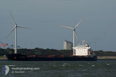
ARIES
Bulk Carrier
Current Trip
| Time Travelled | 7 days |
|---|---|
| Remaining Time | --- |
| Distance Travelled | 1651.23 nm |
| Remaining Distance | --- |
| AVG Speed | 11.2 Knopen |
| MAX Speed | 13.4 Knopen |
| AVG Wind | 7.9 knots |
| MAX Wind | 28.3 knots |
| MIN Temp | 26.5°C / 79.7°F |
| MAX Temp | 31.7°C / 89.06°F |
| Diepgang | 12.5 M |
| Positie ontvangen | 4 d geleden |
Current Position
| Lengtegraad | 57.12715° |
|---|---|
| Breedtegraat | 25.69351° |
| Status | Under way using engine |
| Snelheid | 11.9 Knopen |
| Koers | 143.9° |
| Gebied | Gulf of Oman |
| Station | T-AIS |
| Positie ontvangen | 4 d geleden |
Info
Information
The current position of ARIES is in Gulf of Oman with coordinates 25.69351° / 57.12715° as reported on 2024-04-30 00:56 by AIS to our vessel tracker app. The vessel's current speed is 11.9 Knopen and is heading at the port of BANDAR IMAM KHOMEINI. The estimated time of arrival as calculated by MyShipTracking vessel tracking app is 2024-04-28 08:00 LT
The vessel ARIES (IMO: 9369722, MMSI: 422035400) is a Bulk Carrier that was built in 2008 ( 16 Jaar oud ). It's sailing under the flag of [IR] Iran.
In this page you can find informations about the vessels current position, last detected port calls, and current voyage information. If the vessels is not in coverage by AIS you will find the latest position.
The current position of ARIES is detected by our AIS receivers and we are not responsible for the reliability of the data. The last position was recorded while the vessel was in Coverage by the Ais receivers of our vessel tracking app.
The current draught of ARIES as reported by AIS is 12.5 meters
Weather
| Temperature | 29.2°C / 84.56°F |
|---|---|
| Wind Speed | 9 knots |
| Direction | 332° NNW |
| Pressure | 1009.1 hPa |
| Humidity | 69.7 % |
| Cloud Coverage | 64 % |
Featured Company
Events
| Tijd | Evenement | Details | Positie / Bestemming | Info |
|---|---|---|---|---|
| 2024-04-30 08:00 | Start beweging | 4.82 nm, East of JASK |
25.62338 / 57.85204
IRAN B ABAS
|
Snelheid: 3.4 kn Koers: 163° |
| 2024-04-30 06:13 | Stop beweging | 4.51 nm, East of JASK |
25.63378 / 57.84921
IRAN B ABAS
|
Snelheid: 0.3 kn Koers: 118° |
| 2024-04-30 01:01 | Status Changed | Default Under way using engine |
25.67968 / 57.13828
IRAN B ABAS
|
Snelheid: 11.9 kn Koers: 143.9° |
| 2024-04-30 00:56 | Buitenbereik |
25.69351 / 57.12715
Gulf of Oman
|
Snelheid: 11.9 kn Koers: 143.9° |
|
| 2024-04-30 00:20 | Wijzig zee gebeid | Iranian part of the Gulf of Oman Iranian part of the Persian Gulf |
25.79913 / 57.07140
Gulf of Oman
|
Snelheid: 11.7 kn Koers: 165.1° |
| 2024-04-30 00:19 | Status Changed | Under way using engine Default |
25.80117 / 57.07077
IRAN B ABAS
|
Snelheid: 11.6 kn Koers: 158° |
| 2024-04-30 00:13 | Binnenbereik |
25.79913 / 57.07140
Gulf of Oman
|
Snelheid: 11.7 kn Koers: 165.1° |
|
| 2024-04-29 16:08 | Start beweging | 3.74 nm, North East of QUESHM |
27.01198 / 56.32242
IRAN B ABAS
|
Snelheid: 4.1 kn Koers: 131° |
| 2024-04-28 05:58 | Stop beweging | 4 nm, North East of QUESHM |
27.02625 / 56.31046
IRAN B ABAS
|
Snelheid: Koers: 122° |
| 2024-04-27 22:12 | Buitenbereik |
26.26997 / 55.60603
Persian Gulf
IRAN B ABAS
|
Snelheid: 10.6 kn Koers: 51.6° |