
APOLLONAS
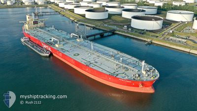
Tanker
Current Trip
| Time Travelled | --- |
|---|---|
| Remaining Time | --- |
| Distance Travelled | 12888.67 nm |
| Remaining Distance | --- |
| AVG Speed | 12.3 Knopen |
| MAX Speed | 16.8 Knopen |
| AVG Wind | 11 knots |
| MAX Wind | 32.7 knots |
| MIN Temp | 16.5°C / 61.7°F |
| MAX Temp | 30.4°C / 86.72°F |
| Diepgang | 19.9 M |
| Positie ontvangen | Nu |
Current Position
| Lengtegraad | 55.19266° |
|---|---|
| Breedtegraat | -20.92074° |
| Status | Under way using engine |
| Snelheid | 1.8 Knopen |
| Koers | 64° |
| Gebied | Indian Ocean |
| Station | T-AIS |
| Positie ontvangen | Nu |
Info
Information
The current position of APOLLONAS is in Indian Ocean with coordinates -20.92074° / 55.19266° as reported on 2024-04-29 05:36 by AIS to our vessel tracker app. The vessel's current speed is 1.8 Knopen and is heading at the port of HUIZHOU. The estimated time of arrival as calculated by MyShipTracking vessel tracking app is 2024-05-16 01:00 LT
The vessel APOLLONAS (IMO: 9733806, MMSI: 538006613) is a Tanker It's sailing under the flag of [MH] Marshall Is.
In this page you can find informations about the vessels current position, last detected port calls, and current voyage information. If the vessels is not in coverage by AIS you will find the latest position.
The current position of APOLLONAS is detected by our AIS receivers and we are not responsible for the reliability of the data. The last position was recorded while the vessel was in Coverage by the Ais receivers of our vessel tracking app.
The current draught of APOLLONAS as reported by AIS is 19.9 meters
Weather
| Temperature | 24.4°C / 75.92°F |
|---|---|
| Wind Speed | 4 knots |
| Direction | 249° WSW |
| Pressure | 1017.7 hPa |
| Humidity | 74.8 % |
| Cloud Coverage | 59 % |
Featured Company
Most Visited Ports (Last year)
| Port | Arrivals | |
|---|---|---|
| 4 | ||
| 2 |
Last Trips
| Origin | Departure | Destination | Arrival | Distance | |
|---|---|---|---|---|---|
| 2024-02-18 13:14 | 2024-02-23 12:03 | 58.31 nm | |||
| 2023-12-05 08:11 | 2024-02-17 11:46 | 7453.89 nm |
Events
| Tijd | Evenement | Details | Positie / Bestemming | Info |
|---|---|---|---|---|
| 2024-04-29 00:52 | Status Changed | Under way using engine Default |
-21.14768 / 54.64492
CN HUI
|
Snelheid: 9.3 kn Koers: 49° |
| 2024-04-29 00:50 | Status Changed | Default Under way using engine |
-21.15109 / 54.64068
CN HUI
|
Snelheid: 9.3 kn Koers: 49° |
| 2024-04-29 00:07 | Status Changed | Under way using engine Default |
-21.22644 / 54.55031
CN HUI
|
Snelheid: 9.1 kn Koers: 45° |
| 2024-04-28 23:42 | Status Changed | Default Under way using engine |
-21.27167 / 54.49833
CN HUI
|
Snelheid: 8.9 kn Koers: 47.8° |
| 2024-04-28 23:31 | Wijzig zee gebeid | R�union part of the Indian Ocean South African part of the South Atlantic Ocean |
-21.28823 / 54.48045
Indian Ocean
CN HUI
|
Snelheid: 8.9 kn Koers: 46.8° |
| 2024-04-28 23:31 | Status Changed | Under way using engine Default |
-21.28823 / 54.48045
CN HUI
|
Snelheid: 8.9 kn Koers: 46° |
| 2024-04-28 23:23 | Binnenbereik |
-21.28823 / 54.48045
Indian Ocean
CN HUI
|
Snelheid: 8.9 kn Koers: 46.8° |
|
| 2024-04-22 06:35 | Status Changed | Default Under way using engine |
-34.91833 / 18.36667
CN HUI
|
Snelheid: 13.8 kn Koers: 114.9° |
| 2024-04-22 06:30 | Buitenbereik |
-34.91231 / 18.34979
South Atlantic Ocean
CN HUI
|
Snelheid: 13.8 kn Koers: 114.9° |
|
| 2024-04-22 06:26 | Status Changed | Under way using engine Default |
-34.90477 / 18.33064
CN HUI
|
Snelheid: 14 kn Koers: 117° |