
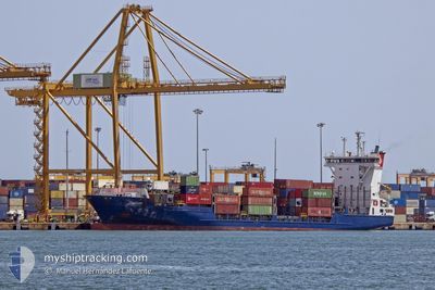
SANTUCA B
Container Ship
Current Trip
| Time Travelled | 2 days |
|---|---|
| Remaining Time | 1 h, 51 mins |
| Distance Travelled | 985.26 nm |
| Remaining Distance | 28.64 nm |
| AVG Speed | 15.2 Knopen |
| MAX Speed | 17.3 Knopen |
| AVG Wind | 8.4 knots |
| MAX Wind | 18 knots |
| MIN Temp | 16.9°C / 62.42°F |
| MAX Temp | 19.9°C / 67.82°F |
| Diepgang | 7.4 M |
| Positie ontvangen | Nu |
Current Position
| Lengtegraad | -15.03783° |
|---|---|
| Breedtegraat | 28.42079° |
| Status | Under way using engine |
| Snelheid | 14.5 Knopen |
| Koers | 224.3° |
| Gebied | North Atlantic Ocean |
| Station | T-AIS |
| Positie ontvangen | Nu |
Info
Information
The current position of SANTUCA B is in North Atlantic Ocean with coordinates 28.42079° / -15.03783° as reported on 2024-05-06 15:37 by AIS to our vessel tracker app. The vessel's current speed is 14.5 Knopen and is heading at the port of LAS PALMAS. The estimated time of arrival as calculated by MyShipTracking vessel tracking app is 2024-05-06 17:29 LT
The vessel SANTUCA B (IMO: 9287687, MMSI: 255805627) is a Container Ship that was built in 2003 ( 21 Jaar oud ). It's sailing under the flag of [PT] Portugal.
In this page you can find informations about the vessels current position, last detected port calls, and current voyage information. If the vessels is not in coverage by AIS you will find the latest position.
The current position of SANTUCA B is detected by our AIS receivers and we are not responsible for the reliability of the data. The last position was recorded while the vessel was in Coverage by the Ais receivers of our vessel tracking app.
The current draught of SANTUCA B as reported by AIS is 7.4 meters
Weather
| Temperature | 19.9°C / 67.82°F |
|---|---|
| Wind Speed | 13 knots |
| Direction | 37° NE |
| Pressure | 1015 hPa |
| Humidity | 85.9 % |
| Cloud Coverage | 24 % |
Featured Company
Last Port Calls
| Port | Arrival | Departure | Time In Port |
|---|---|---|---|
| 2024-05-03 04:14 | 2024-05-03 21:33 | 17 h | |
| 2024-04-29 07:30 | 2024-04-30 01:16 | 17 h | |
| 2024-04-28 23:44 | 2024-04-29 04:05 | 4 h | |
| 2024-04-26 05:16 | 2024-04-27 04:29 | 23 h | |
| 2024-04-23 20:42 | 2024-04-24 01:18 | 4 h | |
| 2024-04-23 06:15 | 2024-04-23 14:17 | 8 h | |
| 2024-04-22 18:00 | 2024-04-23 01:54 | 7 h | |
| 2024-04-19 05:52 | 2024-04-20 03:01 | 21 h | |
| 2024-04-15 07:04 | 2024-04-15 23:04 | 15 h | |
| 2024-04-14 23:52 | 2024-04-15 03:11 | 3 h |
Last Trips
| Origin | Departure | Destination | Arrival | Distance | |
|---|---|---|---|---|---|
| 2024-04-30 02:16 | 2024-05-03 06:14 | 1012.44 nm | |||
| 2024-04-29 05:05 | 2024-04-29 08:30 | 53.62 nm | |||
| 2024-04-27 06:29 | 2024-04-29 00:44 | 701.97 nm | |||
| 2024-04-24 02:18 | 2024-04-26 07:16 | 751.02 nm | |||
| 2024-04-23 15:17 | 2024-04-23 21:42 | 100.32 nm | |||
| 2024-04-23 02:54 | 2024-04-23 07:15 | 54.28 nm | |||
| 2024-04-20 05:01 | 2024-04-22 19:00 | 1014.00 nm | |||
| 2024-04-16 00:04 | 2024-04-19 07:52 | 1017.54 nm | |||
| 2024-04-15 04:11 | 2024-04-15 08:04 | 54.33 nm | |||
| 2024-04-13 06:04 | 2024-04-15 00:52 | 702.83 nm |
Events
| Tijd | Evenement | Details | Positie / Bestemming | Info |
|---|---|---|---|---|
| 2024-05-06 14:38 | Status Changed | Under way using engine Default |
28.58771 / -14.85527
ESLPA
|
Snelheid: 14.1 kn Koers: 225° |
| 2024-05-06 14:29 | Binnenbereik |
28.58771 / -14.85527
North Atlantic Ocean
ESLPA
|
Snelheid: 14.1 kn Koers: 227.1° |
|
| 2024-05-06 12:41 | Status Changed | Default Under way using engine |
28.90729 / -14.48759
ESLPA
|
Snelheid: 14.2 kn Koers: 224.7° |
| 2024-05-06 12:27 | Gevonden in zee | Spanish (Canary Islands) part of the North Atlantic Ocean |
28.94835 / -14.44238
North Atlantic Ocean
ESLPA
|
Snelheid: 14.2 kn Koers: 224.7° |
| 2024-05-06 12:27 | Status Changed | Under way using engine Default |
28.94835 / -14.44238
ESLPA
|
Snelheid: 14.2 kn Koers: 224° |
| 2024-05-06 12:27 | Binnenbereik |
28.94835 / -14.44238
North Atlantic Ocean
ESLPA
|
Snelheid: 14.2 kn Koers: 224.7° |
|
| 2024-05-06 12:27 | Buitenbereik |
28.94835 / -14.44238
North Atlantic Ocean
ESLPA
|
Snelheid: 14.2 kn Koers: 224.7° |
|
| 2024-05-05 17:24 | Status Changed | Default Under way using engine |
32.16895 / -10.73927
ESLPA
|
Snelheid: 14.1 kn Koers: 225° |
| 2024-05-05 17:24 | Buitenbereik |
32.16988 / -10.73819
North Atlantic Ocean
ESLPA
|
Snelheid: 14.1 kn Koers: 225° |
|
| 2024-05-05 16:33 | Status Changed | Under way using engine Default |
32.31329 / -10.57124
ESLPA
|
Snelheid: 14.2 kn Koers: 224° |