
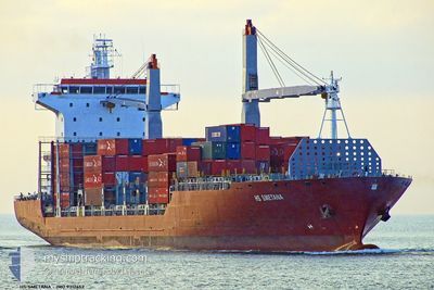
CMA CGM SUEZ
Container Ship
Current Trip
AEJEA>KEMBA
| Time Travelled | 21 h, 11 mins |
|---|---|
| Remaining Time | --- |
| Distance Travelled | 282.56 nm |
| Remaining Distance | --- |
| AVG Speed | 13.4 Knopen |
| MAX Speed | 13.4 Knopen |
| AVG Wind | 18.8 knots |
| MAX Wind | 24.9 knots |
| MIN Temp | 26.9°C / 80.42°F |
| MAX Temp | 29.2°C / 84.56°F |
| Diepgang | 10.8 M |
| Positie ontvangen | 28 d geleden |
Current Position
| Lengtegraad | 57.35893° |
|---|---|
| Breedtegraat | 25.15431° |
| Status | Under way using engine |
| Snelheid | 15 Knopen |
| Koers | 134.5° |
| Gebied | Gulf of Oman |
| Station | T-AIS |
| Positie ontvangen | 28 d geleden |
Info
Information
The current position of CMA CGM SUEZ is in Gulf of Oman with coordinates 25.15431° / 57.35893° as reported on 2024-03-31 16:12 by AIS to our vessel tracker app. The vessel's current speed is 15 Knopen
The vessel CMA CGM SUEZ (IMO: 9312652, MMSI: 248269000) is a Container Ship that was built in 2006 ( 18 Jaar oud ). It's sailing under the flag of [MT] Malta.
In this page you can find informations about the vessels current position, last detected port calls, and current voyage information. If the vessels is not in coverage by AIS you will find the latest position.
The current position of CMA CGM SUEZ is detected by our AIS receivers and we are not responsible for the reliability of the data. The last position was recorded while the vessel was in Coverage by the Ais receivers of our vessel tracking app.
The current draught of CMA CGM SUEZ as reported by AIS is 10.8 meters
Weather
| Temperature | 29.2°C / 84.56°F |
|---|---|
| Wind Speed | 13 knots |
| Direction | 177° S |
| Pressure | 1010.2 hPa |
| Humidity | 71.6 % |
| Cloud Coverage | 100 % |
Featured Company
Last Port Calls
| Port | Arrival | Departure | Time In Port |
|---|---|---|---|
| 2024-04-26 23:35 | 2024-04-28 06:21 | 1 d | |
| 2024-04-23 15:03 | 2024-04-25 02:30 | 1 d | |
| 2024-04-17 12:15 | 2024-04-19 10:27 | 1 d | |
| 2024-04-09 05:56 | 2024-04-13 07:13 | 4 d | |
| 2024-03-28 07:11 | 2024-03-30 11:16 | 2 d | |
| 2024-03-09 14:51 | 2024-03-10 19:00 | 1 d | |
| 2024-03-03 06:31 | 2024-03-04 04:33 | 22 h | |
| 2024-02-25 04:49 | 2024-02-26 08:50 | 1 d | |
| 2024-02-14 11:33 | 2024-02-16 18:40 | 2 d | |
| 2024-02-12 18:18 | 2024-02-13 09:46 | 15 h |
Last Trips
| Origin | Departure | Destination | Arrival | Distance | |
|---|---|---|---|---|---|
| 2024-04-25 04:30 | 2024-04-27 01:35 | 547.52 nm | |||
| 2024-04-19 13:27 | 2024-04-23 17:03 | 769.61 nm | |||
| 2024-04-13 10:13 | 2024-04-17 15:15 | 628.91 nm | |||
| 2024-03-30 15:16 | 2024-04-09 08:56 | 2667.85 nm | |||
| 2024-03-10 21:00 | 2024-03-28 11:11 | 3231.98 nm | |||
| 2024-03-04 06:33 | 2024-03-09 16:51 | 500.35 nm | |||
| 2024-02-26 11:50 | 2024-03-03 08:31 | 1195.71 nm | |||
| 2024-02-16 22:40 | 2024-02-25 07:49 | 2523.53 nm | |||
| 2024-02-13 13:46 | 2024-02-14 15:33 | 273.41 nm | |||
| 2024-02-07 09:45 | 2024-02-07 19:53 | 146.71 nm |
Events
| Tijd | Evenement | Details | Positie / Bestemming | Info |
|---|---|---|---|---|
| 2024-04-28 06:21 | Vertrekhaven |
|
-14.53333 / 40.66500
AEJEA>KEMBA
|
Snelheid: 2 kn Koers: -1° |
| 2024-04-26 23:35 | Stop beweging |
-14.54095 / 40.66460
[MZ] NACALA PORTO
|
Snelheid: 0.3 kn Koers: 40° |
|
| 2024-04-26 23:35 | Aankomsthaven |
|
-14.54095 / 40.66460
[MZ] NACALA PORTO
|
Snelheid: 0.5 kn Koers: 32° |
| 2024-04-25 02:30 | Start beweging | 1.21 nm, South of BEIRA |
-19.83333 / 34.82667
AEJEA>KEMBA
|
Snelheid: 9 kn Koers: -1° |
| 2024-04-25 02:30 | Vertrekhaven |
|
-19.83333 / 34.82667
AEJEA>KEMBA
|
Snelheid: 3 kn Koers: -1° |
| 2024-04-23 15:03 | Stop beweging |
-19.82052 / 34.83383
[MZ] BEIRA
|
Snelheid: Koers: 12° |
|
| 2024-04-23 15:03 | Aankomsthaven |
|
-19.82052 / 34.83383
[MZ] BEIRA
|
Snelheid: 4 kn Koers: -1° |
| 2024-04-23 12:21 | Start beweging | 16.45 nm, South East of BEIRA |
-19.92833 / 35.09833
AEJEA>KEMBA
|
Snelheid: 6 kn Koers: 275° |
| 2024-04-21 20:15 | Stop beweging | 17.35 nm, South East of BEIRA |
-19.93333 / 35.11333
AEJEA>KEMBA
|
Snelheid: Koers: -1° |
| 2024-04-19 10:27 | Vertrekhaven |
|
-12.65536 / 45.12631
AEJEA>KEMBA
|
Snelheid: Koers: -1° |