
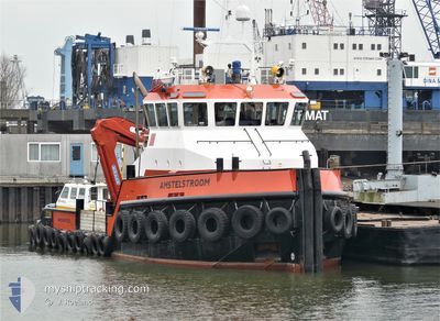
AMSTELSTROOM
Tug
Current Trip
EGAKI
| Time Travelled | 20 h, 8 mins |
|---|---|
| Remaining Time | --- |
| Distance Travelled | 3.91 nm |
| Remaining Distance | --- |
| AVG Speed | 5.6 Knopen |
| MAX Speed | 5.7 Knopen |
| AVG Wind | 6.7 knots |
| MAX Wind | 14 knots |
| MIN Temp | 15.9°C / 60.62°F |
| MAX Temp | 21.2°C / 70.16°F |
| Diepgang | 3 M |
| Positie ontvangen | 13 d geleden |
Current Position
| Lengtegraad | --- |
|---|---|
| Breedtegraat | --- |
| Status | Under way using engine |
| Snelheid | 0.1 Knopen |
| Koers | 288° |
| Gebied | Mediterranean Sea - Eastern Basin |
| Station | T-AIS |
| Positie ontvangen | 13 d geleden |
Info
Information
The current position of AMSTELSTROOM is in Mediterranean Sea - Eastern Basin with coordinates 31.33587° / 30.06089° as reported on 2025-11-22 19:35 by AIS to our vessel tracker app. The vessel's current speed is 0.1 Knopen
The vessel AMSTELSTROOM (IMO: 9295775, MMSI: 246203000) is a Tug that was built in 2004 ( 21 Jaar oud ). It's sailing under the flag of [NL] Netherlands.
In this page you can find informations about the vessels current position, last detected port calls, and current voyage information. If the vessels is not in coverage by AIS you will find the latest position.
The current position of AMSTELSTROOM is detected by our AIS receivers and we are not responsible for the reliability of the data. The last position was recorded while the vessel was in Coverage by the Ais receivers of our vessel tracking app.
The current draught of AMSTELSTROOM as reported by AIS is 3 meters
Weather
| Temperature | 18.1°C / 64.58°F |
|---|---|
| Wind Speed | 9 knots |
| Direction | 224° SW |
| Pressure | 1012.5 hPa |
| Humidity | 47.4 % |
| Cloud Coverage | --- |
Featured Company
Last Port Calls
| Port | Arrival | Departure | Time In Port |
|---|---|---|---|
| 2025-12-05 13:06 | 2025-12-05 13:43 | 36 m | |
| 2025-12-04 23:50 | 2025-12-05 08:29 | 8 h | |
| 2025-12-04 16:39 | 2025-12-04 18:45 | 2 h | |
| 2025-12-03 22:34 | 2025-12-03 23:28 | 53 m | |
| 2025-12-03 13:31 | 2025-12-03 14:10 | 39 m | |
| 2025-12-03 09:08 | 2025-12-03 10:08 | 1 h | |
| 2025-12-01 21:40 | 2025-12-01 22:13 | 33 m | |
| 2025-12-01 18:07 | 2025-12-01 19:52 | 1 h | |
| 2025-12-01 08:50 | 2025-12-01 12:12 | 3 h | |
| 2025-12-01 03:08 | 2025-12-01 07:28 | 4 h |
Most Visited Ports (Last year)
| Port | Arrivals | |
|---|---|---|
| 404 | ||
| 2 | ||
| 1 | ||
| 1 |
Last Trips
| Origin | Departure | Destination | Arrival | Distance | |
|---|---|---|---|---|---|
| 2025-12-05 08:29 | 2025-12-05 13:06 | 11.24 nm | |||
| 2025-12-04 18:45 | 2025-12-04 23:50 | 5.78 nm | |||
| 2025-12-03 23:28 | 2025-12-04 16:39 | 10.83 nm | |||
| 2025-12-03 14:10 | 2025-12-03 22:34 | 24.57 nm | |||
| 2025-12-03 10:08 | 2025-12-03 13:31 | 5.69 nm | |||
| 2025-12-01 22:13 | 2025-12-03 09:08 | 83.54 nm | |||
| 2025-12-01 19:52 | 2025-12-01 21:40 | 4.80 nm | |||
| 2025-12-01 12:12 | 2025-12-01 18:07 | 7.43 nm | |||
| 2025-12-01 07:28 | 2025-12-01 08:50 | 3.58 nm | |||
| 2025-11-30 08:17 | 2025-12-01 03:08 | 7.46 nm |
Events
| Tijd | Evenement | Details | Positie / Bestemming | Info |
|---|---|---|---|---|
| 2025-12-06 04:26 | Stop beweging | 1.69 nm, North West of ABU QIR |
31.33607 / 30.06002
EGAKI
|
Snelheid: 0.3 kn Koers: 331° |
| 2025-12-06 04:21 | Start beweging | 1.67 nm, North West of ABU QIR |
31.33606 / 30.06053
EGAKI
|
Snelheid: 4.2 kn Koers: 250° |
| 2025-12-05 13:30 | Stop beweging | 1.6 nm, North West of ABU QIR |
31.33701 / 30.06416
EGAKI
|
Snelheid: 0.3 kn Koers: 124° |
| 2025-12-05 13:12 | Start beweging | 1.81 nm, North West of ABU QIR |
31.33795 / 30.05881
EGAKI
|
Snelheid: 5.4 kn Koers: 81° |
| 2025-12-05 12:07 | Stop beweging | 1.7 nm, North West of ABU QIR |
31.33967 / 30.06536
EGAKI
|
Snelheid: 0.2 kn Koers: 101° |
| 2025-12-05 11:51 | Start beweging | 2.04 nm, North of ABU QIR |
31.34891 / 30.08234
EGAKI
|
Snelheid: 9.3 kn Koers: 243° |
| 2025-12-05 11:43 | Vertrekhaven |
|
31.34891 / 30.08234
EGAKI
|
Snelheid: Koers: 143° |
| 2025-12-05 11:29 | Stop beweging |
31.32957 / 30.07926
[EG] ABU QIR
|
Snelheid: Koers: 144° |
|
| 2025-12-05 11:06 | Aankomsthaven |
|
31.32886 / 30.07930
[EG] ABU QIR
|
Snelheid: 8.7 kn Koers: 193° |
| 2025-12-05 10:29 | Start beweging | 2.95 nm, North West of ABU QIR |
31.35558 / 30.04945
EGAKI
|
Snelheid: 8.8 kn Koers: 42° |