
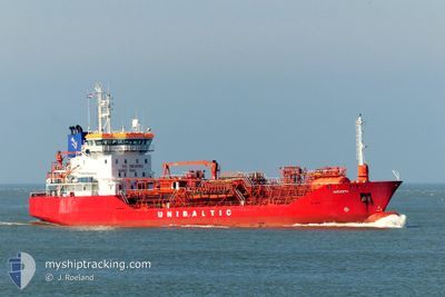
AMONITH
Oil/Chemical Tanker
Current Trip
| Time Travelled | 1 day |
|---|---|
| Remaining Time | 2 days |
| Distance Travelled | 290.95 nm |
| Remaining Distance | 387.27 nm |
| AVG Speed | 9.3 Knopen |
| MAX Speed | 12 Knopen |
| AVG Wind | 15.7 knots |
| MAX Wind | 21 knots |
| MIN Temp | 11.1°C / 51.98°F |
| MAX Temp | 13.1°C / 55.58°F |
| Diepgang | 4.6 M |
| Positie ontvangen | Nu |
Current Position
| Lengtegraad | 7.66544° |
|---|---|
| Breedtegraat | 56.90225° |
| Status | Under way using engine |
| Snelheid | 7.6 Knopen |
| Koers | 217.5° |
| Gebied | North Sea |
| Station | T-AIS |
| Positie ontvangen | Nu |
Info
Information
The current position of AMONITH is in North Sea with coordinates 56.90225° / 7.66544° as reported on 2024-06-08 02:43 by AIS to our vessel tracker app. The vessel's current speed is 7.6 Knopen and is heading at the port of IPSWICH. The estimated time of arrival as calculated by MyShipTracking vessel tracking app is 2024-06-10 06:45 LT
The vessel AMONITH (IMO: 9164093, MMSI: 210745000) is a Oil/Chemical Tanker that was built in 1999 ( 25 Jaar oud ). It's sailing under the flag of [CY] Cyprus.
In this page you can find informations about the vessels current position, last detected port calls, and current voyage information. If the vessels is not in coverage by AIS you will find the latest position.
The current position of AMONITH is detected by our AIS receivers and we are not responsible for the reliability of the data. The last position was recorded while the vessel was in Coverage by the Ais receivers of our vessel tracking app.
The current draught of AMONITH as reported by AIS is 4.6 meters
Weather
| Temperature | 12.3°C / 54.14°F |
|---|---|
| Wind Speed | 18 knots |
| Direction | 226° SW |
| Pressure | 1006.9 hPa |
| Humidity | 79.2 % |
| Cloud Coverage | 13 % |
Featured Company
Last Port Calls
| Port | Arrival | Departure | Time In Port |
|---|---|---|---|
| 2024-06-06 04:56 | 2024-06-06 20:24 | 15 h | |
| 2024-06-02 04:22 | 2024-06-03 08:57 | 1 d | |
| 2024-05-29 09:50 | |||
| 2024-05-23 06:26 | 2024-05-24 07:23 | 1 d | |
| 2024-05-19 23:48 | 2024-05-20 20:14 | 20 h | |
| 2024-05-13 22:33 | 2024-05-15 09:02 | 1 d | |
| 2024-05-08 20:36 | 2024-05-10 10:41 | 1 d | |
| 2024-04-26 12:24 | 2024-04-28 13:54 | 2 d | |
| 2024-04-21 04:40 | 2024-04-22 07:08 | 1 d | |
| 2024-04-15 15:23 | 2024-04-16 14:41 | 23 h |
Most Visited Ports (Last year)
| Port | Arrivals | |
|---|---|---|
| 30 | ||
| 25 | ||
| 21 | ||
| 7 | ||
| 6 | ||
| 5 |
Last Trips
| Origin | Departure | Destination | Arrival | Distance | |
|---|---|---|---|---|---|
| 2024-06-03 10:57 | 2024-06-06 06:56 | 681.72 nm | |||
| 2024-05-24 09:23 | 2024-06-02 06:22 | 1896.72 nm | |||
| 2024-05-24 09:23 | 2024-05-29 10:50 | 1126.84 nm | |||
| 2024-05-20 22:14 | 2024-05-23 08:26 | 534.56 nm | |||
| 2024-05-15 11:02 | 2024-05-20 01:48 | 683.08 nm | |||
| 2024-05-10 12:41 | 2024-05-14 00:33 | 430.16 nm | |||
| 2024-04-28 14:54 | 2024-05-08 22:36 | 990.43 nm | |||
| 2024-04-22 08:08 | 2024-04-26 13:24 | 803.54 nm | |||
| 2024-04-16 16:41 | 2024-04-21 05:40 | 1129.18 nm | |||
| 2024-04-13 14:25 | 2024-04-15 17:23 | 417.02 nm |
Events
| Tijd | Evenement | Details | Positie / Bestemming | Info |
|---|---|---|---|---|
| 2024-06-07 22:20 | Gevonden in zee | Danish part of the North Sea |
57.32861 / 8.23148
North Sea
GB IPS
|
Snelheid: 7.5 kn Koers: 233° |
| 2024-06-07 15:59 | ETA Changed | 2024/06/10 04:00 2024/06/10 09:00 |
57.84490 / 9.44506
GB IPS
|
Snelheid: 7.5 kn Koers: 226.8° |
| 2024-06-07 15:53 | ETA Changed | 2024/06/10 09:00 2024/06/09 09:00 |
57.85401 / 9.46356
GB IPS
|
Snelheid: 7.7 kn Koers: 225.5° |
| 2024-06-07 10:19 | Wijzig zee gebeid | Danish part of the Skaggerak Danish part of the Kattegat |
57.80991 / 10.94871
Skaggerak
GB IPS
|
Snelheid: 11.1 kn Koers: 322.4° |
| 2024-06-07 09:14 | Wijzig zee gebeid | Danish part of the Kattegat Swedish part of the Kattegat |
57.65307 / 11.20394
Kattegat
GB IPS
|
Snelheid: 12 kn Koers: 317.8° |
| 2024-06-07 04:47 | Wijzig zee gebeid | Swedish part of the Kattegat Danish part of the Kattegat |
56.91615 / 11.82479
Kattegat
GB IPS
|
Snelheid: 11 kn Koers: 345.1° |
| 2024-06-06 20:24 | Vertrekhaven |
|
55.66893 / 11.06675
GB IPS
|
Snelheid: 9.6 kn Koers: 287° |
| 2024-06-06 20:13 | Start beweging |
55.67367 / 11.09000
[DK] KALUNDBORG
|
Snelheid: 3.2 kn Koers: 210° |
|
| 2024-06-06 20:02 | Status Changed | Under way using engine Moored |
55.67417 / 11.10024
[DK] KALUNDBORG
|
Snelheid: Koers: 270° |
| 2024-06-06 19:51 | Draught Changed | 4.6 5.9 |
55.67416 / 11.10026
[DK] KALUNDBORG
|
Snelheid: Koers: 270° |