
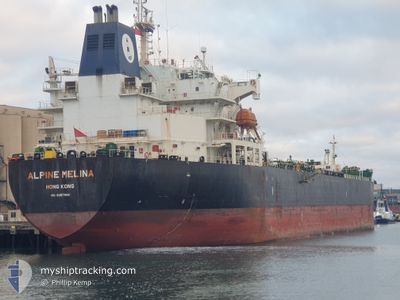
ALPINE MELINA
Oil/Chemical Tanker
Current Trip
| Time Travelled | 2 days |
|---|---|
| Remaining Time | --- |
| Distance Travelled | 610.48 nm |
| Remaining Distance | 15.85 nm |
| AVG Speed | 9.6 Knopen |
| MAX Speed | 13.5 Knopen |
| AVG Wind | 19.3 knots |
| MAX Wind | 25.9 knots |
| MIN Temp | 14.8°C / 58.64°F |
| MAX Temp | 19.3°C / 66.74°F |
| Diepgang | 11.1 M |
| Positie ontvangen | Nu |
Current Position
| Lengtegraad | 151.48557° |
|---|---|
| Breedtegraat | -33.99045° |
| Status | Under way using engine |
| Snelheid | 0.8 Knopen |
| Koers | 114° |
| Gebied | Tasman Sea |
| Station | T-AIS |
| Positie ontvangen | Nu |
Info
Information
The current position of ALPINE MELINA is in Tasman Sea with coordinates -33.99045° / 151.48557° as reported on 2024-04-30 19:46 by AIS to our vessel tracker app. The vessel's current speed is 0.8 Knopen and is heading at the port of SYDNEY. The estimated time of arrival as calculated by MyShipTracking vessel tracking app is 2024-04-30 15:30 LT
The vessel ALPINE MELINA (IMO: 9387944, MMSI: 477733900) is a Oil/Chemical Tanker that was built in 2010 ( 14 Jaar oud ). It's sailing under the flag of [HK] Hong Kong.
In this page you can find informations about the vessels current position, last detected port calls, and current voyage information. If the vessels is not in coverage by AIS you will find the latest position.
The current position of ALPINE MELINA is detected by our AIS receivers and we are not responsible for the reliability of the data. The last position was recorded while the vessel was in Coverage by the Ais receivers of our vessel tracking app.
The current draught of ALPINE MELINA as reported by AIS is 11.1 meters
Weather
| Temperature | 19.1°C / 66.38°F |
|---|---|
| Wind Speed | 23 knots |
| Direction | 169° S |
| Pressure | 1026.7 hPa |
| Humidity | 63.6 % |
| Cloud Coverage | 100 % |
Featured Company
Last Port Calls
| Port | Arrival | Departure | Time In Port |
|---|---|---|---|
| 2024-04-25 20:32 | 2024-04-28 07:27 | 2 d | |
| 2024-04-21 10:59 | 2024-04-22 14:15 | 1 d | |
| 2024-04-19 06:17 | 2024-04-21 00:41 | 1 d | |
| 2024-04-16 18:05 | 2024-04-18 03:08 | 1 d | |
| 2024-04-09 15:56 | 2024-04-14 12:41 | 4 d | |
| 2024-03-24 19:01 | 2024-03-26 01:20 | 1 d | |
| 2024-03-23 10:23 | 2024-03-24 12:44 | 1 d | |
| 2024-03-19 21:46 | 2024-03-23 01:34 | 3 d | |
| 2024-03-02 06:40 | 2024-03-04 12:21 | 2 d | |
| 2024-02-12 18:46 | 2024-02-14 16:30 | 1 d |
Most Visited Ports (Last year)
| Port | Arrivals | |
|---|---|---|
| 8 | ||
| 2 | ||
| 2 | ||
| 2 | ||
| 2 | ||
| 2 |
Last Trips
| Origin | Departure | Destination | Arrival | Distance | |
|---|---|---|---|---|---|
| 2024-04-23 00:15 | 2024-04-26 06:32 | 264.71 nm | |||
| 2024-04-21 10:41 | 2024-04-21 20:59 | 30.38 nm | |||
| 2024-04-18 13:08 | 2024-04-19 16:17 | 333.43 nm | |||
| 2024-04-14 22:41 | 2024-04-17 04:05 | 506.91 nm | |||
| 2024-03-26 09:20 | 2024-04-10 01:56 | 4002.43 nm | |||
| 2024-03-24 20:44 | 2024-03-25 03:01 | 59.57 nm | |||
| 2024-03-23 09:34 | 2024-03-23 18:23 | 54.36 nm | |||
| 2024-03-04 20:21 | 2024-03-20 05:46 | 2602.94 nm | |||
| 2024-02-15 00:30 | 2024-03-02 14:40 | 3571.83 nm | |||
| 2024-02-06 17:38 | 2024-02-13 02:46 | 1677.52 nm |
Events
| Tijd | Evenement | Details | Positie / Bestemming | Info |
|---|---|---|---|---|
| 2024-04-30 17:39 | Stop beweging | 13.82 nm, South East of ROSE BAY |
-33.96697 / 151.51403
AUSYD
|
Snelheid: 0.1 kn Koers: 91° |
| 2024-04-30 14:21 | ETA Changed | 2024/04/30 15:30 2024/04/30 23:00 |
-34.24148 / 151.41517
AUSYD
|
Snelheid: 10.4 kn Koers: 22° |
| 2024-04-30 14:07 | Wijzig zee gebeid | Australian part of the Tasman Sea Australian part of the Bass Strait |
-34.27987 / 151.39540
Tasman Sea
AUSYD
|
Snelheid: 10.9 kn Koers: 24° |
| 2024-04-30 14:05 | Status Changed | Under way using engine Default |
-34.28643 / 151.39211
AUSYD
|
Snelheid: 10.9 kn Koers: 20° |
| 2024-04-30 13:50 | Binnenbereik |
-34.27987 / 151.39540
Tasman Sea
AUSYD
|
Snelheid: 10.9 kn Koers: 24° |
|
| 2024-04-29 02:16 | Status Changed | Default Under way using engine |
-39.26208 / 146.60770
AUSYD
|
Snelheid: 11.2 kn Koers: 68° |
| 2024-04-29 02:10 | Status Changed | Under way using engine Default |
-39.26835 / 146.58864
AUSYD
|
Snelheid: 11.1 kn Koers: 67° |
| 2024-04-29 02:10 | Buitenbereik |
-39.26835 / 146.58864
Bass Strait
AUSYD
|
Snelheid: 11.2 kn Koers: 68° |
|
| 2024-04-29 02:04 | Binnenbereik |
-39.26835 / 146.58864
Bass Strait
AUSYD
|
Snelheid: 11.2 kn Koers: 68° |
|
| 2024-04-29 01:08 | Buitenbereik |
-39.28419 / 146.33963
Bass Strait
AUSYD
|
Snelheid: 11.4 kn Koers: 83° |