
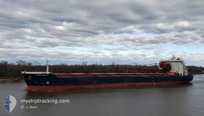
ALGOMA INTEGRITY
Self Discharging Bulk Carrier
Current Trip
| Time Travelled | 21 days |
|---|---|
| Remaining Time | 4 days |
| Distance Travelled | 3208.89 nm |
| Remaining Distance | 1025.38 nm |
| AVG Speed | 10.1 Knopen |
| MAX Speed | 13 Knopen |
| AVG Wind | 14.6 knots |
| MAX Wind | 30.5 knots |
| MIN Temp | 1°C / 33.8°F |
| MAX Temp | 25°C / 77°F |
| Diepgang | 8.6 M |
| Positie ontvangen | 3 h, 51 m geleden |
Current Position
| Lengtegraad | -79.52979° |
|---|---|
| Breedtegraat | 25.86687° |
| Status | Under way using engine |
| Snelheid | 8.6 Knopen |
| Koers | 185.9° |
| Gebied | North Atlantic Ocean |
| Station | T-AIS |
| Positie ontvangen | 3 h, 51 m geleden |
Info
Information
The current position of ALGOMA INTEGRITY is in North Atlantic Ocean with coordinates 25.86687° / -79.52979° as reported on 2024-04-28 03:27 by AIS to our vessel tracker app. The vessel's current speed is 8.6 Knopen and is heading at the port of VERACRUZ. The estimated time of arrival as calculated by MyShipTracking vessel tracking app is 2024-05-02 14:56 LT
The vessel ALGOMA INTEGRITY (IMO: 9405162, MMSI: 311000808) is a Self Discharging Bulk Carrier that was built in 2009 ( 15 Jaar oud ). It's sailing under the flag of [BS] Bahamas.
In this page you can find informations about the vessels current position, last detected port calls, and current voyage information. If the vessels is not in coverage by AIS you will find the latest position.
The current position of ALGOMA INTEGRITY is detected by our AIS receivers and we are not responsible for the reliability of the data. The last position was recorded while the vessel was in Coverage by the Ais receivers of our vessel tracking app.
The current draught of ALGOMA INTEGRITY as reported by AIS is 8.6 meters
Weather
| Temperature | 24°C / 75.2°F |
|---|---|
| Wind Speed | 22 knots |
| Direction | 93° E |
| Pressure | 1018.9 hPa |
| Humidity | 71.6 % |
| Cloud Coverage | 69 % |
Featured Company
Last Port Calls
| Port | Arrival | Departure | Time In Port |
|---|---|---|---|
| 2024-04-06 17:14 | 2024-04-07 02:02 | 8 h | |
| 2024-04-02 05:18 | 2024-04-04 00:03 | 1 d | |
| 2024-03-14 10:26 | 2024-03-16 23:00 | 2 d | |
| 2024-03-09 13:35 | 2024-03-10 10:05 | 20 h | |
| 2024-02-04 01:04 | 2024-02-05 19:26 | 1 d |
Most Visited Ports (Last year)
| Port | Arrivals | |
|---|---|---|
| 12 | ||
| 8 | ||
| 7 | ||
| 6 | ||
| 3 | ||
| 2 |
Last Trips
| Origin | Departure | Destination | Arrival | Distance | |
|---|---|---|---|---|---|
| 2024-04-03 20:03 | 2024-04-06 13:14 | 10.25 nm | |||
| 2024-03-16 19:00 | 2024-04-02 01:18 | 2416.14 nm | |||
| 2024-03-10 07:05 | 2024-03-14 06:26 | 967.93 nm | |||
| 2024-02-05 14:26 | 2024-03-09 09:35 | 3019.45 nm | |||
| 2024-01-31 06:36 | 2024-02-03 20:04 | 938.42 nm |
Events
| Tijd | Evenement | Details | Positie / Bestemming | Info |
|---|---|---|---|---|
| 2024-04-28 03:30 | Status Changed | Default Under way using engine |
25.86007 / -79.53053
MXVER
|
Snelheid: 8.6 kn Koers: 185.9° |
| 2024-04-28 03:27 | Status Changed | Under way using engine Default |
25.86687 / -79.52979
MXVER
|
Snelheid: 8.8 kn Koers: 188° |
| 2024-04-28 03:27 | Binnenbereik |
25.86687 / -79.52979
North Atlantic Ocean
MXVER
|
Snelheid: 8.6 kn Koers: 185.9° |
|
| 2024-04-28 03:27 | Buitenbereik |
25.86687 / -79.52979
North Atlantic Ocean
MXVER
|
Snelheid: 8.6 kn Koers: 185.9° |
|
| 2024-04-28 02:13 | Status Changed | Default Under way using engine |
26.04490 / -79.50010
MXVER
|
Snelheid: 8.9 kn Koers: 187.9° |
| 2024-04-28 02:04 | Buitenbereik |
26.06735 / -79.49632
North Atlantic Ocean
MXVER
|
Snelheid: 8.9 kn Koers: 187.9° |
|
| 2024-04-28 00:22 | Wijzig zee gebeid | Bahamas part of the North Atlantic Ocean United States part of the North Atlantic Ocean |
26.33280 / -79.45284
North Atlantic Ocean
MXVER
|
Snelheid: 9.8 kn Koers: 186.9° |
| 2024-04-28 00:22 | Status Changed | Under way using engine Default |
26.33424 / -79.45265
MXVER
|
Snelheid: 9.6 kn Koers: 189° |
| 2024-04-28 00:22 | Binnenbereik |
26.33280 / -79.45284
North Atlantic Ocean
MXVER
|
Snelheid: 9.8 kn Koers: 186.9° |
|
| 2024-04-27 00:01 | Buitenbereik |
30.04172 / -80.73553
North Atlantic Ocean
MXVER
|
Snelheid: 11.7 kn Koers: 118° |