
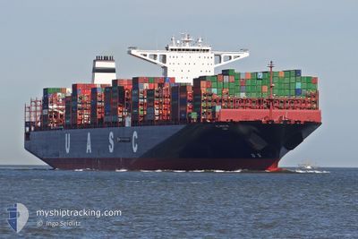
AL NEFUD
Cargo A
Current Trip
| Time Travelled | 21 days |
|---|---|
| Remaining Time | --- |
| Distance Travelled | 7506.88 nm |
| Remaining Distance | --- |
| AVG Speed | 13.9 Knopen |
| MAX Speed | 17.8 Knopen |
| AVG Wind | 12.5 knots |
| MAX Wind | 26 knots |
| MIN Temp | 16.4°C / 61.52°F |
| MAX Temp | 30.9°C / 87.62°F |
| Diepgang | 16.5 M |
| Positie ontvangen | 5 d geleden |
Current Position
| Lengtegraad | 17.35561° |
|---|---|
| Breedtegraat | -33.85684° |
| Status | Under way using engine |
| Snelheid | 13.6 Knopen |
| Koers | 317.7° |
| Gebied | South Atlantic Ocean |
| Station | T-AIS |
| Positie ontvangen | 5 d geleden |
Info
Information
The current position of AL NEFUD is in South Atlantic Ocean with coordinates -33.85684° / 17.35561° as reported on 2024-05-22 11:26 by AIS to our vessel tracker app. The vessel's current speed is 13.6 Knopen and is heading at the port of TANGER MED. The estimated time of arrival as calculated by MyShipTracking vessel tracking app is 2024-06-06 06:00 LT
The vessel AL NEFUD (IMO: 9708813, MMSI: 218000250) is a Cargo A It's sailing under the flag of [DE] Germany.
In this page you can find informations about the vessels current position, last detected port calls, and current voyage information. If the vessels is not in coverage by AIS you will find the latest position.
The current position of AL NEFUD is detected by our AIS receivers and we are not responsible for the reliability of the data. The last position was recorded while the vessel was in Coverage by the Ais receivers of our vessel tracking app.
The current draught of AL NEFUD as reported by AIS is 16.5 meters
Weather
| Temperature | 25°C / 77°F |
|---|---|
| Wind Speed | 11 knots |
| Direction | 133° SE |
| Pressure | 1014 hPa |
| Humidity | 74.3 % |
| Cloud Coverage | 35 % |
Featured Company
Last Port Calls
| Port | Arrival | Departure | Time In Port |
|---|---|---|---|
| 2024-05-04 12:18 | 2024-05-06 11:28 | 1 d | |
| 2024-04-29 00:00 | 2024-04-30 01:48 | 1 d | |
| 2024-04-27 22:36 | 2024-04-28 12:32 | 13 h | |
| 2024-04-17 18:03 | 2024-04-19 21:52 | 2 d | |
| 2024-04-09 05:25 | 2024-04-11 08:22 | 2 d | |
| 2024-03-01 16:59 | 2024-03-06 06:37 | 4 d |
Most Visited Ports (Last year)
| Port | Arrivals | |
|---|---|---|
| 8 | ||
| 4 | ||
| 3 | ||
| 3 | ||
| 3 | ||
| 3 |
Last Trips
| Origin | Departure | Destination | Arrival | Distance | |
|---|---|---|---|---|---|
| 2024-04-30 01:48 | 2024-05-04 12:18 | 1469.11 nm | |||
| 2024-04-28 12:32 | 2024-04-29 00:00 | 128.76 nm | |||
| 2024-04-19 21:52 | 2024-04-27 22:36 | 1449.00 nm | |||
| 2024-04-11 08:22 | 2024-04-17 18:03 | 2527.47 nm | |||
| 2024-03-06 06:37 | 2024-04-09 05:25 | 11945.82 nm | |||
| 2024-02-29 21:51 | 2024-03-01 16:59 | 258.02 nm |
Events
| Tijd | Evenement | Details | Positie / Bestemming | Info |
|---|---|---|---|---|
| 2024-05-22 11:30 | Status Changed | Default Under way using engine |
-33.84335 / 17.34105
MAPTM
|
Snelheid: 13.6 kn Koers: 317.7° |
| 2024-05-22 11:26 | Buitenbereik |
-33.85684 / 17.35561
South Atlantic Ocean
MAPTM
|
Snelheid: 13.6 kn Koers: 317.7° |
|
| 2024-05-22 11:25 | Status Changed | Under way using engine Default |
-33.85881 / 17.35775
MAPTM
|
Snelheid: 13.7 kn Koers: 317° |
| 2024-05-22 11:23 | Status Changed | Default Under way using engine |
-33.86400 / 17.36341
MAPTM
|
Snelheid: 13.3 kn Koers: 318.8° |
| 2024-05-22 11:17 | Status Changed | Under way using engine Default |
-33.88025 / 17.38115
MAPTM
|
Snelheid: 13.4 kn Koers: 317° |
| 2024-05-22 11:07 | Binnenbereik |
-33.88025 / 17.38115
South Atlantic Ocean
MAPTM
|
Snelheid: 13.3 kn Koers: 318.8° |
|
| 2024-05-22 08:40 | Status Changed | Default Under way using engine |
-34.30875 / 17.87806
MAPTM
|
Snelheid: 13.5 kn Koers: 312.8° |
| 2024-05-22 08:39 | Buitenbereik |
-34.31181 / 17.88199
South Atlantic Ocean
MAPTM
|
Snelheid: 13.5 kn Koers: 312.8° |
|
| 2024-05-22 04:52 | Status Changed | Under way using engine Default |
-34.75395 / 18.70538
MAPTM
|
Snelheid: 12.8 kn Koers: 285° |
| 2024-05-22 04:08 | Status Changed | Default Under way using engine |
-34.80032 / 18.88974
MAPTM
|
Snelheid: 12.8 kn Koers: 288.3° |