
AILA
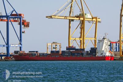
Container Ship
Current Trip
| Time Travelled | 1 day |
|---|---|
| Remaining Time | 20 h, 38 mins |
| Distance Travelled | 408.26 nm |
| Remaining Distance | 306.90 nm |
| AVG Speed | 13 Knopen |
| MAX Speed | 16.4 Knopen |
| AVG Wind | 16.1 knots |
| MAX Wind | 32.7 knots |
| MIN Temp | 10.1°C / 50.18°F |
| MAX Temp | 11.7°C / 53.06°F |
| Diepgang | 6.6 M |
| Positie ontvangen | 17 h, 10 m geleden |
Current Position
| Lengtegraad | --- |
|---|---|
| Breedtegraat | --- |
| Status | Under way using engine |
| Snelheid | 14.4 Knopen |
| Koers | 203.1° |
| Gebied | Celtic Sea |
| Station | T-AIS |
| Positie ontvangen | 17 h, 10 m geleden |
Info
Information
The current position of AILA is in Celtic Sea with coordinates 51.98835° / -5.82486° as reported on 2025-12-15 09:41 by AIS to our vessel tracker app. The vessel's current speed is 14.4 Knopen and is heading at the port of BILBAO. The estimated time of arrival as calculated by MyShipTracking vessel tracking app is 2025-12-17 00:30 LT
The vessel AILA (IMO: 9354337, MMSI: 230985000) is a Container Ship that was built in 2007 ( 18 Jaar oud ). It's sailing under the flag of [FI] Finland.
In this page you can find informations about the vessels current position, last detected port calls, and current voyage information. If the vessels is not in coverage by AIS you will find the latest position.
The current position of AILA is detected by our AIS receivers and we are not responsible for the reliability of the data. The last position was recorded while the vessel was in Coverage by the Ais receivers of our vessel tracking app.
The current draught of AILA as reported by AIS is 6.6 meters
Weather
| Temperature | 11.5°C / 52.7°F |
|---|---|
| Wind Speed | 19 knots |
| Direction | 355° N |
| Pressure | 1006 hPa |
| Humidity | 71.4 % |
| Cloud Coverage | 100 % |
Featured Company
Last Port Calls
| Port | Arrival | Departure | Time In Port |
|---|---|---|---|
| 2025-12-13 14:35 | 2025-12-14 19:11 | 1 d | |
| 2025-12-05 21:23 | 2025-12-11 11:43 | 5 d | |
| 2025-12-01 16:15 | 2025-12-03 11:04 | 1 d | |
| 2025-11-30 06:44 | 2025-11-30 14:42 | 7 h | |
| 2025-11-28 12:41 | 2025-11-29 01:16 | 12 h | |
| 2025-11-23 15:58 | 2025-11-24 02:17 | 10 h | |
| 2025-11-19 19:06 | 2025-11-21 14:39 | 1 d | |
| 2025-11-16 16:41 | 2025-11-17 13:26 | 20 h | |
| 2025-11-15 11:56 | 2025-11-16 03:17 | 15 h | |
| 2025-11-12 00:13 | 2025-11-13 06:21 | 1 d |
Last Trips
| Origin | Departure | Destination | Arrival | Distance | |
|---|---|---|---|---|---|
| 2025-12-11 11:43 | 2025-12-13 14:35 | 703.77 nm | |||
| 2025-12-03 11:04 | 2025-12-05 21:23 | 831.09 nm | |||
| 2025-11-30 14:42 | 2025-12-01 16:15 | 324.10 nm | |||
| 2025-11-29 01:16 | 2025-11-30 06:44 | 412.31 nm | |||
| 2025-11-24 02:17 | 2025-11-28 12:41 | 329.98 nm | |||
| 2025-11-21 14:39 | 2025-11-23 15:58 | 736.65 nm | |||
| 2025-11-17 13:26 | 2025-11-19 19:06 | 805.10 nm | |||
| 2025-11-16 03:17 | 2025-11-16 16:41 | 165.98 nm | |||
| 2025-11-13 06:21 | 2025-11-15 11:56 | 737.46 nm | |||
| 2025-11-09 19:16 | 2025-11-12 00:13 | 791.13 nm |
Events
| Tijd | Evenement | Details | Positie / Bestemming | Info |
|---|---|---|---|---|
| 2025-12-15 09:46 | Status Changed | Default Under way using engine |
51.96833 / -5.83833
ESBIO
|
Snelheid: 14.4 kn Koers: 203.1° |
| 2025-12-15 09:41 | Buitenbereik |
51.98835 / -5.82486
Celtic Sea
ESBIO
|
Snelheid: 14.4 kn Koers: 203.1° |
|
| 2025-12-15 09:29 | Wijzig zee gebeid | United Kingdom part of the Celtic Sea United Kingdom part of the Irish Sea and St. George's Channel |
52.03674 / -5.79432
Celtic Sea
ESBIO
|
Snelheid: 15 kn Koers: 200.7° |
| 2025-12-15 09:21 | Status Changed | Under way using engine Default |
52.06614 / -5.77586
ESBIO
|
Snelheid: 15 kn Koers: 199° |
| 2025-12-15 09:02 | Status Changed | Default Under way using engine |
52.13992 / -5.72888
ESBIO
|
Snelheid: 13.7 kn Koers: 200.4° |
| 2025-12-15 08:56 | Status Changed | Under way using engine Default |
52.16298 / -5.71436
ESBIO
|
Snelheid: 14.4 kn Koers: 202° |
| 2025-12-15 08:36 | Binnenbereik |
52.16298 / -5.71436
Irish Sea and St. George's Channel
ESBIO
|
Snelheid: 13.7 kn Koers: 200.4° |
|
| 2025-12-15 05:52 | Status Changed | Default Under way using engine |
52.78189 / -5.31152
ESBIO
|
Snelheid: 10.8 kn Koers: 201.2° |
| 2025-12-15 05:46 | Buitenbereik |
52.79817 / -5.30118
Irish Sea and St. George's Channel
ESBIO
|
Snelheid: 10.8 kn Koers: 201.2° |
|
| 2025-12-15 05:40 | Status Changed | Under way using engine Default |
52.81419 / -5.29087
ESBIO
|
Snelheid: 9.2 kn Koers: 201° |