
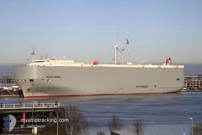
AEGEAN HIGHWAY
Vehicles Carrier
Current Trip
| Time Travelled | 3 days |
|---|---|
| Remaining Time | --- |
| Distance Travelled | 1561.50 nm |
| Remaining Distance | --- |
| AVG Speed | 17.2 Knopen |
| MAX Speed | 20.2 Knopen |
| AVG Wind | 13 knots |
| MAX Wind | 23 knots |
| MIN Temp | 7.2°C / 44.96°F |
| MAX Temp | 18.7°C / 65.66°F |
| Diepgang | 9.8 M |
| Positie ontvangen | 3 d geleden |
Current Position
| Lengtegraad | 139.27758° |
|---|---|
| Breedtegraat | 33.72915° |
| Status | Under way using engine |
| Snelheid | 17.6 Knopen |
| Koers | 98° |
| Gebied | Philippine Sea |
| Station | T-AIS |
| Positie ontvangen | 3 d geleden |
Info
Information
The current position of AEGEAN HIGHWAY is in Philippine Sea with coordinates 33.72915° / 139.27758° as reported on 2024-04-22 18:14 by AIS to our vessel tracker app. The vessel's current speed is 17.6 Knopen and is heading at the port of BALBOA. The estimated time of arrival as calculated by MyShipTracking vessel tracking app is 2024-05-10 23:00 LT
The vessel AEGEAN HIGHWAY (IMO: 9464388, MMSI: 432666000) is a Vehicles Carrier that was built in 2008 ( 16 Jaar oud ). It's sailing under the flag of [JP] Japan.
In this page you can find informations about the vessels current position, last detected port calls, and current voyage information. If the vessels is not in coverage by AIS you will find the latest position.
The current position of AEGEAN HIGHWAY is detected by our AIS receivers and we are not responsible for the reliability of the data. The last position was recorded while the vessel was in Coverage by the Ais receivers of our vessel tracking app.
The current draught of AEGEAN HIGHWAY as reported by AIS is 9.8 meters
Weather
| Temperature | 9°C / 48.2°F |
|---|---|
| Wind Speed | 11 knots |
| Direction | 212° SSW |
| Pressure | 1026.8 hPa |
| Humidity | 81.2 % |
| Cloud Coverage | 100 % |
Featured Company
Last Port Calls
| Port | Arrival | Departure | Time In Port |
|---|---|---|---|
| 2024-04-19 05:55 | 2024-04-22 08:56 | 3 d | |
| 2024-03-21 03:47 | 2024-03-22 06:07 | 1 d | |
| 2024-03-17 23:49 | 2024-03-18 21:44 | 21 h | |
| 2024-02-16 06:01 | 2024-02-19 08:37 | 3 d |
Most Visited Ports (Last year)
| Port | Arrivals | |
|---|---|---|
| 8 | ||
| 4 | ||
| 4 | ||
| 4 | ||
| 2 | ||
| 2 |
Last Trips
| Origin | Departure | Destination | Arrival | Distance | |
|---|---|---|---|---|---|
| 2024-03-22 02:07 | 2024-04-19 14:55 | 10083.03 nm | |||
| 2024-03-18 17:44 | 2024-03-20 23:47 | 817.14 nm | |||
| 2024-02-19 17:37 | 2024-03-17 19:49 | 9642.84 nm | |||
| 2024-01-27 23:13 | 2024-02-16 15:01 | 6629.19 nm |
Events
| Tijd | Evenement | Details | Positie / Bestemming | Info |
|---|---|---|---|---|
| 2024-04-22 18:22 | Status Changed | Default Under way using engine |
33.72333 / 139.32050
PA BLB
|
Snelheid: 17.6 kn Koers: 98° |
| 2024-04-22 18:14 | Status Changed | Under way using engine Default |
33.72915 / 139.27758
PA BLB
|
Snelheid: 17.7 kn Koers: 97° |
| 2024-04-22 18:14 | Binnenbereik |
33.72915 / 139.27758
Philippine Sea
PA BLB
|
Snelheid: 17.6 kn Koers: 98° |
|
| 2024-04-22 18:14 | Buitenbereik |
33.72915 / 139.27758
Philippine Sea
PA BLB
|
Snelheid: 17.6 kn Koers: 98° |
|
| 2024-04-22 14:04 | Status Changed | Default Under way using engine |
34.12605 / 137.97995
PA BLB
|
Snelheid: 16.6 kn Koers: 115° |
| 2024-04-22 13:56 | Status Changed | Under way using engine Default |
34.14183 / 137.93995
PA BLB
|
Snelheid: 16.9 kn Koers: 116° |
| 2024-04-22 13:56 | Buitenbereik |
34.14183 / 137.93995
Philippine Sea
PA BLB
|
Snelheid: 16.6 kn Koers: 115° |
|
| 2024-04-22 13:28 | Status Changed | Default Under way using engine |
34.19758 / 137.79617
PA BLB
|
Snelheid: 17 kn Koers: 113° |
| 2024-04-22 12:59 | Draught Changed | 9.8 7.8 |
34.25358 / 137.64365
PA BLB
|
Snelheid: 17.1 kn Koers: 114° |
| 2024-04-22 12:59 | Destination Changed | PA BLB JP THS |
34.25358 / 137.64365
PA BLB
|
Snelheid: 17.1 kn Koers: 114° |