
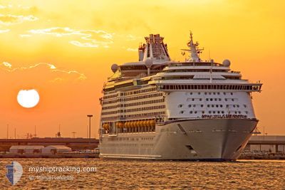
ADVENTURE OF THE SEA
Passenger
Current Trip
| Time Travelled | 1 day |
|---|---|
| Remaining Time | 16 h, 17 mins |
| Distance Travelled | 910.69 nm |
| Remaining Distance | 407.50 nm |
| AVG Speed | 19.8 Knopen |
| MAX Speed | 23 Knopen |
| AVG Wind | 18.8 knots |
| MAX Wind | 25 knots |
| MIN Temp | 22.2°C / 71.96°F |
| MAX Temp | 27.6°C / 81.68°F |
| Diepgang | 9 M |
| Positie ontvangen | 22 h, 9 m geleden |
Current Position
| Lengtegraad | -74.67521° |
|---|---|
| Breedtegraat | 22.55716° |
| Status | Under way using engine |
| Snelheid | 19.4 Knopen |
| Koers | 183.6° |
| Gebied | North Atlantic Ocean |
| Station | T-AIS |
| Positie ontvangen | 22 h, 9 m geleden |
Info
Information
The current position of ADVENTURE OF THE SEA is in North Atlantic Ocean with coordinates 22.55716° / -74.67521° as reported on 2024-04-27 22:18 by AIS to our vessel tracker app. The vessel's current speed is 19.4 Knopen and is heading at the port of WILLEMSTAD. The estimated time of arrival as calculated by MyShipTracking vessel tracking app is 2024-04-29 12:45 LT
The vessel ADVENTURE OF THE SEA (MMSI: 311263000) is a Passenger It's sailing under the flag of [BS] Bahamas.
In this page you can find informations about the vessels current position, last detected port calls, and current voyage information. If the vessels is not in coverage by AIS you will find the latest position.
The current position of ADVENTURE OF THE SEA is detected by our AIS receivers and we are not responsible for the reliability of the data. The last position was recorded while the vessel was in Coverage by the Ais receivers of our vessel tracking app.
The current draught of ADVENTURE OF THE SEA as reported by AIS is 9 meters
Weather
| Temperature | 27.4°C / 81.32°F |
|---|---|
| Wind Speed | 17 knots |
| Direction | 77° ENE |
| Pressure | 1011.5 hPa |
| Humidity | 78.3 % |
| Cloud Coverage | --- |
Featured Company
Last Port Calls
| Port | Arrival | Departure | Time In Port |
|---|---|---|---|
| 2024-04-26 08:46 | 2024-04-26 20:31 | 11 h | |
| 2024-04-24 10:47 | 2024-04-24 22:22 | 11 h | |
| 2024-04-23 03:35 | 2024-04-23 07:21 | 3 h | |
| 2024-04-22 11:57 | 2024-04-22 22:05 | 10 h | |
| 2024-04-20 08:37 | 2024-04-20 20:25 | 11 h | |
| 2024-04-17 11:27 | 2024-04-17 22:30 | 11 h | |
| 2024-04-15 19:58 | 2024-04-15 20:12 | 13 m | |
| 2024-04-14 11:23 | 2024-04-14 21:02 | 9 h | |
| 2024-04-12 08:52 | 2024-04-12 20:44 | 11 h | |
| 2024-04-09 11:09 | 2024-04-09 21:12 | 10 h |
Most Visited Ports (Last year)
| Port | Arrivals | |
|---|---|---|
| 28 | ||
| 25 | ||
| 21 | ||
| 18 | ||
| 16 | ||
| 15 |
Last Trips
| Origin | Departure | Destination | Arrival | Distance | |
|---|---|---|---|---|---|
| 2024-04-24 18:22 | 2024-04-26 04:46 | 285.17 nm | |||
| 2024-04-23 03:21 | 2024-04-24 06:47 | 501.65 nm | |||
| 2024-04-22 18:05 | 2024-04-22 23:35 | 101.44 nm | |||
| 2024-04-20 16:25 | 2024-04-22 07:57 | 766.44 nm | |||
| 2024-04-17 18:30 | 2024-04-20 04:37 | 1086.12 nm | |||
| 2024-04-15 16:12 | 2024-04-17 07:27 | 413.54 nm | |||
| 2024-04-14 17:02 | 2024-04-15 15:58 | 146.11 nm | |||
| 2024-04-12 16:44 | 2024-04-14 07:23 | 672.02 nm | |||
| 2024-04-09 17:12 | 2024-04-12 04:52 | 782.32 nm | |||
| 2024-04-07 17:19 | 2024-04-09 07:09 | 557.61 nm |
Events
| Tijd | Evenement | Details | Positie / Bestemming | Info |
|---|---|---|---|---|
| 2024-04-27 22:20 | Status Changed | Default Under way using engine |
22.54667 / -74.67667
CURACAO
|
Snelheid: 19.4 kn Koers: 183.6° |
| 2024-04-27 22:18 | Buitenbereik |
22.55716 / -74.67521
North Atlantic Ocean
|
Snelheid: 19.4 kn Koers: 183.6° |
|
| 2024-04-27 20:52 | Status Changed | Under way using engine Default |
23.02241 / -74.66777
CURACAO
|
Snelheid: 19 kn Koers: 185° |
| 2024-04-27 20:52 | Binnenbereik |
23.02241 / -74.66777
North Atlantic Ocean
|
Snelheid: 19.2 kn Koers: 189.4° |
|
| 2024-04-27 18:08 | Status Changed | Default Under way using engine |
23.88667 / -74.75333
CURACAO
|
Snelheid: 19.7 kn Koers: 147° |
| 2024-04-27 18:05 | Buitenbereik |
23.90043 / -74.76200
North Atlantic Ocean
|
Snelheid: 19.7 kn Koers: 147° |
|
| 2024-04-27 18:03 | Status Changed | Under way using engine Default |
23.91155 / -74.76975
CURACAO
|
Snelheid: 20 kn Koers: 147° |
| 2024-04-27 17:53 | Status Changed | Default Under way using engine |
23.95667 / -74.80167
CURACAO
|
Snelheid: 20 kn Koers: 147.1° |
| 2024-04-27 17:44 | Status Changed | Under way using engine Default |
23.99790 / -74.82937
CURACAO
|
Snelheid: 20 kn Koers: 148° |
| 2024-04-27 17:32 | Status Changed | Default Under way using engine |
24.05500 / -74.86833
CURACAO
|
Snelheid: 19.5 kn Koers: 148.4° |