
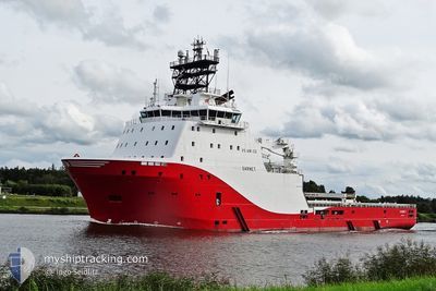
ABEILLE NORMANDIE
Anchor Handling Vessel
Current Trip
NAVY ORDERS
| Time Travelled | 1 day |
|---|---|
| Remaining Time | --- |
| Distance Travelled | 107.79 nm |
| Remaining Distance | --- |
| AVG Speed | 8 Knopen |
| MAX Speed | 14.6 Knopen |
| AVG Wind | 9.4 knots |
| MAX Wind | 14 knots |
| MIN Temp | 12.1°C / 53.78°F |
| MAX Temp | 14.9°C / 58.82°F |
| Diepgang | 7.1 M |
| Positie ontvangen | Nu |
Current Position
| Lengtegraad | 1.52642° |
|---|---|
| Breedtegraat | 50.67286° |
| Status | At anchor |
| Snelheid | |
| Koers | 50° |
| Gebied | English Channel |
| Station | T-AIS |
| Positie ontvangen | Nu |
Info
Information
The current position of ABEILLE NORMANDIE is in English Channel with coordinates 50.67286° / 1.52642° as reported on 2024-05-14 23:31 by AIS to our vessel tracker app. The vessel's current speed is 0 Knopen
The vessel ABEILLE NORMANDIE (IMO: 9442421, MMSI: 228415800) is a Anchor Handling Vessel that was built in 2010 ( 14 Jaar oud ). It's sailing under the flag of [FR] France.
In this page you can find informations about the vessels current position, last detected port calls, and current voyage information. If the vessels is not in coverage by AIS you will find the latest position.
The current position of ABEILLE NORMANDIE is detected by our AIS receivers and we are not responsible for the reliability of the data. The last position was recorded while the vessel was in Coverage by the Ais receivers of our vessel tracking app.
The current draught of ABEILLE NORMANDIE as reported by AIS is 7.1 meters
Weather
| Temperature | 12.9°C / 55.22°F |
|---|---|
| Wind Speed | 11 knots |
| Direction | 140° SE |
| Pressure | 1004 hPa |
| Humidity | 90.7 % |
| Cloud Coverage | 100 % |
Featured Company
Last Port Calls
| Port | Arrival | Departure | Time In Port |
|---|---|---|---|
| 2024-05-13 13:44 | 2024-05-13 21:25 | 7 h | |
| 2024-05-13 09:53 | 2024-05-13 13:04 | 3 h | |
| 2024-05-11 11:02 | 2024-05-11 15:42 | 4 h | |
| 2024-05-06 10:08 | 2024-05-06 14:45 | 4 h | |
| 2024-05-05 09:05 | 2024-05-06 04:00 | 18 h | |
| 2024-05-01 20:16 | 2024-05-04 05:09 | 2 d | |
| 2024-04-30 08:07 | 2024-05-01 03:22 | 19 h | |
| 2024-04-29 12:20 | 2024-04-30 03:41 | 15 h | |
| 2024-04-27 12:21 | 2024-04-29 06:17 | 1 d | |
| 2024-04-26 15:21 | 2024-04-27 04:54 | 13 h |
Most Visited Ports (Last year)
| Port | Arrivals | |
|---|---|---|
| 115 | ||
| 7 | ||
| 3 |
Last Trips
| Origin | Departure | Destination | Arrival | Distance | |
|---|---|---|---|---|---|
| 2024-05-13 15:04 | 2024-05-13 15:44 | 8.55 nm | |||
| 2024-05-11 17:42 | 2024-05-13 11:53 | 147.25 nm | |||
| 2024-05-06 16:45 | 2024-05-11 13:02 | 55.84 nm | |||
| 2024-05-06 06:00 | 2024-05-06 12:08 | 28.49 nm | |||
| 2024-05-04 07:09 | 2024-05-05 11:05 | 64.45 nm | |||
| 2024-05-01 05:22 | 2024-05-01 22:16 | 166.24 nm | |||
| 2024-04-30 05:41 | 2024-04-30 10:07 | 33.83 nm | |||
| 2024-04-29 08:17 | 2024-04-29 14:20 | 38.71 nm | |||
| 2024-04-27 06:54 | 2024-04-27 14:21 | 45.12 nm | |||
| 2024-04-26 13:11 | 2024-04-26 17:21 | 24.68 nm |
Events
| Tijd | Evenement | Details | Positie / Bestemming | Info |
|---|---|---|---|---|
| 2024-05-14 18:52 | Status Changed | At anchor Under way using engine |
50.67363 / 1.52713
NAVY ORDERS
|
Snelheid: 0.3 kn Koers: 178° |
| 2024-05-14 18:51 | Stop beweging | 4.13 nm, South West of BOULOGNE-SUR-MER |
50.67384 / 1.52720
NAVY ORDERS
|
Snelheid: 0.3 kn Koers: 198° |
| 2024-05-14 16:53 | Gevonden in zee | French part of the English Channel |
50.96682 / 1.65887
English Channel
|
Snelheid: 12.9 kn Koers: 223.4° |
| 2024-05-14 14:24 | Start beweging | 3.38 nm, North East of DUNKERQUE |
51.06701 / 2.34240
NAVY ORDERS
|
Snelheid: 3.2 kn Koers: 266° |
| 2024-05-14 14:19 | Stop beweging | 3.46 nm, North East of DUNKERQUE |
51.06635 / 2.34537
NAVY ORDERS
|
Snelheid: 0.3 kn Koers: 26° |
| 2024-05-14 13:30 | Status Changed | Under way using engine Default |
51.05853 / 2.20929
NAVY ORDERS
|
Snelheid: 13.8 kn Koers: 83° |
| 2024-05-14 13:29 | Status Changed | Default Under way using engine |
51.05802 / 2.20242
NAVY ORDERS
|
Snelheid: 13.8 kn Koers: 83° |
| 2024-05-14 12:13 | Start beweging | 7.97 nm, North East of CALAIS |
51.08479 / 1.95298
NAVY ORDERS
|
Snelheid: 3.2 kn Koers: 154° |
| 2024-05-14 12:04 | Stop beweging | 8.11 nm, North East of CALAIS |
51.08787 / 1.95155
NAVY ORDERS
|
Snelheid: 0.3 kn Koers: 71° |
| 2024-05-14 11:00 | Start beweging | 9.59 nm, North East of CALAIS |
51.09827 / 1.99866
NAVY ORDERS
|
Snelheid: 3.4 kn Koers: 124° |