
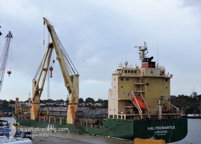
AAL FREMANTLE
General Cargo
Current Trip
| Time Travelled | 8 days |
|---|---|
| Remaining Time | 3 days |
| Distance Travelled | 2908.84 nm |
| Remaining Distance | 1340.28 nm |
| AVG Speed | 13.7 Knopen |
| MAX Speed | 18 Knopen |
| AVG Wind | 9.8 knots |
| MAX Wind | 20.8 knots |
| MIN Temp | 20.7°C / 69.26°F |
| MAX Temp | 30.2°C / 86.36°F |
| Diepgang | 6.2 M |
| Positie ontvangen | 1 m geleden |
Current Position
| Lengtegraad | 119.78552° |
|---|---|
| Breedtegraat | 14.72895° |
| Status | Under way using engine |
| Snelheid | 13.8 Knopen |
| Koers | 347.6° |
| Gebied | South China Sea |
| Station | T-AIS |
| Positie ontvangen | 1 m geleden |
Info
Information
The current position of AAL FREMANTLE is in South China Sea with coordinates 14.72895° / 119.78552° as reported on 2024-05-16 03:44 by AIS to our vessel tracker app. The vessel's current speed is 13.8 Knopen and is heading at the port of BUSAN. The estimated time of arrival as calculated by MyShipTracking vessel tracking app is 2024-05-20 03:00 LT
The vessel AAL FREMANTLE (IMO: 9521095, MMSI: 210415000) is a General Cargo that was built in 2011 ( 13 Jaar oud ). It's sailing under the flag of [CY] Cyprus.
In this page you can find informations about the vessels current position, last detected port calls, and current voyage information. If the vessels is not in coverage by AIS you will find the latest position.
The current position of AAL FREMANTLE is detected by our AIS receivers and we are not responsible for the reliability of the data. The last position was recorded while the vessel was in Coverage by the Ais receivers of our vessel tracking app.
The current draught of AAL FREMANTLE as reported by AIS is 6.2 meters
Weather
| Temperature | 29.7°C / 85.46°F |
|---|---|
| Wind Speed | 10 knots |
| Direction | 138° SE |
| Pressure | 1010.8 hPa |
| Humidity | 73.9 % |
| Cloud Coverage | 11 % |
Featured Company
Last Port Calls
| Port | Arrival | Departure | Time In Port |
|---|---|---|---|
| 2024-05-03 15:09 | 2024-05-07 10:46 | 3 d | |
| 2024-04-26 14:13 | 2024-05-02 00:50 | 5 d | |
| 2024-04-21 02:03 | 2024-04-26 12:30 | 5 d | |
| 2024-04-16 16:02 | 2024-04-17 15:15 | 23 h | |
| 2024-04-10 13:46 | 2024-04-11 14:01 | 1 d | |
| 2024-04-08 05:02 | 2024-04-10 09:07 | 2 d | |
| 2024-03-18 14:22 | 2024-03-19 07:26 | 17 h | |
| 2024-03-06 10:53 | 2024-03-07 07:22 | 20 h | |
| 2024-03-01 15:38 |
Most Visited Ports (Last year)
| Port | Arrivals | |
|---|---|---|
| 7 | ||
| 4 | ||
| 3 | ||
| 3 | ||
| 3 | ||
| 2 |
Last Trips
| Origin | Departure | Destination | Arrival | Distance | |
|---|---|---|---|---|---|
| 2024-05-02 08:50 | 2024-05-03 23:09 | 9.84 nm | |||
| 2024-04-26 20:30 | 2024-04-26 22:13 | 12.36 nm | |||
| 2024-04-17 23:15 | 2024-04-21 10:03 | 1011.32 nm | |||
| 2024-04-11 22:01 | 2024-04-17 00:02 | 1708.26 nm | |||
| 2024-04-10 17:07 | 2024-04-10 21:46 | 41.03 nm | |||
| 2024-03-19 15:26 | 2024-04-08 13:02 | 3705.33 nm | |||
| 2024-03-07 15:22 | 2024-03-18 22:22 | 3472.24 nm | |||
| 2024-03-01 23:38 | 2024-03-06 18:53 | 107.32 nm |
Events
| Tijd | Evenement | Details | Positie / Bestemming | Info |
|---|---|---|---|---|
| 2024-05-16 03:22 | Wijzig zee gebeid | Philippines part of the South China Sea Australian part of the Indian Ocean |
14.64884 / 119.80357
South China Sea
AUFRE>KRPUS
|
Snelheid: 13.8 kn Koers: 348° |
| 2024-05-16 03:21 | Status Changed | Under way using engine Default |
14.64259 / 119.80492
AUFRE>KRPUS
|
Snelheid: 13 kn Koers: 355° |
| 2024-05-16 03:21 | Binnenbereik |
14.64884 / 119.80357
South China Sea
AUFRE>KRPUS
|
Snelheid: 13.8 kn Koers: 348° |
|
| 2024-05-09 19:51 | Status Changed | Default Under way using engine |
-19.13993 / 113.87838
AUFRE>KRPUS
|
Snelheid: 14 kn Koers: 11.6° |
| 2024-05-09 19:44 | Buitenbereik |
-19.16660 / 113.87379
Indian Ocean
AUFRE>KRPUS
|
Snelheid: 14 kn Koers: 11.6° |
|
| 2024-05-09 19:33 | Status Changed | Under way using engine Default |
-19.21155 / 113.86393
AUFRE>KRPUS
|
Snelheid: 14.1 kn Koers: 11° |
| 2024-05-09 19:11 | Status Changed | Default Under way using engine |
-19.29465 / 113.85027
AUFRE>KRPUS
|
Snelheid: 14.2 kn Koers: 10.2° |
| 2024-05-09 18:20 | Status Changed | Under way using engine Default |
-19.49522 / 113.81258
AUFRE>KRPUS
|
Snelheid: 14.1 kn Koers: 8° |
| 2024-05-09 18:03 | Status Changed | Default Under way using engine |
-19.55903 / 113.80257
AUFRE>KRPUS
|
Snelheid: 14 kn Koers: 10.6° |
| 2024-05-09 15:56 | Status Changed | Under way using engine Default |
-20.04521 / 113.71086
AUFRE>KRPUS
|
Snelheid: 13.7 kn Koers: 7° |