
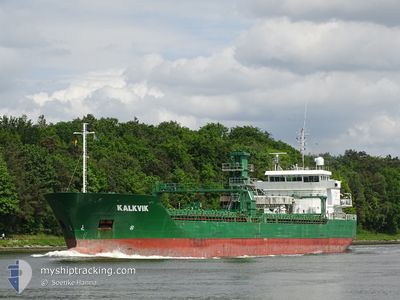
KALKVIK
General Cargo
Current Trip
| Time Travelled | 6 days |
|---|---|
| Remaining Time | 2 h, 1 mins |
| Distance Travelled | 1767.53 nm |
| Remaining Distance | 20.27 nm |
| AVG Speed | 10.9 Knopen |
| MAX Speed | 13.1 Knopen |
| AVG Wind | 11.1 knots |
| MAX Wind | 20.9 knots |
| MIN Temp | -1.4°C / 29.48°F |
| MAX Temp | 13.6°C / 56.48°F |
| Diepgang | 7.7 M |
| Positie ontvangen | 13 h, 17 m geleden |
Current Position
| Lengtegraad | 20.82068° |
|---|---|
| Breedtegraat | 63.54749° |
| Status | Under way using engine |
| Snelheid | 11.6 Knopen |
| Koers | 78.4° |
| Gebied | Gulf of Bothnia |
| Station | T-AIS |
| Positie ontvangen | 13 h, 17 m geleden |
Info
Information
The current position of KALKVIK is in Gulf of Bothnia with coordinates 63.54749° / 20.82068° as reported on 2024-04-30 16:34 by AIS to our vessel tracker app. The vessel's current speed is 11.6 Knopen and is heading at the port of LULEA. The estimated time of arrival as calculated by MyShipTracking vessel tracking app is 2024-05-01 07:53 LT
The vessel KALKVIK (IMO: 9341172, MMSI: 231791000) is a General Cargo that was built in 2007 ( 17 Jaar oud ). It's sailing under the flag of [FO] Faroe Is.
In this page you can find informations about the vessels current position, last detected port calls, and current voyage information. If the vessels is not in coverage by AIS you will find the latest position.
The current position of KALKVIK is detected by our AIS receivers and we are not responsible for the reliability of the data. The last position was recorded while the vessel was in Coverage by the Ais receivers of our vessel tracking app.
The current draught of KALKVIK as reported by AIS is 7.7 meters
Weather
| Temperature | 1.9°C / 35.42°F |
|---|---|
| Wind Speed | 7 knots |
| Direction | 172° S |
| Pressure | 1030.2 hPa |
| Humidity | 93.8 % |
| Cloud Coverage | 100 % |
Featured Company
Last Port Calls
| Port | Arrival | Departure | Time In Port |
|---|---|---|---|
| 2024-04-23 12:20 | 2024-04-24 14:59 | 1 d | |
| 2024-04-19 04:37 | 2024-04-19 05:48 | 1 h | |
| 2024-04-17 12:28 | 2024-04-18 22:43 | 1 d | |
| 2024-04-17 06:14 | 2024-04-17 06:43 | 28 m | |
| 2024-04-13 03:20 | 2024-04-13 19:12 | 15 h | |
| 2024-04-10 13:22 | 2024-04-12 10:31 | 1 d | |
| 2024-04-05 12:45 | 2024-04-06 14:16 | 1 d | |
| 2024-03-31 16:29 | 2024-03-31 17:21 | 52 m | |
| 2024-03-30 05:47 | 2024-03-31 10:25 | 1 d | |
| 2024-03-29 23:06 | 2024-03-29 23:43 | 36 m |
Most Visited Ports (Last year)
| Port | Arrivals | |
|---|---|---|
| 12 | ||
| 9 | ||
| 9 | ||
| 9 | ||
| 6 | ||
| 3 |
Last Trips
| Origin | Departure | Destination | Arrival | Distance | |
|---|---|---|---|---|---|
| 2024-04-19 07:48 | 2024-04-23 14:20 | 1187.21 nm | |||
| 2024-04-19 00:43 | 2024-04-19 06:37 | 59.75 nm | |||
| 2024-04-17 08:43 | 2024-04-17 14:28 | 65.06 nm | |||
| 2024-04-13 21:12 | 2024-04-17 08:14 | 874.09 nm | |||
| 2024-04-12 12:31 | 2024-04-13 05:20 | 161.71 nm | |||
| 2024-04-06 16:16 | 2024-04-10 15:22 | 910.36 nm | |||
| 2024-03-31 19:21 | 2024-04-05 14:45 | 1203.65 nm | |||
| 2024-03-31 12:25 | 2024-03-31 18:29 | 63.80 nm | |||
| 2024-03-30 00:43 | 2024-03-30 06:47 | 65.87 nm | |||
| 2024-03-25 17:41 | 2024-03-30 00:06 | 1061.29 nm |
Events
| Tijd | Evenement | Details | Positie / Bestemming | Info |
|---|---|---|---|---|
| 2024-04-30 16:40 | Status Changed | Default Under way using engine |
63.55332 / 20.86645
LULEA
|
Snelheid: 11.6 kn Koers: 78.4° |
| 2024-04-30 16:34 | Status Changed | Under way using engine Default |
63.54749 / 20.82068
LULEA
|
Snelheid: 11.6 kn Koers: 78° |
| 2024-04-30 16:34 | Buitenbereik |
63.54749 / 20.82068
Gulf of Bothnia
LULEA
|
Snelheid: 11.6 kn Koers: 78.4° |
|
| 2024-04-30 16:24 | Status Changed | Default Under way using engine |
63.54133 / 20.75768
LULEA
|
Snelheid: 7.4 kn Koers: 89.3° |
| 2024-04-30 15:52 | Wijzig zee gebeid | Swedish part of the Gulf of Bothnia Finnish part of the Gulf of Bothnia |
63.47818 / 20.66640
Gulf of Bothnia
LULEA
|
Snelheid: 11.2 kn Koers: 30.2° |
| 2024-04-30 15:52 | Status Changed | Under way using engine Default |
63.47732 / 20.66527
LULEA
|
Snelheid: 11.1 kn Koers: 30° |
| 2024-04-30 15:40 | Status Changed | Default Under way using engine |
63.44656 / 20.62318
LULEA
|
Snelheid: 11.3 kn Koers: 33.1° |
| 2024-04-30 15:22 | Status Changed | Under way using engine Default |
63.39895 / 20.54681
LULEA
|
Snelheid: 11.5 kn Koers: 41° |
| 2024-04-30 15:20 | Status Changed | Default Under way using engine |
63.39534 / 20.53983
LULEA
|
Snelheid: 11.4 kn Koers: 44° |
| 2024-04-30 15:05 | Status Changed | Under way using engine Default |
63.36019 / 20.46754
LULEA
|
Snelheid: 11.6 kn Koers: 40° |