
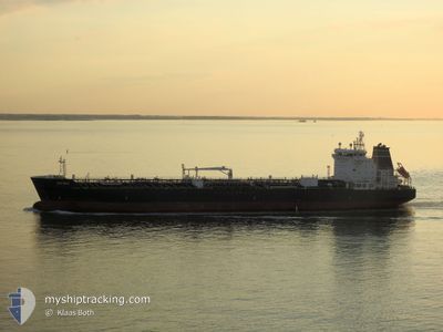
ZEFIREA
Oil/Chemical Tanker
Current Trip
LAKONIKOS BAY
| Time Travelled | 20 days |
|---|---|
| Remaining Time | --- |
| Distance Travelled | 4385.15 nm |
| Remaining Distance | --- |
| AVG Speed | 12.7 Noeuds |
| MAX Speed | 15.8 Noeuds |
| AVG Wind | 13.9 knots |
| MAX Wind | 33.8 knots |
| MIN Temp | 0.4°C / 32.72°F |
| MAX Temp | 19.4°C / 66.92°F |
| Tirant d eau | 10.1 m |
| Position reçue | 3 d depuis |
Current Position
| Longitude | 22.63025° |
|---|---|
| Latitude | 36.14927° |
| Etat | Under way using engine |
| Vitesse | 11.6 Noeuds |
| Parcours | 21.6° |
| Zone | Mediterranean Sea - Eastern Basin |
| Station | T-AIS |
| Position reçue | 3 d depuis |
Info
Information
The current position of ZEFIREA is in Mediterranean Sea - Eastern Basin with coordinates 36.14927° / 22.63025° as reported on 2024-05-09 17:45 by AIS to our vessel tracker app. The vessel's current speed is 11.6 Noeuds
The vessel ZEFIREA (IMO: 9607643, MMSI: 247322500) is a Oil/Chemical Tanker that was built in 2012 ( 12 Age ). It's sailing under the flag of [IT] Italy.
In this page you can find informations about the vessels current position, last detected port calls, and current voyage information. If the vessels is not in coverage by AIS you will find the latest position.
The current position of ZEFIREA is detected by our AIS receivers and we are not responsible for the reliability of the data. The last position was recorded while the vessel was in Coverage by the Ais receivers of our vessel tracking app.
The current draught of ZEFIREA as reported by AIS is 10.1 meters
Weather
| Temperature | 18.3°C / 64.94°F |
|---|---|
| Wind Speed | 10 knots |
| Direction | 281° W |
| Pressure | 1016.5 hPa |
| Humidity | 75.1 % |
| Cloud Coverage | --- |
Featured Company
Last Port Calls
| Port | Arrival | Departure | Time In Port |
|---|---|---|---|
| 2024-04-22 02:42 | 2024-04-23 11:20 | 1 d | |
| 2024-04-18 22:25 | 2024-04-18 22:29 | 4 m | |
| 2024-04-03 00:52 | 2024-04-04 02:06 | 1 d | |
| 2024-03-26 21:04 | 2024-03-28 03:06 | 1 d | |
| 2024-03-24 00:04 | 2024-03-25 12:57 | 1 d | |
| 2024-03-18 13:19 | 2024-03-20 03:19 | 1 d | |
| 2024-03-14 20:25 | 2024-03-16 00:10 | 1 d | |
| 2024-03-13 13:47 |
Most Visited Ports (Last year)
| Port | Arrivals | |
|---|---|---|
| 4 | ||
| 2 | ||
| 2 | ||
| 2 | ||
| 2 | ||
| 2 |
Last Trips
| Origin | Departure | Destination | Arrival | Distance | |
|---|---|---|---|---|---|
| 2024-04-18 22:29 | 2024-04-22 02:42 | 778.34 nm | |||
| 2024-04-04 02:06 | 2024-04-18 22:25 | 3545.57 nm | |||
| 2024-03-28 03:06 | 2024-04-03 00:52 | 1360.62 nm | |||
| 2024-03-25 12:57 | 2024-03-26 21:04 | 156.85 nm | |||
| 2024-03-20 03:19 | 2024-03-24 00:04 | 163.97 nm | |||
| 2024-03-16 00:10 | 2024-03-18 13:19 | 474.18 nm | |||
| 2024-03-13 13:47 | 2024-03-14 20:25 | 185.76 nm |
Events
| Heure | Evenement | Détails | Position/ Destination | Info |
|---|---|---|---|---|
| 2024-05-12 17:54 | Arret |
36.20011 / 22.49273
LAKONIKOS BAY
|
Vitesse: 0.2 kn Parcours: 271° |
|
| 2024-05-12 15:57 | Démarrage | 20.97 nm, South West of KAPSALI |
35.95263 / 22.64121
LAKONIKOS BAY
|
Vitesse: 3.7 kn Parcours: 336° |
| 2024-05-11 11:05 | Arret | 19.22 nm, West of KAPSALI |
36.09315 / 22.61250
LAKONIKOS BAY
|
Vitesse: 0.2 kn Parcours: 148° |
| 2024-05-11 09:37 | Démarrage |
35.98318 / 22.54455
LAKONIKOS BAY
|
Vitesse: 3.6 kn Parcours: 232° |
|
| 2024-05-10 21:56 | Arret | 20.59 nm, West of KAPSALI |
36.06300 / 22.59120
LAKONIKOS BAY
|
Vitesse: 0.3 kn Parcours: 5° |
| 2024-05-10 20:23 | Démarrage | 16.45 nm, South West of PLATIA AMMOS |
36.23455 / 22.66292
LAKONIKOS BAY
|
Vitesse: 3.8 kn Parcours: 132° |
| 2024-05-10 18:08 | Arret | 17.22 nm, West of AGIA PELAGIA |
36.22143 / 22.65248
LAKONIKOS BAY
|
Vitesse: 0.1 kn Parcours: 136° |
| 2024-05-09 17:53 | Etat Changé | Default Under way using engine |
36.17437 / 22.64262
LAKONIKOS BAY
|
Vitesse: 11.6 kn Parcours: 21.6° |
| 2024-05-09 17:45 | Etat Changé | Under way using engine Default |
36.14927 / 22.63025
LAKONIKOS BAY
|
Vitesse: 11.4 kn Parcours: 22° |
| 2024-05-09 17:45 | Hors de la zone couverte |
36.14927 / 22.63025
Mediterranean Sea - Eastern Basin
|
Vitesse: 11.6 kn Parcours: 21.6° |