
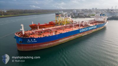
YUAN LAN WAN
Tanker
Current Trip
| Time Travelled | 13 days |
|---|---|
| Remaining Time | 1 day |
| Distance Travelled | 4009.66 nm |
| Remaining Distance | 357.61 nm |
| AVG Speed | 12.7 Noeuds |
| MAX Speed | 15.2 Noeuds |
| AVG Wind | 6.4 knots |
| MAX Wind | 15.4 knots |
| MIN Temp | 24.6°C / 76.28°F |
| MAX Temp | 30.8°C / 87.44°F |
| Tirant d eau | 12.5 m |
| Position reçue | 1 d depuis |
Current Position
| Longitude | 104.12447° |
|---|---|
| Latitude | 1.25802° |
| Etat | Under way using engine |
| Vitesse | 11.9 Noeuds |
| Parcours | 82.2° |
| Zone | Singapore Strait |
| Station | T-AIS |
| Position reçue | 1 d depuis |
Info
Information
The current position of YUAN LAN WAN is in Singapore Strait with coordinates 1.25802° / 104.12447° as reported on 2024-04-30 12:38 by AIS to our vessel tracker app. The vessel's current speed is 11.9 Noeuds and is heading at the port of MAP TA PHUT. The estimated time of arrival as calculated by MyShipTracking vessel tracking app is 2024-05-02 22:27 LT
The vessel YUAN LAN WAN (IMO: 9845946, MMSI: 412706000) is a Tanker It's sailing under the flag of [CN] China.
In this page you can find informations about the vessels current position, last detected port calls, and current voyage information. If the vessels is not in coverage by AIS you will find the latest position.
The current position of YUAN LAN WAN is detected by our AIS receivers and we are not responsible for the reliability of the data. The last position was recorded while the vessel was in Coverage by the Ais receivers of our vessel tracking app.
The current draught of YUAN LAN WAN as reported by AIS is 12.5 meters
Weather
| Temperature | 30°C / 86°F |
|---|---|
| Wind Speed | 7 knots |
| Direction | 137° SE |
| Pressure | 1006.1 hPa |
| Humidity | 71.3 % |
| Cloud Coverage | 100 % |
Featured Company
Last Port Calls
| Port | Arrival | Departure | Time In Port |
|---|---|---|---|
| 2024-04-17 10:58 | 2024-04-18 10:00 | 23 h | |
| 2024-03-26 04:40 | 2024-03-30 07:12 | 4 d | |
| 2024-03-12 23:23 | |||
| 2024-03-01 23:43 | 2024-03-04 00:43 | 2 d |
Most Visited Ports (Last year)
| Port | Arrivals | |
|---|---|---|
| 4 | ||
| 2 | ||
| 2 | ||
| 1 | ||
| 1 | ||
| 1 |
Events
| Heure | Evenement | Détails | Position/ Destination | Info |
|---|---|---|---|---|
| 2024-04-30 12:45 | Etat Changé | Default Under way using engine |
1.26073 / 104.14555
MAP TA PHUT
|
Vitesse: 11.9 kn Parcours: 82.2° |
| 2024-04-30 12:38 | Hors de la zone couverte |
1.25802 / 104.12447
Singapore Strait
MAP TA PHUT
|
Vitesse: 11.9 kn Parcours: 82.2° |
|
| 2024-04-30 12:25 | Etat Changé | Under way using engine Default |
1.25238 / 104.08331
MAP TA PHUT
|
Vitesse: 11.5 kn Parcours: 84° |
| 2024-04-30 12:16 | Etat Changé | Default Under way using engine |
1.24873 / 104.05447
MAP TA PHUT
|
Vitesse: 11.4 kn Parcours: 75° |
| 2024-04-30 10:38 | Changement d'ETA | 2024/05/02 23:00 2024/05/03 01:00 |
1.14379 / 103.77529
MAP TA PHUT
|
Vitesse: 10.9 kn Parcours: 51.8° |
| 2024-04-30 10:16 | Changement de zone | Indonesian part of the Singapore Strait Iranian part of the Gulf of Oman |
1.09438 / 103.73169
Singapore Strait
MAP TA PHUT
|
Vitesse: 10.7 kn Parcours: 42° |
| 2024-04-30 10:16 | Etat Changé | Under way using engine Default |
1.09438 / 103.73169
MAP TA PHUT
|
Vitesse: 11.6 kn Parcours: 44° |
| 2024-04-30 10:09 | Dans la zone couverte |
1.09438 / 103.73169
Singapore Strait
MAP TA PHUT
|
Vitesse: 10.7 kn Parcours: 42° |