
YONG XIN 16
Cargo
Current Trip
| Trip Time | 8 mins |
|---|---|
| Trip Distance | 0.88 nm |
| AVG Speed | --- |
| MAX Speed | --- |
| Tirant d eau | 4.7 m |
| AVG Wind | 3.6 knots |
| MAX Wind | 3.6 knots |
| MIN Temp | 14.1°C / 57.38°F |
| MAX Temp | 14.2°C / 57.56°F |
| Position reçue | 6 m depuis |
Current Position
| Longitude | 131.93296° |
|---|---|
| Latitude | 43.10691° |
| Etat | Moored |
| Vitesse | |
| Parcours | 37° |
| Zone | Japan Sea |
| Station | T-AIS |
| Position reçue | 6 m depuis |
Info
Information
The current position of YONG XIN 16 is in Japan Sea with coordinates 43.10691° / 131.93296° as reported on 2024-06-12 14:49 by AIS to our vessel tracker app. The vessel's current speed is 0 Noeuds and is currently inside the port of VLADIVOSTOK.
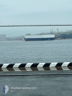
The vessel YONG XIN 16 (IMO: 9988231, MMSI: 352003465) is a Cargo It's sailing under the flag of [PA] Panama.
In this page you can find informations about the vessels current position, last detected port calls, and current voyage information. If the vessels is not in coverage by AIS you will find the latest position.
The current position of YONG XIN 16 is detected by our AIS receivers and we are not responsible for the reliability of the data. The last position was recorded while the vessel was in Coverage by the Ais receivers of our vessel tracking app.
The current draught of YONG XIN 16 as reported by AIS is 4.7 meters
Weather
| Temperature | 14.8°C / 58.64°F |
|---|---|
| Wind Speed | 15 knots |
| Direction | 336° NNW |
| Pressure | 1003.7 hPa |
| Humidity | 92 % |
| Cloud Coverage | 22 % |
Featured Company
Last Port Calls
| Port | Arrival | Departure | Time In Port |
|---|---|---|---|
| 2024-06-12 06:39 | |||
| 2024-06-11 08:49 | 2024-06-12 06:31 | 21 h | |
| 2024-05-31 06:39 | 2024-06-01 04:48 | 22 h | |
| 2024-05-18 13:11 | 2024-05-19 09:04 | 19 h | |
| 2024-05-06 16:56 | 2024-05-07 19:25 | 1 d | |
| 2024-04-25 14:08 | 2024-04-26 08:45 | 18 h | |
| 2024-04-13 21:17 | 2024-04-14 13:52 | 16 h |
Most Visited Ports (Last year)
| Port | Arrivals | |
|---|---|---|
| 7 |
Last Trips
| Origin | Departure | Destination | Arrival | Distance | |
|---|---|---|---|---|---|
| 2024-06-12 16:31 | 2024-06-12 16:39 | 0.88 nm | |||
| 2024-06-01 14:48 | 2024-06-11 18:49 | 1941.57 nm | |||
| 2024-05-19 19:04 | 2024-05-31 16:39 | 1099.37 nm | |||
| 2024-05-08 05:25 | 2024-05-18 23:11 | 1793.18 nm | |||
| 2024-04-26 18:45 | 2024-05-07 02:56 | 1190.36 nm | |||
| 2024-04-14 23:52 | 2024-04-26 00:08 | 1122.58 nm |
Events
| Heure | Evenement | Détails | Position/ Destination | Info |
|---|---|---|---|---|
| 2024-06-12 07:34 | Etat Changé | Moored At anchor |
43.10690 / 131.93293
[RU] VLADIVOSTOK
|
Vitesse: Parcours: 39° |
| 2024-06-12 07:34 | Changement de destination | CNDLC RUVVO |
43.10691 / 131.93293
[RU] VLADIVOSTOK
|
Vitesse: Parcours: 39° |
| 2024-06-12 07:28 | Arret |
43.10685 / 131.93281
[RU] VLADIVOSTOK
|
Vitesse: 0.2 kn Parcours: 40° |
|
| 2024-06-12 06:39 | Port d'arrivée |
|
43.07723 / 131.87744
[RU] VLADIVOSTOK
|
Vitesse: 6.8 kn Parcours: 320.7° |
| 2024-06-12 06:32 | Démarrage | 1.49 nm, South West of VLADIVOSTOK |
43.07373 / 131.89007
RUVVO
|
Vitesse: 3.3 kn Parcours: 265° |
| 2024-06-12 06:31 | PORT DE DEPART |
|
43.07374 / 131.89031
RUVVO
|
Vitesse: 0.8 kn Parcours: 289° |
| 2024-06-11 08:49 | Port d'arrivée |
|
43.07507 / 131.89264
[RU] VLADIVOSTOK
|
Vitesse: Parcours: 255° |
| 2024-06-11 08:41 | Etat Changé | At anchor Under way using engine |
43.07450 / 131.89313
RUVVO
|
Vitesse: 0.2 kn Parcours: 303° |
| 2024-06-11 08:39 | Arret | 1.38 nm, South West of VLADIVOSTOK |
43.07435 / 131.89307
RUVVO
|
Vitesse: 0.3 kn Parcours: 306° |
| 2024-06-11 01:41 | Dans la zone couverte |
42.28731 / 131.64625
Japan Sea
RUVVO
|
Vitesse: 10.2 kn Parcours: 6.6° |