
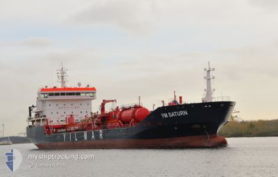
YM SATURN
Oil/Chemical Tanker
Current Trip
| Time Travelled | 5 days |
|---|---|
| Remaining Time | --- |
| Distance Travelled | 927.87 nm |
| Remaining Distance | --- |
| AVG Speed | 12.7 Noeuds |
| MAX Speed | 16 Noeuds |
| AVG Wind | 5.4 knots |
| MAX Wind | 20.1 knots |
| MIN Temp | 6.9°C / 44.42°F |
| MAX Temp | 25.1°C / 77.18°F |
| Tirant d eau | 7.7 m |
| Position reçue | 14 h, 29 m depuis |
Current Position
| Longitude | -60.10240° |
|---|---|
| Latitude | 45.11252° |
| Etat | Under way using engine |
| Vitesse | 12.5 Noeuds |
| Parcours | 225° |
| Zone | North Atlantic Ocean |
| Station | T-AIS |
| Position reçue | 14 h, 29 m depuis |
Info
Information
The current position of YM SATURN is in North Atlantic Ocean with coordinates 45.11252° / -60.10240° as reported on 2024-06-05 13:31 by AIS to our vessel tracker app. The vessel's current speed is 12.5 Noeuds and is heading at the port of PHILADELPHIA. The estimated time of arrival as calculated by MyShipTracking vessel tracking app is 2024-06-08 09:00 LT
The vessel YM SATURN (IMO: 9362138, MMSI: 256929000) is a Oil/Chemical Tanker that was built in 2007 ( 17 Age ). It's sailing under the flag of [MT] Malta.
In this page you can find informations about the vessels current position, last detected port calls, and current voyage information. If the vessels is not in coverage by AIS you will find the latest position.
The current position of YM SATURN is detected by our AIS receivers and we are not responsible for the reliability of the data. The last position was recorded while the vessel was in Coverage by the Ais receivers of our vessel tracking app.
The current draught of YM SATURN as reported by AIS is 7.7 meters
Weather
| Temperature | 11.1°C / 51.98°F |
|---|---|
| Wind Speed | 14 knots |
| Direction | 265° W |
| Pressure | 1009.3 hPa |
| Humidity | 93.9 % |
| Cloud Coverage | 15 % |
Featured Company
Last Port Calls
| Port | Arrival | Departure | Time In Port |
|---|---|---|---|
| 2024-05-31 12:12 | 2024-05-31 14:26 | 2 h | |
| 2024-05-20 04:54 | 2024-05-20 07:10 | 2 h | |
| 2024-05-03 07:42 | 2024-05-04 17:32 | 1 d | |
| 2024-04-29 10:13 | 2024-04-30 21:24 | 1 d | |
| 2024-04-26 15:56 | 2024-04-28 07:40 | 1 d | |
| 2024-04-19 20:22 | 2024-04-21 13:39 | 1 d | |
| 2024-04-14 21:26 | 2024-04-16 12:34 | 1 d | |
| 2024-04-10 11:10 | 2024-04-11 15:49 | 1 d | |
| 2024-04-04 18:36 | 2024-04-04 19:28 | 52 m | |
| 2024-04-03 06:43 | 2024-04-04 18:03 | 1 d |
Most Visited Ports (Last year)
| Port | Arrivals | |
|---|---|---|
| 2 | ||
| 2 | ||
| 2 | ||
| 2 | ||
| 2 | ||
| 2 |
Last Trips
| Origin | Departure | Destination | Arrival | Distance | |
|---|---|---|---|---|---|
| 2024-05-20 03:10 | 2024-05-31 08:12 | 705.52 nm | |||
| 2024-05-04 19:32 | 2024-05-20 00:54 | 4001.85 nm | |||
| 2024-04-30 23:24 | 2024-05-03 09:42 | 351.25 nm | |||
| 2024-04-28 09:40 | 2024-04-29 12:13 | 54.93 nm | |||
| 2024-04-21 15:39 | 2024-04-26 17:56 | 200.69 nm | |||
| 2024-04-16 14:34 | 2024-04-19 22:22 | 968.08 nm | |||
| 2024-04-11 17:49 | 2024-04-14 23:26 | 599.92 nm | |||
| 2024-04-04 20:28 | 2024-04-10 13:10 | 1290.78 nm | |||
| 2024-04-04 19:03 | 2024-04-04 19:36 | 1.99 nm | |||
| 2024-04-03 07:14 | 2024-04-03 07:43 | 1.98 nm |
Events
| Heure | Evenement | Détails | Position/ Destination | Info |
|---|---|---|---|---|
| 2024-06-05 14:05 | Etat Changé | Default Under way using engine |
45.02950 / -60.21700
CAMTR>USPHL
|
Vitesse: 12.5 kn Parcours: 225° |
| 2024-06-05 13:31 | Hors de la zone couverte |
45.11252 / -60.10240
North Atlantic Ocean
CAMTR>USPHL
|
Vitesse: 12.5 kn Parcours: 225° |
|
| 2024-06-05 13:03 | Detecté en mer | Canadian part of the North Atlantic Ocean |
45.18922 / -59.99644
North Atlantic Ocean
CAMTR>USPHL
|
Vitesse: 12.1 kn Parcours: 221° |
| 2024-06-05 13:03 | Etat Changé | Under way using engine Default |
45.18922 / -59.99644
CAMTR>USPHL
|
Vitesse: 12.1 kn Parcours: 226° |
| 2024-06-05 13:03 | Dans la zone couverte |
45.18922 / -59.99644
North Atlantic Ocean
CAMTR>USPHL
|
Vitesse: 12.1 kn Parcours: 221° |
|
| 2024-06-03 16:25 | Etat Changé | Default Under way using engine |
48.60233 / -68.61717
CAMTR>USPHL
|
Vitesse: 10.8 kn Parcours: 59° |
| 2024-06-03 16:19 | Hors de la zone couverte |
48.59333 / -68.63983
Gulf of St-Lawrence
CAMTR>USPHL
|
Vitesse: 10.8 kn Parcours: 59° |
|
| 2024-06-03 16:17 | Etat Changé | Under way using engine Default |
48.58967 / -68.64881
CAMTR>USPHL
|
Vitesse: 10.6 kn Parcours: 58° |
| 2024-06-03 16:05 | Dans la zone couverte |
48.59333 / -68.63983
Gulf of St-Lawrence
CAMTR>USPHL
|
Vitesse: 10.8 kn Parcours: 59° |
|
| 2024-06-03 14:56 | Hors de la zone couverte |
48.45837 / -68.96092
Gulf of St-Lawrence
CAMTR>USPHL
|
Vitesse: 11.1 kn Parcours: 56° |