
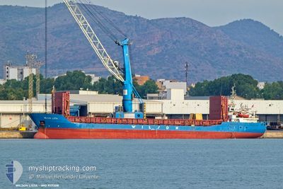
WILSON LISTA
General Cargo
Current Trip
| Trip Time | 1 day |
|---|---|
| Trip Distance | 407.25 nm |
| AVG Speed | 9.9 Noeuds |
| MAX Speed | 14.2 Noeuds |
| Tirant d eau | 5.2 m |
| AVG Wind | 16.9 knots |
| MAX Wind | 27 knots |
| MIN Temp | 6°C / 42.8°F |
| MAX Temp | 10.2°C / 50.36°F |
| Position reçue | 2 m depuis |
Current Position
| Longitude | --- |
|---|---|
| Latitude | --- |
| Etat | At anchor |
| Vitesse | |
| Parcours | 251° |
| Zone | Skaggerak |
| Station | T-AIS |
| Position reçue | 2 m depuis |
Info
Information
The current position of WILSON LISTA is in Skaggerak with coordinates 58.13519° / 7.98334° as reported on 2025-12-10 22:28 by AIS to our vessel tracker app. The vessel's current speed is 0 Noeuds and is currently inside the port of KRISTIANSAND.
The vessel WILSON LISTA (IMO: 9117208, MMSI: 257904000) is a General Cargo that was built in 1994 ( 31 Age ). It's sailing under the flag of [NO] Norway.
In this page you can find informations about the vessels current position, last detected port calls, and current voyage information. If the vessels is not in coverage by AIS you will find the latest position.
The current position of WILSON LISTA is detected by our AIS receivers and we are not responsible for the reliability of the data. The last position was recorded while the vessel was in Coverage by the Ais receivers of our vessel tracking app.
The current draught of WILSON LISTA as reported by AIS is 5.1 meters
Weather
| Temperature | 8.3°C / 46.94°F |
|---|---|
| Wind Speed | 12 knots |
| Direction | 254° WSW |
| Pressure | 1003.1 hPa |
| Humidity | 80.4 % |
| Cloud Coverage | 100 % |
Featured Company
Last Port Calls
| Port | Arrival | Departure | Time In Port |
|---|---|---|---|
| 2025-12-09 17:10 | |||
| 2025-12-07 03:01 | 2025-12-07 21:45 | 18 h | |
| 2025-12-03 17:52 | 2025-12-05 18:02 | 2 d | |
| 2025-11-30 17:18 | 2025-12-01 13:20 | 20 h | |
| 2025-11-28 22:31 | 2025-11-29 15:00 | 16 h | |
| 2025-11-27 11:09 | 2025-11-28 22:18 | 1 d | |
| 2025-11-20 13:17 | 2025-11-22 18:00 | 2 d | |
| 2025-11-14 03:36 | 2025-11-17 18:50 | 3 d | |
| 2025-11-11 13:52 | 2025-11-12 19:06 | 1 d | |
| 2025-11-08 22:15 | 2025-11-09 18:39 | 20 h |
Last Trips
| Origin | Departure | Destination | Arrival | Distance | |
|---|---|---|---|---|---|
| 2025-12-07 21:45 | 2025-12-09 17:10 | 407.25 nm | |||
| 2025-12-05 18:02 | 2025-12-07 03:01 | 71.19 nm | |||
| 2025-12-01 13:20 | 2025-12-03 17:52 | 402.22 nm | |||
| 2025-11-29 15:00 | 2025-11-30 17:18 | 296.80 nm | |||
| 2025-11-28 22:18 | 2025-11-28 22:31 | 0.90 nm | |||
| 2025-11-22 18:00 | 2025-11-27 11:09 | 1025.59 nm | |||
| 2025-11-17 18:50 | 2025-11-20 13:17 | 589.60 nm | |||
| 2025-11-12 19:06 | 2025-11-14 03:36 | 264.48 nm | |||
| 2025-11-09 18:39 | 2025-11-11 13:52 | 448.87 nm | |||
| 2025-11-08 03:27 | 2025-11-08 22:15 | 224.45 nm |
Events
| Heure | Evenement | Détails | Position/ Destination | Info |
|---|---|---|---|---|
| 2025-12-10 22:22 | Etat Changé | At anchor Default |
58.13524 / 7.98340
[NO] KRISTIANSAND
|
Vitesse: Parcours: 252° |
| 2025-12-10 22:19 | Etat Changé | Default At anchor |
58.13519 / 7.98326
[NO] KRISTIANSAND
|
Vitesse: 0.1 kn Parcours: 252° |
| 2025-12-09 16:31 | Etat Changé | At anchor Under way using engine |
58.13432 / 7.98075
[NO] KRISTIANSAND
|
Vitesse: 0.2 kn Parcours: 25° |
| 2025-12-09 16:30 | Arret |
58.13437 / 7.98072
[NO] KRISTIANSAND
|
Vitesse: 0.3 kn Parcours: 21° |
|
| 2025-12-09 16:20 | Tirant d'eau modifié | 5.1 5.2 |
58.13478 / 7.98517
[NO] KRISTIANSAND
|
Vitesse: 2.9 kn Parcours: 213° |
| 2025-12-09 16:10 | Port d'arrivée |
|
58.12596 / 8.01416
[NO] KRISTIANSAND
|
Vitesse: 8.2 kn Parcours: 308.2° |
| 2025-12-09 13:37 | Changement d'ETA | 2025/12/09 15:45 2025/12/09 16:00 |
57.84524 / 7.57465
GBIMM => NOKRS
|
Vitesse: 9.7 kn Parcours: 53.2° |
| 2025-12-09 12:52 | Detecté en mer | Norwegian part of the Skaggerak |
57.78087 / 7.40990
Skaggerak
GBIMM => NOKRS
|
Vitesse: 9 kn Parcours: 55.4° |
| 2025-12-09 06:50 | Changement de zone | Norwegian part of the North Sea United Kingdom part of the North Sea |
57.24509 / 6.10743
North Sea
GBIMM => NOKRS
|
Vitesse: 9.5 kn Parcours: 52.7° |
| 2025-12-09 06:50 | Etat Changé | Under way using engine Default |
57.24509 / 6.10743
GBIMM => NOKRS
|
Vitesse: 9 kn Parcours: 51° |