
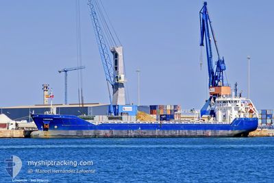
VERTOM JOSE
General Cargo
Current Trip
| Time Travelled | 12 h, 8 mins |
|---|---|
| Remaining Time | --- |
| Distance Travelled | 124.26 nm |
| Remaining Distance | --- |
| AVG Speed | 9 Noeuds |
| MAX Speed | 12.9 Noeuds |
| AVG Wind | 14.7 knots |
| MAX Wind | 23 knots |
| MIN Temp | 2.1°C / 35.78°F |
| MAX Temp | 5.9°C / 42.62°F |
| Tirant d eau | 3.9 m |
| Position reçue | 4 h, 30 m depuis |
Current Position
| Longitude | --- |
|---|---|
| Latitude | --- |
| Etat | Under way using engine |
| Vitesse | 12.2 Noeuds |
| Parcours | 203° |
| Zone | Irish Sea and St. George's Channel |
| Station | T-AIS |
| Position reçue | 4 h, 30 m depuis |
Info
Information
The current position of VERTOM JOSE is in Irish Sea and St. George's Channel with coordinates 53.28904° / -4.97219° as reported on 2026-01-04 16:54 by AIS to our vessel tracker app. The vessel's current speed is 12.2 Noeuds and is heading at the port of SAS VAN GENT. The estimated time of arrival as calculated by MyShipTracking vessel tracking app is 2026-01-07 01:30 LT
The vessel VERTOM JOSE (IMO: 9556313, MMSI: 244790509) is a General Cargo that was built in 2013 ( 13 Age ). It's sailing under the flag of [NL] Netherlands.
In this page you can find informations about the vessels current position, last detected port calls, and current voyage information. If the vessels is not in coverage by AIS you will find the latest position.
The current position of VERTOM JOSE is detected by our AIS receivers and we are not responsible for the reliability of the data. The last position was recorded while the vessel was in Coverage by the Ais receivers of our vessel tracking app.
The current draught of VERTOM JOSE as reported by AIS is 3.9 meters
Weather
| Temperature | 5.3°C / 41.54°F |
|---|---|
| Wind Speed | 18 knots |
| Direction | 314° NW |
| Pressure | 1013.1 hPa |
| Humidity | 71.3 % |
| Cloud Coverage | 93 % |
Featured Company
Last Port Calls
| Port | Arrival | Departure | Time In Port |
|---|---|---|---|
| 2025-12-29 16:33 | 2026-01-04 09:16 | 5 d | |
| 2025-12-20 07:11 | 2025-12-25 07:20 | 5 d | |
| 2025-12-14 05:19 | 2025-12-17 22:32 | 3 d | |
| 2025-12-06 08:48 | 2025-12-09 15:19 | 3 d | |
| 2025-12-01 06:14 | 2025-12-04 16:47 | 3 d | |
| 2025-11-26 17:08 | |||
| 2025-11-20 09:46 | 2025-11-21 19:55 | 1 d | |
| 2025-11-12 10:28 | 2025-11-14 11:12 | 2 d | |
| 2025-11-10 13:07 | 2025-11-10 23:47 | 10 h | |
| 2025-11-06 17:54 | 2025-11-07 15:39 | 21 h |
Most Visited Ports (Last year)
| Port | Arrivals | |
|---|---|---|
| 4 | ||
| 3 | ||
| 2 | ||
| 2 | ||
| 2 | ||
| 2 |
Last Trips
| Origin | Departure | Destination | Arrival | Distance | |
|---|---|---|---|---|---|
| 2025-12-25 07:20 | 2025-12-29 16:33 | 877.58 nm | |||
| 2025-12-17 22:32 | 2025-12-20 07:11 | 321.66 nm | |||
| 2025-12-09 15:19 | 2025-12-14 05:19 | 974.00 nm | |||
| 2025-12-04 16:47 | 2025-12-06 08:48 | 231.42 nm | |||
| 2025-11-26 17:08 | 2025-12-01 06:14 | 849.34 nm | |||
| 2025-11-14 11:12 | 2025-11-20 09:46 | 1048.28 nm | |||
| 2025-11-10 23:47 | 2025-11-12 10:28 | 256.86 nm | |||
| 2025-11-07 15:39 | 2025-11-10 13:07 | 364.63 nm | |||
| 2025-11-05 13:11 | 2025-11-06 17:54 | 270.13 nm | |||
| 2025-10-24 14:50 | 2025-11-04 08:24 | 2326.15 nm |
Events
| Heure | Evenement | Détails | Position/ Destination | Info |
|---|---|---|---|---|
| 2026-01-04 16:55 | Etat Changé | Default Under way using engine |
53.28645 / -4.97386
NLSVG
|
Vitesse: 12.2 kn Parcours: 203° |
| 2026-01-04 16:54 | Etat Changé | Under way using engine Default |
53.28904 / -4.97219
NLSVG
|
Vitesse: 12.1 kn Parcours: 202° |
| 2026-01-04 16:54 | Dans la zone couverte |
53.28904 / -4.97219
Irish Sea and St. George's Channel
NLSVG
|
Vitesse: 12.2 kn Parcours: 203° |
|
| 2026-01-04 16:54 | Hors de la zone couverte |
53.28904 / -4.97219
Irish Sea and St. George's Channel
NLSVG
|
Vitesse: 12.2 kn Parcours: 203° |
|
| 2026-01-04 15:07 | Etat Changé | Default Under way using engine |
53.55156 / -4.57646
NLSVG
|
Vitesse: 12.5 kn Parcours: 259.2° |
| 2026-01-04 15:06 | Etat Changé | Under way using engine Default |
53.55208 / -4.57066
NLSVG
|
Vitesse: 12.7 kn Parcours: 261° |
| 2026-01-04 15:06 | Hors de la zone couverte |
53.55208 / -4.57066
Irish Sea and St. George's Channel
NLSVG
|
Vitesse: 12.5 kn Parcours: 259.2° |
|
| 2026-01-04 14:47 | Etat Changé | Default Under way using engine |
53.55613 / -4.45942
NLSVG
|
Vitesse: 12.7 kn Parcours: 270.2° |
| 2026-01-04 14:39 | Etat Changé | Under way using engine Default |
53.55610 / -4.41297
NLSVG
|
Vitesse: 12.8 kn Parcours: 271° |
| 2026-01-04 14:39 | Dans la zone couverte |
53.55610 / -4.41297
Irish Sea and St. George's Channel
NLSVG
|
Vitesse: 12.7 kn Parcours: 270.2° |