
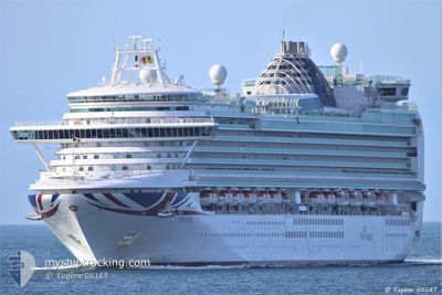
VENTURA
Passengers Ship
Current Trip
| Time Travelled | 2 days |
|---|---|
| Remaining Time | --- |
| Distance Travelled | 1122.53 nm |
| Remaining Distance | 232.59 nm |
| AVG Speed | 16.5 Noeuds |
| MAX Speed | 20.5 Noeuds |
| AVG Wind | 13.9 knots |
| MAX Wind | 22.6 knots |
| MIN Temp | 12.7°C / 54.86°F |
| MAX Temp | 16.6°C / 61.88°F |
| Tirant d eau | 8.5 m |
| Position reçue | 1 d depuis |
Current Position
| Longitude | -10.49150° |
|---|---|
| Latitude | 43.56021° |
| Etat | Under way using engine |
| Vitesse | 16.9 Noeuds |
| Parcours | 194° |
| Zone | North Atlantic Ocean |
| Station | T-AIS |
| Position reçue | 1 d depuis |
Info
Information
The current position of VENTURA is in North Atlantic Ocean with coordinates 43.56021° / -10.49150° as reported on 2024-05-13 06:11 by AIS to our vessel tracker app. The vessel's current speed is 16.9 Noeuds and is heading at the port of FUNCHAL. The estimated time of arrival as calculated by MyShipTracking vessel tracking app is 2024-05-15 07:00 LT
The vessel VENTURA (IMO: 9333175, MMSI: 310562000) is a Passengers Ship that was built in 2008 ( 16 Age ). It's sailing under the flag of [BM] Bermuda.
In this page you can find informations about the vessels current position, last detected port calls, and current voyage information. If the vessels is not in coverage by AIS you will find the latest position.
The current position of VENTURA is detected by our AIS receivers and we are not responsible for the reliability of the data. The last position was recorded while the vessel was in Coverage by the Ais receivers of our vessel tracking app.
The current draught of VENTURA as reported by AIS is 8.5 meters
Weather
| Temperature | 16.7°C / 62.06°F |
|---|---|
| Wind Speed | 15 knots |
| Direction | 2° N |
| Pressure | 1020.9 hPa |
| Humidity | 67.1 % |
| Cloud Coverage | 100 % |
Featured Company
Last Port Calls
| Port | Arrival | Departure | Time In Port |
|---|---|---|---|
| 2024-05-11 04:57 | 2024-05-11 19:33 | 14 h | |
| 2024-05-10 11:14 | 2024-05-10 19:12 | 7 h | |
| 2024-05-10 08:11 | 2024-05-10 10:13 | 2 h | |
| 2024-05-08 06:48 | 2024-05-08 17:29 | 10 h | |
| 2024-05-07 07:11 | 2024-05-07 18:24 | 11 h | |
| 2024-05-06 07:10 | 2024-05-06 17:30 | 10 h | |
| 2024-05-04 05:27 | 2024-05-04 18:48 | 13 h | |
| 2024-05-03 03:48 | 2024-05-03 04:25 | 37 m | |
| 2024-05-01 14:28 | 2024-05-03 02:41 | 1 d | |
| 2024-05-01 12:30 | 2024-05-01 13:15 | 44 m |
Last Trips
| Origin | Departure | Destination | Arrival | Distance | |
|---|---|---|---|---|---|
| 2024-05-10 19:12 | 2024-05-11 04:57 | 135.02 nm | |||
| 2024-05-10 10:13 | 2024-05-10 11:14 | 5.44 nm | |||
| 2024-05-08 17:29 | 2024-05-10 08:11 | 685.99 nm | |||
| 2024-05-07 18:24 | 2024-05-08 06:48 | 136.22 nm | |||
| 2024-05-06 17:30 | 2024-05-07 07:11 | 147.06 nm | |||
| 2024-05-04 18:48 | 2024-05-06 07:10 | 580.42 nm | |||
| 2024-05-03 04:25 | 2024-05-04 05:27 | 287.03 nm | |||
| 2024-05-03 02:41 | 2024-05-03 03:48 | 4.47 nm | |||
| 2024-05-01 13:15 | 2024-05-01 14:28 | 9.23 nm | |||
| 2024-04-30 18:22 | 2024-05-01 12:30 | 297.14 nm |
Events
| Heure | Evenement | Détails | Position/ Destination | Info |
|---|---|---|---|---|
| 2024-05-13 06:20 | Etat Changé | Default Under way using engine |
43.52167 / -10.50500
PTFNC
|
Vitesse: 16.9 kn Parcours: 194° |
| 2024-05-13 06:11 | Hors de la zone couverte |
43.56021 / -10.49150
North Atlantic Ocean
PTFNC
|
Vitesse: 16.9 kn Parcours: 194° |
|
| 2024-05-13 06:00 | Etat Changé | Under way using engine Default |
43.61019 / -10.47230
PTFNC
|
Vitesse: 16.5 kn Parcours: 215° |
| 2024-05-13 05:47 | Etat Changé | Default Under way using engine |
43.66164 / -10.42822
PTFNC
|
Vitesse: 16.5 kn Parcours: 213.1° |
| 2024-05-13 03:43 | Detecté en mer | Spanish part of the North Atlantic Ocean |
44.15332 / -10.04542
North Atlantic Ocean
PTFNC
|
Vitesse: 16.8 kn Parcours: 212.1° |
| 2024-05-13 03:43 | Etat Changé | Under way using engine Default |
44.15332 / -10.04542
PTFNC
|
Vitesse: 17 kn Parcours: 212° |
| 2024-05-13 03:28 | Dans la zone couverte |
44.15332 / -10.04542
North Atlantic Ocean
PTFNC
|
Vitesse: 16.8 kn Parcours: 212.1° |
|
| 2024-05-12 12:56 | Etat Changé | Default Under way using engine |
47.69699 / -6.88521
PTFNC
|
Vitesse: 18.9 kn Parcours: 211.6° |
| 2024-05-12 12:51 | Etat Changé | Under way using engine Default |
47.72106 / -6.86322
PTFNC
|
Vitesse: 19 kn Parcours: 212° |
| 2024-05-12 12:51 | Hors de la zone couverte |
47.72106 / -6.86322
Celtic Sea
PTFNC
|
Vitesse: 18.9 kn Parcours: 211.6° |