
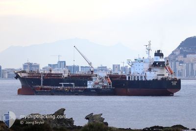
UOG SYROS
Oil/Chemical Tanker
Current Trip
BR ITQ
| Time Travelled | 7 h, 40 mins |
|---|---|
| Remaining Time | --- |
| Distance Travelled | 78.63 nm |
| Remaining Distance | --- |
| AVG Speed | 12.9 Noeuds |
| MAX Speed | 14.5 Noeuds |
| AVG Wind | 8.6 knots |
| MAX Wind | 12.3 knots |
| MIN Temp | 25.9°C / 78.62°F |
| MAX Temp | 29.1°C / 84.38°F |
| Tirant d eau | 10.1 m |
| Position reçue | 9 d depuis |
Current Position
| Longitude | -38.59464° |
|---|---|
| Latitude | -13.03413° |
| Etat | At anchor |
| Vitesse | |
| Parcours | 150° |
| Zone | South Atlantic Ocean |
| Station | T-AIS |
| Position reçue | 9 d depuis |
Info
Information
The current position of UOG SYROS is in South Atlantic Ocean with coordinates -13.03413° / -38.59464° as reported on 2024-05-27 16:21 by AIS to our vessel tracker app. The vessel's current speed is 0 Noeuds
The vessel UOG SYROS (IMO: 9472751, MMSI: 538006161) is a Oil/Chemical Tanker that was built in 2010 ( 14 Age ). It's sailing under the flag of [MH] Marshall Is.
In this page you can find informations about the vessels current position, last detected port calls, and current voyage information. If the vessels is not in coverage by AIS you will find the latest position.
The current position of UOG SYROS is detected by our AIS receivers and we are not responsible for the reliability of the data. The last position was recorded while the vessel was in Coverage by the Ais receivers of our vessel tracking app.
The current draught of UOG SYROS as reported by AIS is 10.1 meters
Weather
| Temperature | 28.3°C / 82.94°F |
|---|---|
| Wind Speed | 12 knots |
| Direction | 87° E |
| Pressure | 1013.8 hPa |
| Humidity | 76.1 % |
| Cloud Coverage | 1 % |
Featured Company
Last Port Calls
| Port | Arrival | Departure | Time In Port |
|---|---|---|---|
| 2024-06-03 04:58 | 2024-06-05 18:18 | 2 d | |
| 2024-05-24 02:49 | 2024-05-26 22:37 | 2 d | |
| 2024-05-16 16:58 | 2024-05-18 05:03 | 1 d | |
| 2024-05-09 05:51 | 2024-05-10 14:38 | 1 d | |
| 2024-05-06 09:05 | 2024-05-07 14:49 | 1 d | |
| 2024-04-25 20:36 | 2024-04-29 04:16 | 3 d | |
| 2024-04-07 02:02 | 2024-04-09 21:02 | 2 d |
Last Trips
| Origin | Departure | Destination | Arrival | Distance | |
|---|---|---|---|---|---|
| 2024-05-26 22:37 | 2024-06-03 04:58 | 1265.67 nm | |||
| 2024-05-18 05:03 | 2024-05-24 02:49 | 1516.92 nm | |||
| 2024-05-10 14:38 | 2024-05-16 16:58 | 1029.23 nm | |||
| 2024-05-07 14:49 | 2024-05-09 05:51 | 350.86 nm | |||
| 2024-04-29 04:16 | 2024-05-06 09:05 | 493.49 nm | |||
| 2024-04-09 21:02 | 2024-04-25 20:36 | 1307.26 nm | |||
| 2024-03-12 21:15 | 2024-04-07 02:02 | 3953.15 nm |
Events
| Heure | Evenement | Détails | Position/ Destination | Info |
|---|---|---|---|---|
| 2024-06-05 21:18 | PORT DE DEPART |
|
-2.55947 / -44.38658
BR ITQ
|
Vitesse: Parcours: 122° |
| 2024-06-03 08:10 | Arret |
-2.57077 / -44.37730
[BR] ITAQUI
|
Vitesse: 0.1 kn Parcours: 123° |
|
| 2024-06-03 07:58 | Port d'arrivée |
|
-2.57123 / -44.37780
[BR] ITAQUI
|
Vitesse: 1.6 kn Parcours: 120° |
| 2024-06-03 06:09 | Démarrage | 4.42 nm, North of SAO LUIS |
-2.44704 / -44.30165
BR ITQ
|
Vitesse: 3.5 kn Parcours: 19° |
| 2024-05-31 13:48 | Arret | 4.49 nm, North of SAO LUIS |
-2.44667 / -44.29666
BR ITQ
|
Vitesse: Parcours: -1° |
| 2024-05-27 17:54 | Démarrage | 6.42 nm, South West of SALVADOR |
-13.04108 / -38.59420
BR ITQ
|
Vitesse: 4.1 kn Parcours: 180° |
| 2024-05-27 16:24 | Etat Changé | Default At anchor |
-13.03414 / -38.59466
BR ITQ
|
Vitesse: Parcours: 150° |
| 2024-05-27 16:21 | Hors de la zone couverte |
-13.03413 / -38.59464
South Atlantic Ocean
BR ITQ
|
Vitesse: Parcours: 306.5° |
|
| 2024-05-27 15:15 | Etat Changé | At anchor Default |
-13.03470 / -38.59520
BR ITQ
|
Vitesse: Parcours: 120° |
| 2024-05-27 15:12 | Etat Changé | Default At anchor |
-13.03473 / -38.59524
BR ITQ
|
Vitesse: Parcours: 117° |