
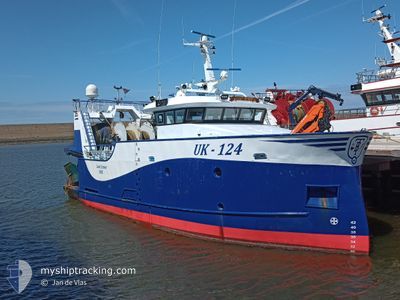
UK-124 LUUT SENIOR
Fishing
Current Trip
| Trip Time | 2 days |
|---|---|
| Trip Distance | 154.66 nm |
| AVG Speed | 8.4 Noeuds |
| MAX Speed | 12.5 Noeuds |
| Tirant d eau | 4.6 m |
| AVG Wind | 8.6 knots |
| MAX Wind | 10.8 knots |
| MIN Temp | 10.9°C / 51.62°F |
| MAX Temp | 11.9°C / 53.42°F |
| Position reçue | 1 m depuis |
Current Position
| Longitude | 1.58831° |
|---|---|
| Latitude | 50.72715° |
| Etat | Engaged in Fishing |
| Vitesse | |
| Parcours | 339° |
| Zone | English Channel |
| Station | T-AIS |
| Position reçue | 1 m depuis |
Info
Information
The current position of UK-124 LUUT SENIOR is in English Channel with coordinates 50.72715° / 1.58831° as reported on 2024-05-11 10:25 by AIS to our vessel tracker app. The vessel's current speed is 0 Noeuds and is currently inside the port of BOULOGNE-SUR-MER.
The vessel UK-124 LUUT SENIOR (IMO: 9873838, MMSI: 244921000) is a Fishing It's sailing under the flag of [NL] Netherlands.
In this page you can find informations about the vessels current position, last detected port calls, and current voyage information. If the vessels is not in coverage by AIS you will find the latest position.
The current position of UK-124 LUUT SENIOR is detected by our AIS receivers and we are not responsible for the reliability of the data. The last position was recorded while the vessel was in Coverage by the Ais receivers of our vessel tracking app.
The current draught of UK-124 LUUT SENIOR as reported by AIS is 4.6 meters
Weather
| Temperature | 16.4°C / 61.52°F |
|---|---|
| Wind Speed | 8 knots |
| Direction | 72° ENE |
| Pressure | 1020.3 hPa |
| Humidity | 79.5 % |
| Cloud Coverage | 27 % |
Featured Company
Last Port Calls
| Port | Arrival | Departure | Time In Port |
|---|---|---|---|
| 2024-05-08 18:18 | |||
| 2024-05-02 18:23 | 2024-05-06 03:36 | 3 d | |
| 2024-04-25 23:18 | 2024-04-29 03:04 | 3 d | |
| 2024-04-19 20:32 | 2024-04-22 04:22 | 2 d | |
| 2024-04-18 20:40 | 2024-04-18 22:25 | 1 h | |
| 2024-04-16 22:23 | 2024-04-16 23:23 | 59 m | |
| 2024-04-12 15:59 | 2024-04-15 21:48 | 3 d | |
| 2024-04-11 23:29 | 2024-04-12 01:13 | 1 h | |
| 2024-03-29 03:20 | 2024-04-08 00:08 | 9 d | |
| 2024-03-28 05:08 | 2024-03-28 06:37 | 1 h |
Most Visited Ports (Last year)
| Port | Arrivals | |
|---|---|---|
| 33 | ||
| 7 | ||
| 6 | ||
| 3 | ||
| 2 | ||
| 2 |
Last Trips
| Origin | Departure | Destination | Arrival | Distance | |
|---|---|---|---|---|---|
| 2024-05-06 05:36 | 2024-05-08 20:18 | 154.66 nm | |||
| 2024-04-29 05:04 | 2024-05-02 20:23 | 112.13 nm | |||
| 2024-04-22 06:22 | 2024-04-26 01:18 | 224.37 nm | |||
| 2024-04-19 00:25 | 2024-04-19 22:32 | 26.35 nm | |||
| 2024-04-17 01:23 | 2024-04-18 22:40 | 26.19 nm | |||
| 2024-04-15 23:48 | 2024-04-17 00:23 | 28.98 nm | |||
| 2024-04-12 03:13 | 2024-04-12 17:59 | 50.50 nm | |||
| 2024-04-08 02:08 | 2024-04-12 01:29 | 313.54 nm | |||
| 2024-03-28 07:37 | 2024-03-29 04:20 | 187.41 nm | |||
| 2024-03-25 23:07 | 2024-03-28 06:08 | 230.08 nm |
Events
| Heure | Evenement | Détails | Position/ Destination | Info |
|---|---|---|---|---|
| 2024-05-08 19:30 | Arret |
50.72537 / 1.58820
[FR] BOULOGNE-SUR-MER
|
Vitesse: 0.1 kn Parcours: 147° |
|
| 2024-05-08 19:28 | Démarrage |
50.72691 / 1.59008
[FR] BOULOGNE-SUR-MER
|
Vitesse: 4.4 kn Parcours: 234° |
|
| 2024-05-08 18:22 | Arret |
50.72877 / 1.59103
[FR] BOULOGNE-SUR-MER
|
Vitesse: 0.2 kn Parcours: 174° |
|
| 2024-05-08 18:18 | Port d'arrivée |
|
50.73171 / 1.58620
[FR] BOULOGNE-SUR-MER
|
Vitesse: 8.1 kn Parcours: 121° |
| 2024-05-08 17:44 | Changement de zone | French part of the English Channel United Kingdom part of the English Channel |
50.78446 / 1.47835
English Channel
|
Vitesse: 9.8 kn Parcours: 136° |
| 2024-05-08 17:43 | Dans la zone couverte |
50.78446 / 1.47835
English Channel
|
Vitesse: 9.8 kn Parcours: 136° |
|
| 2024-05-07 08:43 | Hors de la zone couverte |
50.50634 / .32328
English Channel
|
Vitesse: 12 kn Parcours: 72° |
|
| 2024-05-07 05:19 | Démarrage | 19.71 nm, South of BRIGHTON MARINA |
50.48426 / -.16377
FISHINGGROUNDS
|
Vitesse: 3.9 kn Parcours: 238° |
| 2024-05-07 04:48 | Arret | 19.47 nm, South of BRIGHTON MARINA |
50.48816 / -.16118
FISHINGGROUNDS
|
Vitesse: 0.1 kn Parcours: 246° |
| 2024-05-07 00:16 | Dans la zone couverte |
50.45556 / .09864
English Channel
|
Vitesse: 6.3 kn Parcours: 252° |