
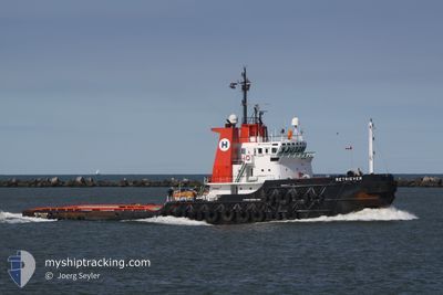
TULA
Tug
Current Trip
LAST UPDATE TIME
| Time Travelled | 28 days |
|---|---|
| Remaining Time | --- |
| Distance Travelled | 1810.07 nm |
| Remaining Distance | --- |
| AVG Speed | 3.8 Noeuds |
| MAX Speed | 5.1 Noeuds |
| AVG Wind | 16.1 knots |
| MAX Wind | 26.9 knots |
| MIN Temp | 24.5°C / 76.1°F |
| MAX Temp | 28.6°C / 83.48°F |
| Tirant d eau | 5.5 m |
| Position reçue | 12 d depuis |
Current Position
| Longitude | -77.11500° |
|---|---|
| Latitude | 15.45670° |
| Etat | Restricted manoeuverability |
| Vitesse | 3 Noeuds |
| Parcours | 121° |
| Zone | Caribbean Sea |
| Station | T-AIS |
| Position reçue | 12 d depuis |
Info
Information
The current position of TULA is in Caribbean Sea with coordinates 15.45670° / -77.11500° as reported on 2024-05-09 23:57 by AIS to our vessel tracker app. The vessel's current speed is 3 Noeuds
The vessel TULA (IMO: 8106991, MMSI: 345070245) is a Tug that was built in 1982 ( 42 Age ). It's sailing under the flag of [MX] Mexico.
In this page you can find informations about the vessels current position, last detected port calls, and current voyage information. If the vessels is not in coverage by AIS you will find the latest position.
The current position of TULA is detected by our AIS receivers and we are not responsible for the reliability of the data. The last position was recorded while the vessel was in Coverage by the Ais receivers of our vessel tracking app.
The current draught of TULA as reported by AIS is 5.5 meters
Weather
| Temperature | 27.9°C / 82.22°F |
|---|---|
| Wind Speed | 18 knots |
| Direction | 106° ESE |
| Pressure | 1010.6 hPa |
| Humidity | 88.3 % |
| Cloud Coverage | 100 % |
Featured Company
Last Port Calls
| Port | Arrival | Departure | Time In Port |
|---|---|---|---|
| 2024-04-19 14:56 | 2024-04-24 13:50 | 4 d | |
| 2024-04-01 17:28 | 2024-04-15 22:41 | 14 d | |
| 2024-03-19 20:37 | 2024-03-23 22:46 | 4 d | |
| 2024-03-18 16:52 | |||
| 2024-03-13 00:04 | 2024-03-13 06:23 | 6 h | |
| 2024-03-09 17:27 | 2024-03-12 02:05 | 2 d | |
| 2024-03-01 05:56 | 2024-03-03 06:34 | 2 d |
Most Visited Ports (Last year)
| Port | Arrivals | |
|---|---|---|
| 9 | ||
| 5 | ||
| 4 | ||
| 1 |
Last Trips
| Origin | Departure | Destination | Arrival | Distance | |
|---|---|---|---|---|---|
| 2024-04-15 17:41 | 2024-04-19 09:56 | 244.83 nm | |||
| 2024-03-23 16:46 | 2024-04-01 11:28 | 526.38 nm | |||
| 2024-03-18 10:52 | 2024-03-19 14:37 | 106.29 nm | |||
| 2024-03-11 20:05 | 2024-03-12 18:04 | 96.93 nm | |||
| 2024-03-03 00:34 | 2024-03-09 11:27 | 188.04 nm | |||
| 2024-02-26 01:17 | 2024-02-29 23:56 | 104.19 nm |
Events
| Heure | Evenement | Détails | Position/ Destination | Info |
|---|---|---|---|---|
| 2024-05-22 15:31 | Arret | 1.41 nm, South West of WILLEMSTAD |
12.08433 / -68.95293
LAST UPDATE TIME
|
Vitesse: 0.3 kn Parcours: 113° |
| 2024-05-22 13:03 | Démarrage | 5.31 nm, South East of WILLEMSTAD |
12.04575 / -68.86846
LAST UPDATE TIME
|
Vitesse: 3.6 kn Parcours: 324° |
| 2024-05-22 10:39 | Arret | 5.14 nm, South East of WILLEMSTAD |
12.03674 / -68.88178
LAST UPDATE TIME
|
Vitesse: 0.3 kn Parcours: 111° |
| 2024-05-21 13:30 | Arret | 2.28 nm, South of WILLEMSTAD |
12.06650 / -68.94998
LAST UPDATE TIME
|
Vitesse: 0.3 kn Parcours: 119° |
| 2024-05-20 16:31 | Démarrage |
12.22424 / -69.39848
LAST UPDATE TIME
|
Vitesse: 3.1 kn Parcours: 112° |
|
| 2024-05-15 20:48 | Arret |
13.13167 / -72.48333
LAST UPDATE TIME
|
Vitesse: Parcours: -1° |
|
| 2024-05-13 15:18 | Arret |
13.49667 / -73.53500
LAST UPDATE TIME
|
Vitesse: Parcours: -1° |