
TRANSAMERICA
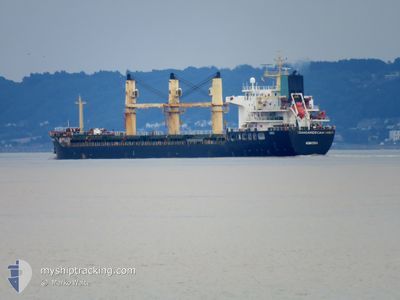
Bulk Carrier
Current Trip
| Trip Time | 8 days |
|---|---|
| Trip Distance | 1673.51 nm |
| AVG Speed | 9.5 Noeuds |
| MAX Speed | 11.3 Noeuds |
| Tirant d eau | 8.3 m |
| AVG Wind | 7.4 knots |
| MAX Wind | 13 knots |
| MIN Temp | 26.2°C / 79.16°F |
| MAX Temp | 34.9°C / 94.82°F |
| Position reçue | 2024-02-12 16:18 |
Current Position
| Longitude | -14.23505° |
|---|---|
| Latitude | 27.23242° |
| Etat | Under way using engine |
| Vitesse | 11.5 Noeuds |
| Parcours | 211.2° |
| Zone | North Atlantic Ocean |
| Station | T-AIS |
| Position reçue | 2024-02-12 16:18 |
Info
Information
The current position of TRANSAMERICA is in North Atlantic Ocean with coordinates 27.23242° / -14.23505° as reported on 2024-02-12 16:18 by AIS to our vessel tracker app. The vessel's current speed is 11.5 Noeuds and is currently inside the port of DOUALA.
The vessel TRANSAMERICA (IMO: 9486257, MMSI: 636020457) is a Bulk Carrier that was built in 2010 ( 14 Age ). It's sailing under the flag of [LR] Liberia.
In this page you can find informations about the vessels current position, last detected port calls, and current voyage information. If the vessels is not in coverage by AIS you will find the latest position.
The current position of TRANSAMERICA is detected by our AIS receivers and we are not responsible for the reliability of the data. The last position was recorded while the vessel was in Coverage by the Ais receivers of our vessel tracking app.
The current draught of TRANSAMERICA as reported by AIS is 8.3 meters
Weather
| Temperature | 28.4°C / 83.12°F |
|---|---|
| Wind Speed | 5 knots |
| Direction | 214° SW |
| Pressure | 1009 hPa |
| Humidity | 80.4 % |
| Cloud Coverage | 100 % |
Featured Company
Most Visited Ports (Last year)
| Port | Arrivals | |
|---|---|---|
| 3 | ||
| 2 | ||
| 2 | ||
| 1 | ||
| 1 | ||
| 1 |
Events
| Heure | Evenement | Détails | Position/ Destination | Info |
|---|---|---|---|---|
| 2024-04-30 11:16 | Arret |
4.05581 / 9.69243
[CM] DOUALA
|
Vitesse: Parcours: 37° |
|
| 2024-04-30 11:12 | Port d'arrivée |
|
4.05596 / 9.69219
[CM] DOUALA
|
Vitesse: 1.1 kn Parcours: 40° |
| 2024-04-30 08:52 | Démarrage | 13.93 nm, South West of DOUALA |
3.88283 / 9.53349
CMDLA
|
Vitesse: 4.6 kn Parcours: 35° |
| 2024-04-29 07:20 | Arret | 14.16 nm, South West of DOUALA |
3.87879 / 9.53236
CMDLA
|
Vitesse: 0.3 kn Parcours: 268° |