
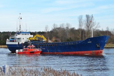
TORNES
Self Discharging Bulk Carrier
Current Trip
| Time Travelled | 1 day |
|---|---|
| Remaining Time | --- |
| Distance Travelled | 1.06 nm |
| Remaining Distance | --- |
| AVG Speed | --- |
| MAX Speed | --- |
| AVG Wind | 9.1 knots |
| MAX Wind | 10 knots |
| MIN Temp | 2.5°C / 36.5°F |
| MAX Temp | 2.9°C / 37.22°F |
| Tirant d eau | 4.7 m |
| Position reçue | 1 m depuis |
Current Position
| Longitude | --- |
|---|---|
| Latitude | --- |
| Etat | Under way using engine |
| Vitesse | |
| Parcours | 272° |
| Zone | Norwegian Sea |
| Station | T-AIS |
| Position reçue | 1 m depuis |
Info
Information
The current position of TORNES is in Norwegian Sea with coordinates 63.09085° / 7.77231° as reported on 2025-12-05 10:03 by AIS to our vessel tracker app. The vessel's current speed is 0 Noeuds
The vessel TORNES (IMO: 7002318, MMSI: 258392000) is a Self Discharging Bulk Carrier that was built in 1969 ( 56 Age ). It's sailing under the flag of [NO] Norway.
In this page you can find informations about the vessels current position, last detected port calls, and current voyage information. If the vessels is not in coverage by AIS you will find the latest position.
The current position of TORNES is detected by our AIS receivers and we are not responsible for the reliability of the data. The last position was recorded while the vessel was in Coverage by the Ais receivers of our vessel tracking app.
The current draught of TORNES as reported by AIS is 4.7 meters
Weather
| Temperature | 2.5°C / 36.5°F |
|---|---|
| Wind Speed | 10 knots |
| Direction | 157° SSE |
| Pressure | 1011.5 hPa |
| Humidity | 69.8 % |
| Cloud Coverage | 100 % |
Featured Company
Last Port Calls
| Port | Arrival | Departure | Time In Port |
|---|---|---|---|
| 2025-12-04 02:45 | 2025-12-04 03:05 | 20 m | |
| 2025-11-27 08:23 | 2025-11-27 11:38 | 3 h | |
| 2025-11-26 19:46 | 2025-11-26 19:59 | 12 m | |
| 2025-11-26 17:34 | 2025-11-26 17:40 | 6 m | |
| 2025-11-17 16:05 | 2025-11-17 19:35 | 3 h | |
| 2025-11-07 20:55 | 2025-11-07 20:59 | 4 m | |
| 2025-11-07 19:52 | 2025-11-07 20:13 | 21 m | |
| 2025-11-02 21:15 | 2025-11-03 13:39 | 16 h | |
| 2025-10-31 06:52 | 2025-10-31 10:37 | 3 h | |
| 2025-10-21 08:38 | 2025-10-21 16:45 | 8 h |
Most Visited Ports (Last year)
| Port | Arrivals | |
|---|---|---|
| 20 | ||
| 8 | ||
| 7 | ||
| 3 | ||
| 3 | ||
| 2 |
Last Trips
| Origin | Departure | Destination | Arrival | Distance | |
|---|---|---|---|---|---|
| 2025-11-27 11:38 | 2025-12-04 02:45 | 277.25 nm | |||
| 2025-11-26 19:59 | 2025-11-27 08:23 | 32.92 nm | |||
| 2025-11-26 17:40 | 2025-11-26 19:46 | 6.71 nm | |||
| 2025-11-17 19:35 | 2025-11-26 17:34 | 564.17 nm | |||
| 2025-11-07 20:59 | 2025-11-17 16:05 | 622.78 nm | |||
| 2025-11-07 20:13 | 2025-11-07 20:55 | 0.32 nm | |||
| 2025-11-03 13:39 | 2025-11-07 19:52 | 495.18 nm | |||
| 2025-10-31 10:37 | 2025-11-02 21:15 | 159.64 nm | |||
| 2025-10-21 16:45 | 2025-10-31 06:52 | 741.40 nm | |||
| 2025-10-20 17:27 | 2025-10-21 08:38 | 23.12 nm |
Events
| Heure | Evenement | Détails | Position/ Destination | Info |
|---|---|---|---|---|
| 2025-12-04 02:20 | Arret | 1.56 nm, South East of KRISTIANSUND |
63.09111 / 7.77295
SUNNDALSORA
|
Vitesse: 0.3 kn Parcours: 245° |
| 2025-12-04 02:05 | PORT DE DEPART |
|
63.10093 / 7.76587
SUNNDALSORA
|
Vitesse: 7.9 kn Parcours: 103° |
| 2025-12-04 01:45 | Port d'arrivée |
|
63.12112 / 7.76874
[NO] KRISTIANSUND
|
Vitesse: 6.6 kn Parcours: 226.1° |
| 2025-12-04 01:14 | Etat Changé | Under way using engine Default |
63.13233 / 7.92565
SUNNDALSORA
|
Vitesse: 9.8 kn Parcours: 286° |
| 2025-12-04 01:13 | Etat Changé | Default Under way using engine |
63.13137 / 7.93342
SUNNDALSORA
|
Vitesse: 9.7 kn Parcours: 285.4° |
| 2025-12-03 22:44 | Démarrage | 12.2 nm, South East of HALSA |
62.98610 / 8.63914
SUNNDALSORA
|
Vitesse: 5.8 kn Parcours: 235.9° |
| 2025-12-03 18:54 | Arret | 12.43 nm, South East of HALSA |
62.98613 / 8.64814
SUNNDALSORA
|
Vitesse: Parcours: 38° |
| 2025-12-03 11:22 | Etat Changé | Under way using engine Default |
62.91215 / 6.84894
SUNNDALSORA
|
Vitesse: 8.8 kn Parcours: 331° |
| 2025-12-03 11:20 | Etat Changé | Default Under way using engine |
62.90833 / 6.85245
SUNNDALSORA
|
Vitesse: 8.8 kn Parcours: 329.7° |
| 2025-12-03 10:34 | Etat Changé | Under way using engine Default |
62.81968 / 6.97044
SUNNDALSORA
|
Vitesse: 8.5 kn Parcours: 9° |