
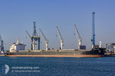
TOMINI UNITY
Cargo
Current Trip
PANAMA
| Time Travelled | 3 days |
|---|---|
| Remaining Time | --- |
| Distance Travelled | 1008.28 nm |
| Remaining Distance | --- |
| AVG Speed | 12.2 Noeuds |
| MAX Speed | 14.1 Noeuds |
| AVG Wind | 5.5 knots |
| MAX Wind | 12 knots |
| MIN Temp | 25.9°C / 78.62°F |
| MAX Temp | 30.5°C / 86.9°F |
| Tirant d eau | 11.5 m |
| Position reçue | 3 d depuis |
Current Position
| Longitude | -88.33427° |
|---|---|
| Latitude | 29.95797° |
| Etat | Under way using engine |
| Vitesse | 12.7 Noeuds |
| Parcours | 138.2° |
| Zone | Gulf of Mexico |
| Station | T-AIS |
| Position reçue | 3 d depuis |
Info
Information
The current position of TOMINI UNITY is in Gulf of Mexico with coordinates 29.95797° / -88.33427° as reported on 2024-09-17 17:13 by AIS to our vessel tracker app. The vessel's current speed is 12.7 Noeuds
The vessel TOMINI UNITY (IMO: 9718167, MMSI: 538006521) is a Cargo It's sailing under the flag of [MH] Marshall Is.
In this page you can find informations about the vessels current position, last detected port calls, and current voyage information. If the vessels is not in coverage by AIS you will find the latest position.
The current position of TOMINI UNITY is detected by our AIS receivers and we are not responsible for the reliability of the data. The last position was recorded while the vessel was in Coverage by the Ais receivers of our vessel tracking app.
The current draught of TOMINI UNITY as reported by AIS is 11.5 meters
Weather
| Temperature | 29.2°C / 84.56°F |
|---|---|
| Wind Speed | 6 knots |
| Direction | 83° E |
| Pressure | 1007.8 hPa |
| Humidity | 73.7 % |
| Cloud Coverage | 100 % |
Featured Company
Last Port Calls
| Port | Arrival | Departure | Time In Port |
|---|---|---|---|
| 2024-09-13 17:04 | 2024-09-17 09:19 | 3 d | |
| 2024-09-02 14:41 | 2024-09-07 22:23 | 5 d | |
| 2024-08-19 01:17 | 2024-08-21 18:47 | 2 d | |
| 2024-07-29 23:19 | 2024-08-05 23:16 | 6 d | |
| 2024-07-08 01:02 | 2024-07-15 20:54 | 7 d |
Most Visited Ports (Last year)
| Port | Arrivals | |
|---|---|---|
| 2 | ||
| 1 | ||
| 1 | ||
| 1 | ||
| 1 | ||
| 1 |
Last Trips
| Origin | Departure | Destination | Arrival | Distance | |
|---|---|---|---|---|---|
| 2024-09-07 22:23 | 2024-09-13 17:04 | 141.40 nm | |||
| 2024-08-21 18:47 | 2024-09-02 14:41 | 3489.26 nm | |||
| 2024-08-05 23:16 | 2024-08-19 01:17 | 2963.04 nm | |||
| 2024-07-15 20:54 | 2024-07-29 23:19 | 2245.37 nm | |||
| 2024-06-30 08:38 | 2024-07-08 01:02 | 979.11 nm |
Events
| Heure | Evenement | Détails | Position/ Destination | Info |
|---|---|---|---|---|
| 2024-09-17 17:18 | Etat Changé | Default Under way using engine |
29.94432 / -88.32048
PANAMA
|
Vitesse: 12.7 kn Parcours: 138.2° |
| 2024-09-17 17:13 | Etat Changé | Under way using engine Default |
29.95797 / -88.33427
PANAMA
|
Vitesse: 12.7 kn Parcours: 139° |
| 2024-09-17 17:13 | Hors de la zone couverte |
29.95797 / -88.33427
Gulf of Mexico
PANAMA
|
Vitesse: 12.7 kn Parcours: 138.2° |
|
| 2024-09-17 17:11 | Etat Changé | Default Under way using engine |
29.96367 / -88.34009
PANAMA
|
Vitesse: 12.7 kn Parcours: 138.5° |
| 2024-09-17 16:40 | Etat Changé | Under way using engine Default |
30.04309 / -88.42553
PANAMA
|
Vitesse: 12.3 kn Parcours: 137° |
| 2024-09-17 16:39 | Etat Changé | Default Under way using engine |
30.04531 / -88.42797
PANAMA
|
Vitesse: 12.2 kn Parcours: 136.9° |
| 2024-09-17 16:12 | Etat Changé | Under way using engine Default |
30.10371 / -88.50252
PANAMA
|
Vitesse: 10.7 kn Parcours: 107° |
| 2024-09-17 16:11 | Etat Changé | Default Under way using engine |
30.10418 / -88.50411
PANAMA
|
Vitesse: 10.6 kn Parcours: 106.5° |
| 2024-09-17 14:52 | Etat Changé | Under way using engine Default |
30.24524 / -88.50778
PANAMA
|
Vitesse: 9.5 kn Parcours: 173° |
| 2024-09-17 14:51 | Etat Changé | Default Under way using engine |
30.24702 / -88.50803
PANAMA
|
Vitesse: 9.4 kn Parcours: 173.5° |