
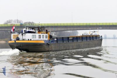
THEAN III
Cargo
Current Trip
BABBELS
Unknown Port
ETA*
---
| Time Travelled | 2 days |
|---|---|
| Remaining Time | --- |
| Distance Travelled | 85.51 nm |
| Remaining Distance | --- |
| AVG Speed | 6.2 Noeuds |
| MAX Speed | 10 Noeuds |
| AVG Wind | 7.1 knots |
| MAX Wind | 11.9 knots |
| MIN Temp | 12.6°C / 54.68°F |
| MAX Temp | 25.6°C / 78.08°F |
| Tirant d eau | 0 m |
| Position reçue | 1 m depuis |
Current Position
| Longitude | 5.68706° |
|---|---|
| Latitude | 51.89202° |
| Etat | Under way using engine |
| Vitesse | |
| Parcours | --- |
| Zone | North Sea |
| Station | T-AIS |
| Position reçue | 1 m depuis |
Info
info
Information
The current position of THEAN III is in North Sea with coordinates 51.89202° / 5.68706° as reported on 2024-05-03 01:04 by AIS to our vessel tracker app. The vessel's current speed is 0 Noeuds
The vessel THEAN III (MMSI: 244650926) is a Cargo It's sailing under the flag of [NL] Netherlands.
In this page you can find informations about the vessels current position, last detected port calls, and current voyage information. If the vessels is not in coverage by AIS you will find the latest position.
The current position of THEAN III is detected by our AIS receivers and we are not responsible for the reliability of the data. The last position was recorded while the vessel was in Coverage by the Ais receivers of our vessel tracking app.
Weather
| Temperature | 12.6°C / 54.68°F |
|---|---|
| Wind Speed | 6 knots |
| Direction | 246° WSW |
| Pressure | 1002.6 hPa |
| Humidity | 96.9 % |
| Cloud Coverage | 100 % |
Featured Company
Limited time offer - Install a base station receiver to your area and list your company on MyShipTracking Free forever!
Last Port Calls
| Port | Arrival | Departure | Time In Port |
|---|---|---|---|
| 2024-04-30 16:29 | 2024-04-30 16:59 | 30 m | |
| 2024-04-29 20:50 | 2024-04-29 21:11 | 20 m | |
| 2024-04-25 21:47 | 2024-04-25 22:19 | 31 m | |
| 2024-04-25 17:10 | 2024-04-25 20:24 | 3 h | |
| 2024-04-25 14:45 | 2024-04-25 15:03 | 17 m | |
| 2024-04-24 15:20 | 2024-04-24 15:51 | 30 m | |
| 2024-04-23 17:28 | 2024-04-24 10:33 | 17 h | |
| 2024-04-23 15:29 | 2024-04-23 15:56 | 27 m | |
| 2024-04-22 22:38 | 2024-04-23 05:55 | 7 h | |
| 2024-04-22 19:00 | 2024-04-22 19:32 | 32 m |
Last Trips
| Origin | Departure | Destination | Arrival | Distance | |
|---|---|---|---|---|---|
| 2024-04-29 23:11 | 2024-04-30 18:29 | 28.41 nm | |||
| 2024-04-26 00:19 | 2024-04-29 22:50 | 85.16 nm | |||
| 2024-04-25 22:24 | 2024-04-25 23:47 | 7.03 nm | |||
| 2024-04-25 17:03 | 2024-04-25 19:10 | 8.09 nm | |||
| 2024-04-24 17:51 | 2024-04-25 16:45 | 45.48 nm | |||
| 2024-04-24 12:33 | 2024-04-24 17:20 | 14.62 nm | |||
| 2024-04-23 17:56 | 2024-04-23 19:28 | 7.22 nm | |||
| 2024-04-23 07:55 | 2024-04-23 17:29 | 43.08 nm | |||
| 2024-04-22 21:32 | 2024-04-23 00:38 | 20.57 nm | |||
| 2024-04-19 15:12 | 2024-04-22 21:00 | 28.55 nm |
Events
| Heure | Evenement | Détails | Position/ Destination | Info |
|---|---|---|---|---|
| 2024-05-02 21:31 | Arret | 0.57 nm, East of DEEST |
51.89196 / 5.68730
BABBELS
|
Vitesse: 0.2 kn Parcours: 511° |
| 2024-05-02 17:53 | Dans la zone couverte |
51.77426 / 5.34736
North Sea
|
Vitesse: 6.5 kn Parcours: 121.8° |
|
| 2024-05-02 10:23 | Hors de la zone couverte |
51.77658 / 5.34352
North Sea
|
Vitesse: 3.1 kn Parcours: 345.1° |
|
| 2024-05-02 08:20 | Démarrage | 0.51 nm, North of W.z.v. Trident |
51.76793 / 5.13886
BABBELS
|
Vitesse: 6.6 kn Parcours: 197° |
| 2024-05-02 05:40 | Arret | 0.58 nm, South East of DE RIETSCHOOF |
51.77055 / 5.14064
BABBELS
|
Vitesse: 0.1 kn Parcours: 511° |
| 2024-05-02 03:43 | Démarrage | 0.42 nm, North West of KERKDRIEL |
51.77508 / 5.34555
BABBELS
|
Vitesse: 4.3 kn Parcours: 122.5° |
| 2024-05-01 18:16 | Dans la zone couverte |
51.77640 / 5.34184
North Sea
|
Vitesse: Parcours: 0° |
|
| 2024-05-01 17:14 | Hors de la zone couverte |
51.77582 / 5.34349
North Sea
|
Vitesse: 1.8 kn Parcours: 303.9° |
|
| 2024-05-01 14:36 | Démarrage | 0.34 nm, East of DEEST |
51.89446 / 5.68143
BABBELS
|
Vitesse: 5.6 kn Parcours: 328.1° |
| 2024-05-01 07:13 | Arret | 0.43 nm, East of DEEST |
51.89337 / 5.68395
BABBELS
|
Vitesse: 0.2 kn Parcours: 511° |