
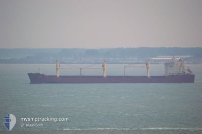
SUNDA
Bulk Carrier
Current Trip
DK SKN
| Time Travelled | 1 day |
|---|---|
| Remaining Time | --- |
| Distance Travelled | 313.64 nm |
| Remaining Distance | --- |
| AVG Speed | 11.7 Noeuds |
| MAX Speed | 12.6 Noeuds |
| AVG Wind | 18.7 knots |
| MAX Wind | 27 knots |
| MIN Temp | 4.7°C / 40.46°F |
| MAX Temp | 9.3°C / 48.74°F |
| Tirant d eau | 9.2 m |
| Position reçue | 8 h, 5 m depuis |
Current Position
| Longitude | --- |
|---|---|
| Latitude | --- |
| Etat | Under way using engine |
| Vitesse | 10.8 Noeuds |
| Parcours | 233.1° |
| Zone | Baltic Sea |
| Station | T-AIS |
| Position reçue | 8 h, 5 m depuis |
Info
Information
The current position of SUNDA is in Baltic Sea with coordinates 55.44398° / 14.63112° as reported on 2025-12-08 07:59 by AIS to our vessel tracker app. The vessel's current speed is 10.8 Noeuds
The vessel SUNDA (IMO: 9498236, MMSI: 636017261) is a Bulk Carrier that was built in 2010 ( 15 Age ). It's sailing under the flag of [LR] Liberia.
In this page you can find informations about the vessels current position, last detected port calls, and current voyage information. If the vessels is not in coverage by AIS you will find the latest position.
The current position of SUNDA is detected by our AIS receivers and we are not responsible for the reliability of the data. The last position was recorded while the vessel was in Coverage by the Ais receivers of our vessel tracking app.
The current draught of SUNDA as reported by AIS is 9.2 meters
Weather
| Temperature | 8.9°C / 48.02°F |
|---|---|
| Wind Speed | 22 knots |
| Direction | 226° SW |
| Pressure | 1008.8 hPa |
| Humidity | 88.7 % |
| Cloud Coverage | 100 % |
Featured Company
Last Port Calls
| Port | Arrival | Departure | Time In Port |
|---|---|---|---|
| 2025-12-03 07:05 | 2025-12-07 13:29 | 4 d | |
| 2025-11-14 14:15 | 2025-11-14 15:47 | 1 h | |
| 2025-10-23 16:56 | 2025-11-13 01:42 | 20 d | |
| 2025-10-17 15:13 | 2025-10-22 13:18 | 4 d | |
| 2025-10-17 07:57 | 2025-10-17 08:52 | 54 m | |
| 2025-10-14 23:34 | 2025-10-17 00:22 | 2 d |
Most Visited Ports (Last year)
| Port | Arrivals | |
|---|---|---|
| 4 | ||
| 2 | ||
| 2 | ||
| 2 | ||
| 2 | ||
| 2 |
Last Trips
| Origin | Departure | Destination | Arrival | Distance | |
|---|---|---|---|---|---|
| 2025-11-14 10:47 | 2025-12-03 09:05 | 4058.92 nm | |||
| 2025-11-12 20:42 | 2025-11-14 09:15 | 320.97 nm | |||
| 2025-10-22 09:18 | 2025-10-23 12:56 | 283.04 nm | |||
| 2025-10-17 04:52 | 2025-10-17 11:13 | 33.16 nm | |||
| 2025-10-16 20:22 | 2025-10-17 03:57 | 69.48 nm | |||
| 2025-09-26 18:57 | 2025-10-14 19:34 | 4575.33 nm |
Events
| Heure | Evenement | Détails | Position/ Destination | Info |
|---|---|---|---|---|
| 2025-12-08 08:05 | Etat Changé | Default Under way using engine |
55.43245 / 14.60750
DK SKN
|
Vitesse: 10.8 kn Parcours: 233.1° |
| 2025-12-08 07:59 | Hors de la zone couverte |
55.44398 / 14.63112
Baltic Sea
DK SKN
|
Vitesse: 10.8 kn Parcours: 233.1° |
|
| 2025-12-08 07:59 | Etat Changé | Under way using engine Default |
55.44398 / 14.63112
DK SKN
|
Vitesse: 10.9 kn Parcours: 238° |
| 2025-12-08 07:57 | Etat Changé | Default Under way using engine |
55.44768 / 14.64048
DK SKN
|
Vitesse: 10.7 kn Parcours: 237.5° |
| 2025-12-08 07:56 | Etat Changé | Under way using engine Default |
55.44984 / 14.64641
DK SKN
|
Vitesse: 10.8 kn Parcours: 241° |
| 2025-12-08 07:56 | Changement de zone | Swedish part of the Baltic Sea Danish part of the Kattegat |
55.44984 / 14.64641
Baltic Sea
DK SKN
|
Vitesse: 10.7 kn Parcours: 237.5° |
| 2025-12-08 07:45 | Etat Changé | Default Under way using engine |
55.46514 / 14.69629
DK SKN
|
Vitesse: 11 kn Parcours: 241.8° |
| 2025-12-08 07:39 | Etat Changé | Under way using engine Default |
55.47381 / 14.72566
DK SKN
|
Vitesse: 11 kn Parcours: 243° |
| 2025-12-08 07:37 | Etat Changé | Default Under way using engine |
55.47662 / 14.73523
DK SKN
|
Vitesse: 10.9 kn Parcours: 243.8° |
| 2025-12-08 07:31 | Etat Changé | Under way using engine Default |
55.48521 / 14.76462
DK SKN
|
Vitesse: 10.9 kn Parcours: 244° |