
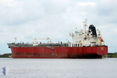
STI GARNET
Oil/Chemical Tanker
Current Trip
KR YOS
| Time Travelled | 4 days |
|---|---|
| Remaining Time | --- |
| Distance Travelled | 1340.47 nm |
| Remaining Distance | --- |
| AVG Speed | 12.6 Noeuds |
| MAX Speed | 15.4 Noeuds |
| AVG Wind | 10 knots |
| MAX Wind | 20.9 knots |
| MIN Temp | 15.2°C / 59.36°F |
| MAX Temp | 28.2°C / 82.76°F |
| Tirant d eau | 8.5 m |
| Position reçue | 9 d depuis |
Current Position
| Longitude | 128.06702° |
|---|---|
| Latitude | 33.28017° |
| Etat | Moored |
| Vitesse | 13.4 Noeuds |
| Parcours | 36.7° |
| Zone | Japan Sea |
| Station | T-AIS |
| Position reçue | 9 d depuis |
Info
Information
The current position of STI GARNET is in Japan Sea with coordinates 33.28017° / 128.06702° as reported on 2024-04-19 12:18 by AIS to our vessel tracker app. The vessel's current speed is 13.4 Noeuds
The vessel STI GARNET (IMO: 9629952, MMSI: 538004533) is a Oil/Chemical Tanker that was built in 2012 ( 12 Age ). It's sailing under the flag of [MH] Marshall Is.
In this page you can find informations about the vessels current position, last detected port calls, and current voyage information. If the vessels is not in coverage by AIS you will find the latest position.
The current position of STI GARNET is detected by our AIS receivers and we are not responsible for the reliability of the data. The last position was recorded while the vessel was in Coverage by the Ais receivers of our vessel tracking app.
The current draught of STI GARNET as reported by AIS is 8.5 meters
Weather
| Temperature | 28.3°C / 82.94°F |
|---|---|
| Wind Speed | 14 knots |
| Direction | 89° E |
| Pressure | 1011.5 hPa |
| Humidity | 74 % |
| Cloud Coverage | 5 % |
Featured Company
Events
| Heure | Evenement | Détails | Position/ Destination | Info |
|---|---|---|---|---|
| 2024-04-25 05:24 | Démarrage | 8.29 nm, East of YEOSU |
34.70716 / 127.82861
KR YOS
|
Vitesse: 4.1 kn Parcours: 79° |
| 2024-04-25 04:12 | Arret | 8.11 nm, East of YEOSU |
34.70345 / 127.82391
KR YOS
|
Vitesse: 0.1 kn Parcours: 338° |
| 2024-04-25 02:40 | PORT DE DEPART |
|
34.86256 / 127.77850
KR YOS
|
Vitesse: 5 kn Parcours: -1° |
| 2024-04-25 02:32 | Démarrage |
34.86666 / 127.75667
[KR] GWANGYANG
|
Vitesse: 5 kn Parcours: -1° |
|
| 2024-04-22 00:59 | Arret |
34.86212 / 127.75084
[KR] GWANGYANG
|
Vitesse: 0.1 kn Parcours: 74° |
|
| 2024-04-22 00:55 | Port d'arrivée |
|
34.86228 / 127.75090
[KR] GWANGYANG
|
Vitesse: 0.7 kn Parcours: 75° |
| 2024-04-21 22:16 | Démarrage | 16.78 nm, South of SINSUAN-GIL |
34.63234 / 127.98339
KR YOS
|
Vitesse: 4.4 kn Parcours: 219° |
| 2024-04-19 12:18 | Hors de la zone couverte |
33.28017 / 128.06702
Japan Sea
|
Vitesse: 13.4 kn Parcours: 36.7° |
|
| 2024-04-19 11:42 | Detecté en mer | Japanese part of the Japan Sea |
33.17360 / 127.96806
Japan Sea
|
Vitesse: 13.4 kn Parcours: 33.6° |
| 2024-04-19 11:42 | Dans la zone couverte |
33.17360 / 127.96806
Japan Sea
|
Vitesse: 13.4 kn Parcours: 33.6° |