
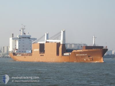
SPUIGRACHT
General Cargo
Current Trip
| Time Travelled | 3 days |
|---|---|
| Remaining Time | --- |
| Distance Travelled | 491.83 nm |
| Remaining Distance | --- |
| AVG Speed | 13.7 Noeuds |
| MAX Speed | 14.6 Noeuds |
| AVG Wind | 15.7 knots |
| MAX Wind | 25 knots |
| MIN Temp | 16°C / 60.8°F |
| MAX Temp | 21.9°C / 71.42°F |
| Tirant d eau | 6.9 m |
| Position reçue | 22 h, 40 m depuis |
Current Position
| Longitude | -11.73937° |
|---|---|
| Latitude | 33.68837° |
| Etat | Under way using engine |
| Vitesse | 1.9 Noeuds |
| Parcours | 85° |
| Zone | North Atlantic Ocean |
| Station | T-AIS |
| Position reçue | 22 h, 40 m depuis |
Info
Information
The current position of SPUIGRACHT is in North Atlantic Ocean with coordinates 33.68837° / -11.73937° as reported on 2024-04-25 08:44 by AIS to our vessel tracker app. The vessel's current speed is 1.9 Noeuds and is heading at the port of AVILES. The estimated time of arrival as calculated by MyShipTracking vessel tracking app is 2024-04-28 08:00 LT
The vessel SPUIGRACHT (IMO: 9202534, MMSI: 245261000) is a General Cargo that was built in 2001 ( 23 Age ). It's sailing under the flag of [NL] Netherlands.
In this page you can find informations about the vessels current position, last detected port calls, and current voyage information. If the vessels is not in coverage by AIS you will find the latest position.
The current position of SPUIGRACHT is detected by our AIS receivers and we are not responsible for the reliability of the data. The last position was recorded while the vessel was in Coverage by the Ais receivers of our vessel tracking app.
The current draught of SPUIGRACHT as reported by AIS is 6.9 meters
Weather
| Temperature | 16.1°C / 60.98°F |
|---|---|
| Wind Speed | 12 knots |
| Direction | 302° WNW |
| Pressure | 1013.3 hPa |
| Humidity | 67.6 % |
| Cloud Coverage | 100 % |
Featured Company
Last Port Calls
| Port | Arrival | Departure | Time In Port |
|---|---|---|---|
| 2024-04-21 07:18 | 2024-04-22 18:26 | 1 d | |
| 2024-04-09 12:29 | 2024-04-10 18:25 | 1 d | |
| 2024-04-01 21:20 | 2024-04-08 19:44 | 6 d | |
| 2024-03-16 20:15 | 2024-03-18 21:00 | 2 d | |
| 2024-03-09 10:22 | 2024-03-13 07:32 | 3 d | |
| 2024-03-08 09:02 | 2024-03-08 23:10 | 14 h | |
| 2024-03-03 19:22 | 2024-03-06 18:26 | 2 d | |
| 2024-02-29 03:42 | 2024-03-01 05:28 | 1 d | |
| 2024-02-10 23:31 | 2024-02-14 01:04 | 3 d | |
| 2024-02-06 14:47 | 2024-02-08 22:34 | 2 d |
Most Visited Ports (Last year)
| Port | Arrivals | |
|---|---|---|
| 6 | ||
| 5 | ||
| 4 | ||
| 3 | ||
| 2 | ||
| 2 |
Last Trips
| Origin | Departure | Destination | Arrival | Distance | |
|---|---|---|---|---|---|
| 2024-04-10 14:25 | 2024-04-21 08:18 | 3618.54 nm | |||
| 2024-04-08 15:44 | 2024-04-09 08:29 | 202.57 nm | |||
| 2024-03-18 22:00 | 2024-04-01 17:20 | 4332.52 nm | |||
| 2024-03-13 08:32 | 2024-03-16 21:15 | 1277.63 nm | |||
| 2024-03-09 01:10 | 2024-03-09 11:22 | 158.01 nm | |||
| 2024-03-06 20:26 | 2024-03-08 11:02 | 396.59 nm | |||
| 2024-03-01 06:28 | 2024-03-03 21:22 | 969.31 nm | |||
| 2024-02-13 20:04 | 2024-02-29 04:42 | 4484.92 nm | |||
| 2024-02-08 17:34 | 2024-02-10 18:31 | 711.81 nm | |||
| 2024-01-17 18:19 | 2024-02-06 09:47 | 4734.60 nm |
Events
| Heure | Evenement | Détails | Position/ Destination | Info |
|---|---|---|---|---|
| 2024-04-25 08:48 | Etat Changé | Default Under way using engine |
33.68618 / -11.73963
AVILES
|
Vitesse: 1.9 kn Parcours: 85° |
| 2024-04-25 08:44 | Hors de la zone couverte |
33.68837 / -11.73937
North Atlantic Ocean
AVILES
|
Vitesse: 1.9 kn Parcours: 183.9° |
|
| 2024-04-25 08:31 | Etat Changé | Under way using engine Default |
33.69439 / -11.73899
AVILES
|
Vitesse: 1.4 kn Parcours: 89° |
| 2024-04-25 08:29 | Etat Changé | Default Under way using engine |
33.69521 / -11.73893
AVILES
|
Vitesse: 1.6 kn Parcours: 84° |
| 2024-04-25 08:24 | Etat Changé | Under way using engine Default |
33.69721 / -11.73875
AVILES
|
Vitesse: 1.7 kn Parcours: 89° |
| 2024-04-25 07:38 | Etat Changé | Default Under way using engine |
33.71766 / -11.73678
AVILES
|
Vitesse: 1.4 kn Parcours: 87° |
| 2024-04-25 07:25 | Etat Changé | Under way using engine Default |
33.72364 / -11.73622
AVILES
|
Vitesse: 1.6 kn Parcours: 82° |
| 2024-04-25 07:10 | Dans la zone couverte |
33.72308 / -11.73626
North Atlantic Ocean
AVILES
|
Vitesse: 1.7 kn Parcours: 185.7° |
|
| 2024-04-25 05:03 | Etat Changé | Default Under way using engine |
33.78213 / -11.73483
AVILES
|
Vitesse: 1.3 kn Parcours: 86° |
| 2024-04-25 04:58 | Hors de la zone couverte |
33.78402 / -11.73457
North Atlantic Ocean
AVILES
|
Vitesse: 1.3 kn Parcours: 187.5° |