
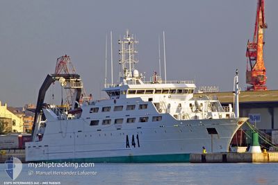
SPANISH NAVYSHIP A41
Fishery Research Vessel
Current Trip
NONE
| Time Travelled | 5 days |
|---|---|
| Remaining Time | --- |
| Distance Travelled | 660.38 nm |
| Remaining Distance | --- |
| AVG Speed | 9.7 Noeuds |
| MAX Speed | 11 Noeuds |
| AVG Wind | 7 knots |
| MAX Wind | 14 knots |
| MIN Temp | 13.9°C / 57.02°F |
| MAX Temp | 19°C / 66.2°F |
| Tirant d eau | 7.1 m |
| Position reçue | 2 d depuis |
Current Position
| Longitude | -10.85655° |
|---|---|
| Latitude | 38.42571° |
| Etat | Default |
| Vitesse | 9.6 Noeuds |
| Parcours | 195.7° |
| Zone | North Atlantic Ocean |
| Station | T-AIS |
| Position reçue | 2 d depuis |
Info
Information
The current position of SPANISH NAVYSHIP A41 is in North Atlantic Ocean with coordinates 38.42571° / -10.85655° as reported on 2024-06-03 13:06 by AIS to our vessel tracker app. The vessel's current speed is 9.6 Noeuds
The vessel SPANISH NAVYSHIP A41 (IMO: 9482615, MMSI: 225402000) is a Fishery Research Vessel that was built in 2009 ( 15 Age ). It's sailing under the flag of [ES] Spain.
In this page you can find informations about the vessels current position, last detected port calls, and current voyage information. If the vessels is not in coverage by AIS you will find the latest position.
The current position of SPANISH NAVYSHIP A41 is detected by our AIS receivers and we are not responsible for the reliability of the data. The last position was recorded while the vessel was in Coverage by the Ais receivers of our vessel tracking app.
The current draught of SPANISH NAVYSHIP A41 as reported by AIS is 7.1 meters
Weather
| Temperature | 19°C / 66.2°F |
|---|---|
| Wind Speed | 8 knots |
| Direction | 223° SW |
| Pressure | 1015.2 hPa |
| Humidity | 84.1 % |
| Cloud Coverage | --- |
Featured Company
Last Port Calls
| Port | Arrival | Departure | Time In Port |
|---|---|---|---|
| 2024-05-29 08:55 | 2024-05-31 07:29 | 1 d | |
| 2024-05-24 15:56 | |||
| 2024-05-23 15:21 | 2024-05-24 08:22 | 17 h | |
| 2024-05-21 18:02 | 2024-05-23 10:47 | 1 d | |
| 2024-05-10 13:49 | 2024-05-20 18:06 | 10 d |
Last Trips
| Origin | Departure | Destination | Arrival | Distance | |
|---|---|---|---|---|---|
| 2024-05-24 10:22 | 2024-05-24 17:56 | 30.47 nm | |||
| 2024-05-23 12:47 | 2024-05-23 17:21 | 27.37 nm | |||
| 2024-05-20 20:06 | 2024-05-21 20:02 | 160.38 nm | |||
| 2024-03-14 09:47 | 2024-05-10 15:49 | 2054.29 nm |
Events
| Heure | Evenement | Détails | Position/ Destination | Info |
|---|---|---|---|---|
| 2024-06-03 13:06 | Hors de la zone couverte |
38.42571 / -10.85655
North Atlantic Ocean
|
Vitesse: 9.6 kn Parcours: 195.7° |
|
| 2024-06-03 13:06 | Dans la zone couverte |
38.42571 / -10.85655
North Atlantic Ocean
|
Vitesse: 9.6 kn Parcours: 195.7° |
|
| 2024-06-03 08:09 | Hors de la zone couverte |
39.17832 / -10.51455
North Atlantic Ocean
|
Vitesse: 10 kn Parcours: 200.4° |
|
| 2024-06-02 18:48 | Dans la zone couverte |
41.29415 / -9.46809
North Atlantic Ocean
|
Vitesse: 10 kn Parcours: 198° |
|
| 2024-06-02 17:32 | Hors de la zone couverte |
41.50213 / -9.37335
North Atlantic Ocean
|
Vitesse: 10.5 kn Parcours: 200.2° |
|
| 2024-06-02 17:32 | Detecté en mer | Portuguese part of the North Atlantic Ocean |
41.50213 / -9.37335
North Atlantic Ocean
|
Vitesse: 10.5 kn Parcours: 200.2° |
| 2024-06-02 17:32 | Dans la zone couverte |
41.50213 / -9.37335
North Atlantic Ocean
|
Vitesse: 10.5 kn Parcours: 200.2° |
|
| 2024-05-31 08:28 | Hors de la zone couverte |
48.31526 / -4.66180
Celtic Sea
|
Vitesse: 10 kn Parcours: 230.2° |
|
| 2024-05-31 07:29 | PORT DE DEPART |
|
48.36672 / -4.48709
NONE
|
Vitesse: 6.1 kn Parcours: 176° |
| 2024-05-31 07:19 | Démarrage |
48.36963 / -4.50875
[FR] BREST
|
Vitesse: 3.2 kn Parcours: 57° |